
 United Kingdom
 France
 Germany
 Netherlands
 Sweden
 USA
USA
 Italy
Italy
 Spain
Spain
More From Contributor


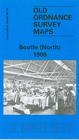
Bootle North 1906
Bootle North in 1906 in a fascinating series of reproductions of old Ordnance Survey plans in the Alan Godfrey Editions, ideal for anyone interested in the history of their neighbourhood or family. The map covers northern Bootle, part of Litherland, Derby Ward and much of Orrell Ward; further east are Victoria Park, Orrell Park and part of Warbreck Park. Features include LYR Liverpool-Southport line with north part of Marsh Lane station, Linacre Gas Works, Leeds & Liverpool Canal, St James RC church, Dye Works, trams and depot, Diamond Match Works, North Recreation Ground, infectious diseases hospital, Derby Park, Orrell Lodge, Liverpool Parochial Cemetery, LYR Liverpool-Accrington line railway with Walton junction station, MR Bootle Goods Branch, Whitefield House, etc.
On the reverse are street directory entries for Cedar Street, Hawthorne Road, Linacre Lane, Marsh Lane, Orrell Village.About the Alan Godfrey Editions of the 25” OS Series:Selected towns in Great Britain and Ireland are covered by maps showing the extent of urban development in the last decades of the 19th and early 20th century. The plans have been taken from the Ordnance Survey mapping and reprinted at about 15 inches to one mile (1:4, 340). On the reverse most maps have historical notes and many also include extracts from contemporary directories. Most maps cover about one mile (1.6kms) north/south, one and a half miles (2.4kms) across; adjoining sheets can be combined to provide wider coverage.FOR MORE INFORMATION AND A COMPLETE LIST OF ALL AVAILABLE TITLES PLEASE CLICK ON THE
SERIES LINK.

Product Description
Reviews/Comments
Add New
Intelligent Comparison
Archived Product

Colne North 1910 Stanfords
£3.50
Archived Product

Bolton North 1908 Stanfords
£3.50
Archived Product
Liverpool North 1906 Stanfords
£2.95
Archived Product

Liverpool North 1906 Stanfords
£3.50
Archived Product

Chorley North 1909 Stanfords
£3.50
Archived Product
Chorley North 1909 Stanfords
£2.95
Archived Product

Whitstable North 1906 Stanfords
£3.50
Archived Product

Bradford North 1906 Stanfords
£3.50
Vouchers
No voucher codes found.
Do you know a voucher code for this product or supplier? Add it to Insights for others to use.
Do you know a voucher code for this product or supplier? Add it to Insights for others to use.
 Denmark