
 United Kingdom
 France
 Germany
 Netherlands
 Sweden
 USA
USA
 Italy
Italy
 Spain
Spain
GPS & NAVIGATIONGARMINGARMIN MAPPING


Available
-
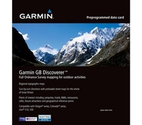
Garmin GB Discoverer
Dartmoor and Exmoor Map
Preprogrammed
Datacard Description: Navigate
with Ordnance Survey
mapping on your Garmin
GPS. Available in 1:25K
scale maps with detailed
topographic data
including terrain
contours, topo
elevations, summits,
paths, routable roads
and geographical
points.Turn-by-turn
navigation anywhere in
Great Britain is made
possible with integrated
street maps, included on
all Garmin GB Discoverer
products. Search, select
and navigate to street
addresses and attractions
and follow routes on
foot, in car or by bike
using the familiar
Ordnance Survey backdrop.
Availability: In Stock
£57.99
Available
-
Garmin GB Discoverer The
Peak District Map
Preprogrammed
Datacard Description:Navigate
with Ordnance Survey
mapping on your Garmin
GPS. Available in 1:25K
scale maps with detailed
topographic data
including terrain
contours, topo
elevations, summits,
paths, routable roads
and geographical
points.Turn-by-turn
navigation anywhere in
Great Britain is made
possible with integrated
street maps, included on
all Garmin GB Discoverer
products. Search, select
and navigate to street
addresses and attractions
and follow routes on
foot, in car or by bike
using the familiar
Ordnance Survey backdrop.
Availability: In Stock
£56.99
Available
-
Garmin Northern Ireland
Discoverer 1:50K + 1:25K
Scenic Spots
Mapping Provides highly
detailed 50K topographic
maps for all of Northern
Ireland from Land and
Property Services
(formally OSNI).Features
special recreational
areas or scenic spots
with 1:25K map coverage
for five of the most
popular walking areas -
including The Mournes,
The Sperrins, The Glens,
Lough Erne and
Strangford Lough,
provided by Land and
Property
Services.Includes terrain
contours, elevations,
summits, trails,
geographic points and
more.Includes detailed
road data and thousands
of points of interest
from NAVTEQ.Provides
turn-by-turn directions
by car or bike.Allows you
to search for
destinations by address
or by category points of
interest include lodging,
food and drink, car
parks, banks, petrol
stations, attractions,
campsites and more.
Availability: In Stock
£93.13
Available
-
Garmin GPS MAP 64st Topo
Europe Rugged,
Full-featured Handheld
with GPS, GLONASS,
Advanced Sensors and
Wireless
Connectivity *2,
6" sunlight-readable
colour
screen *High-sensitivity
GPS and GLONASS receiver
with quad-helix
antenna *Barometric
altimeter and 3-axis
compass *Preloaded
Recreational map of
Europe *Wireless
connectivity via
Bluetooth technology¹
or ANT+ The new GPSMAP
64st handheld navigator
features a 2, 6"
sunlight-readable screen
and a high-sensitivity
GPS and GLONASS receiver
with a quad helix antenna
for superior reception.
The rugged and waterproof
GPSMAP 64st comes with
barometric altimeter,
3-axis compass and a
preloaded Recreational
Map of Europe. It
wirelessly connects to
your smartphone to allow
Live Tracking and Smart
Notification.² Physical
&
Performance Physical
dimensions 2.4" x
6.3" x 1.4"
(6.1 x 16.0 x 3.6
cm) Display size,
WxH 1.43" x
2.15" (3.6 x 5.5 cm)
2.6" diag (6.6
cm) Display resolution,
WxH 160 x 240
pixels Display
type transflective, 65-K
color TFT Weight 8.1 oz
(230 g) with
batteries Battery 2 AA
batteries (not included)
NiMH or Lithium
recommended Battery
life 16 hours Water
Rating IPX7
Availability: In Stock
£319.99
Available
-
Garmin GB Discoverer The
Yorkshire Dales Map
Preprogrammed
Datacard Description: Navigate
with Ordnance Survey
mapping on your Garmin
GPS. Available in 1:25K
scale maps with detailed
topographic data
including terrain
contours, topo
elevations, summits,
paths, routable roads
and geographical
points.Turn-by-turn
navigation anywhere in
Great Britain is made
possible with integrated
street maps, included on
all Garmin GB Discoverer
products. Search, select
and navigate to street
addresses and attractions
and follow routes on
foot, in car or by bike
using the familiar
Ordnance Survey backdrop.
Availability: In Stock
£53.94
Available
-
Garmin GPSMAP 64 with
TOPO UK & Ireland
Light This recreational
map has been compiled
using the community
generated OpenStreetMap
(OSM) database to which
Garmin added a 50-metre
contour line layer,
based on a public digital
elevation model, and
over 20 years of
knowledge and skills in
building electronic
maps. The resulting map
can be used for
orienteering and
reference for any outdoor
or recreational
activities throughout UK
and Ireland. These new
maps include routable
road, trail and path
networks, waterway
detail, place names,
military areas, natural
features, land use
areas, historical sites,
airport structures and
points, buildings,
emergency structures,
power lines, railways
and many points of
interests (POI) including
but not limited to
tourism, sport, shops,
public transport,
leisure, craft and
amenities. TOPO UK &
Ireland Light is capable
of turn-by-turn routing
on the entire road and
trail network present in
the map. The routing
allows the creation of
routes based on your
selected activity type1by
automatically adjusting
the route to suit the
chosen activity and take
into consideration the
elevation. It is not
recommended to use this
map for car navigation
purposes. Features Provides
turn-by-turn visual
navigation with alert
tones on the entire road
and trail network,
including unpaved roads
and footpaths. *Garmin
optimised
routing1calculates routes
based on activity -
Pedestrian, Hiking,
Mountaineering, Tour
Cycling, Cycling and
Mountain
Biking. *Displays named
hiking and bike
trails1. *Shows land
coverage, including
forests, farmland,
rivers, lakes, wetlands
and urban
areas. *Includes contour
lines and Digital
Elevation Model
(DEM). *Detailed digital
elevation model enables
the display of accurate
altitude
profiles. *Searchable
map elements such as
points of Interests,
mountains and
lakes2 *Plan routes
using this map in
BaseCamp.
Availability: In Stock
£219.99
Available
-
Garmin GB Discoverer
Northumberland Map
Preprogrammed
Datacard Description: Navigate
with Ordnance Survey
mapping on your Garmin
GPS. Available in 1:25K
scale maps with detailed
topographic data
including terrain
contours, topo
elevations, summits,
paths, routable roads
and geographical
points.Turn-by-turn
navigation anywhere in
Great Britain is made
possible with integrated
street maps, included on
all Garmin GB Discoverer
products. Search, select
and navigate to street
addresses and attractions
and follow routes on
foot, in car or by bike
using the familiar
Ordnance Survey backdrop.
Availability: In Stock
£56.99
Available
-
Garmin GB Discoverer
Brecon Beacons and
Pembroke Coast Map
Preprogrammed
Datacard Description: Navigate
with Ordnance Survey
mapping on your Garmin
GPS. Available in 1:25K
scale maps with detailed
topographic data
including terrain
contours, topo
elevations, summits,
paths, routable roads
and geographical
points.Turn-by-turn
navigation anywhere in
Great Britain is made
possible with integrated
street maps, included on
all Garmin GB Discoverer
products. Search, select
and navigate to street
addresses and attractions
and follow routes on
foot, in car or by bike
using the familiar
Ordnance Survey backdrop.
Availability: In Stock
£56.99
Available
-
Garmin GB Discoverer
Snowdonia Map
Preprogrammed
Datacard Description: Navigate
with Ordnance Survey
mapping on your Garmin
GPS. Available in 1:25K
scale maps with detailed
topographic data
including terrain
contours, topo
elevations, summits,
paths, routable roads
and geographical
points.Turn-by-turn
navigation anywhere in
Great Britain is made
possible with integrated
street maps, included on
all Garmin GB Discoverer
products. Search, select
and navigate to street
addresses and attractions
and follow routes on
foot, in car or by bike
using the familiar
Ordnance Survey backdrop.
Availability: In Stock
£56.99
Available
-
Garmin New Mapping 1.50K
Northern Region
Preprogrammed Datacard
(Scotland) Description: Navigate
with Ordnance Survey
mapping on your Garmin
GPS. Available in 1:50K
scale maps with detailed
topographic data
including terrain
contours, topo
elevations, summits,
paths, routable roads
and geographical
points.Turn-by-turn
navigation anywhere in
Great Britain is made
possible with integrated
street maps, included on
all Garmin GB Discoverer
products. Search, select
and navigate to street
addresses and attractions
and follow routes on
foot, in car or by bike
using the familiar
Ordnance Survey backdrop.
Availability: In Stock
£104.65
Available
-
Garmin GB Discoverer New
Forest and South Downs
Map Preprogrammed
Datacard Description: Navigate
with Ordnance Survey
mapping on your Garmin
GPS. Available in 1:25K
scale maps with detailed
topographic data
including terrain
contours, topo
elevations, summits,
paths, routable roads
and geographical
points.Turn-by-turn
navigation anywhere in
Great Britain is made
possible with integrated
street maps, included on
all Garmin GB Discoverer
products. Search, select
and navigate to street
addresses and attractions
and follow routes on
foot, in car or by bike
using the familiar
Ordnance Survey backdrop.
Availability: In Stock
£57.99
Available
-
Garmin National Trails
the Coast to Coast Map
Preprogrammed
Datacard Description: Navigate
with Ordnance Survey
mapping on your Garmin
GPS. Available in 1:25K
scale maps with detailed
topographic data
including terrain
contours, topo
elevations, summits,
paths, routable roads
and geographical
points.Turn-by-turn
navigation anywhere in
Great Britain is made
possible with integrated
street maps, included on
all Garmin GB Discoverer
products. Search, select
and navigate to street
addresses and attractions
and follow routes on
foot, in car or by bike
using the familiar
Ordnance Survey backdrop.
Availability: In Stock
£56.99
Available
-
Garmin GB Discoverer Loch
Lomond and The Trossachs
Map Preprogrammed
Datacard Description: Navigate
with Ordnance Survey
mapping on your Garmin
GPS. Available in 1:25K
scale maps with detailed
topographic data
including terrain
contours, topo
elevations, summits,
paths, routable roads
and geographical
points.Turn-by-turn
navigation anywhere in
Great Britain is made
possible with integrated
street maps, included on
all Garmin GB Discoverer
products. Search, select
and navigate to street
addresses and attractions
and follow routes on
foot, in car or by bike
using the familiar
Ordnance Survey backdrop.
Availability: In Stock
£56.99
Available
-
Garmin New Mapping 1.50K
South (Southern England
& Wales) Explore
Southern England &
Wales with detailed 50K
topographic and road
maps. Garmin GB
Discoverer 1:50K -
Southern England &
Wales contains full 1:50K
scale Ordnance Survey
Landranger map coverage
for the entire region.
Plus, with NAVTEQ road
data and points of
interest, you'll get
turn-by-turn directions
to your destination.GB
Discoverer's detailed
topographic data includes
terrain contours, topo
elevations, summits,
paths, routable roads
and geographical points.
The premium NAVTEQ road
data is the same detailed
data included in our
leading automotive
products - with thousands
of addresses and points
of interest, including
lodging, food and drink,
car parks, banks,
petrol stations,
attractions, campsites,
and more. Search for an
address or point of
interest, and your
Garmin device displays
turn-by-turn directions
to your
destination.Topographic
coverage of Southern
England & Wales.
Includes coverage of
Wales and England from
Peak District National
Park, Sheffield and
Nottingham to the whole
of the South, including
the Scilly Islands and
the Isle of Wight.
Availability: In Stock
£106.04
Available
-
Garmin GB Discoverer The
North Yorkshire Moors Map
Preprogrammed
Datacard Description:Navigate
with Ordnance Survey
mapping on your Garmin
GPS. Available in 1:25K
scale maps with detailed
topographic data
including terrain
contours, topo
elevations, summits,
paths, routable roads
and geographical
points.Turn-by-turn
navigation anywhere in
Great Britain is made
possible with integrated
street maps, included on
all Garmin GB Discoverer
products. Search, select
and navigate to street
addresses and attractions
and follow routes on
foot, in car or by bike
using the familiar
Ordnance Survey backdrop.
Availability: In Stock
£56.99
Available
-
Garmin Trip & Waypoint
Manager Features: Make
trip planning simple for
your next outdoor
adventure with MapSource
Trip and Waypoint
Manager. This computer
software allows you to
transfer waypoints,
routes and tracks between
your Garmin device and
your computer. For
reference, Trip and
Waypoint Manager provides
general worldwide maps
that include interstates,
motorways, political
boundaries, principal
cities and towns, oceans
and other general
reference details to
place your GPS data in
context. *Provides
basic worldwide maps to
help you understand your
GPS data in context,
including major
interstates, boundaries,
oceans, principal
cities and towns, and
other general reference
details. *Offers an easy
and convenient way to
archive your GPS data for
future use. *Does not
contain detailed maps.
You cannot use this
product to load maps to
your Garmin device.
Availability: In Stock
£23.90
Available
-
Garmin GB Discoverer The
Cairngorms Map
Preprogrammed
Datacard Description: Navigate
with Ordnance Survey
mapping on your Garmin
GPS. Available in 1:25K
scale maps with detailed
topographic data
including terrain
contours, topo
elevations, summits,
paths, routable roads
and geographical
points.Turn-by-turn
navigation anywhere in
Great Britain is made
possible with integrated
street maps, included on
all Garmin GB Discoverer
products. Search, select
and navigate to street
addresses and attractions
and follow routes on
foot, in car or by bike
using the familiar
Ordnance Survey backdrop.
Availability: In Stock
£56.99
Available
-
Garmin GB Discoverer
1.50K Full Country
Mapping Preprogrammed
Datacard Description: Navigate
with Ordnance Survey
mapping on your Garmin
GPS. 1:50K scale map for
the whole of GB,
detailed topographic data
including terrain
contours, topo
elevations, summits,
paths, routable roads
and geographical
points.Turn-by-turn
navigation anywhere in
Great Britain is made
possible with integrated
street maps, included on
all Garmin GB Discoverer
products. Search, select
and navigate to street
addresses and attractions
and follow routes on
foot, in car or by bike
using the familiar
Ordnance Survey backdrop.
Availability: In Stock
£173.77
Available
-
Garmin GB Discoverer Ben
Nevis and Glencoe Map
Preprogrammed
Datacard Description: Navigate
with Ordnance Survey
mapping on your Garmin
GPS. Available in 1:25K
scale maps with detailed
topographic data
including terrain
contours, topo
elevations, summits,
paths, routable roads
and geographical
points.Turn-by-turn
navigation anywhere in
Great Britain is made
possible with integrated
street maps, included on
all Garmin GB Discoverer
products. Search, select
and navigate to street
addresses and attractions
and follow routes on
foot, in car or by bike
using the familiar
Ordnance Survey backdrop.
Availability: In Stock
£53.94
Available
-
(OD)Garmin Map Source
World Map with Trip and
Waypoint
Manager Features: *Includes
political boundaries,
cities, towns, urban
areas, major motorways
and interstates,
principal highways and
railroads. *Displays
lakes, rivers and major
streams. *Contains
coastline detail,
including many off-shore
islands. *Includes
MapSource, software that
allows you to transfer
waypoints, routes and
tracks between your
computer and your
compatible device.
Availability: In Stock
£46.77
Available
-
Garmin GPSMAP 64s with
TOPO UK & Ireland
Light Rugged,
Full-featured Handheld
with GPS, GLONASS,
Advanced Sensor and
Wireless
Connectivity *2,
6" sunlight-readable
colour
screen *High-sensitivity
GPS and GLONASS receiver
with quad helix
antenna *1-year BirdsEye
Satellite Imagery
subscription *Also
includes Worlwide basemap
with shaded
relief *Barometric
altimeter and 3-axis
compass *Outdoor
optimised dual battery
system *Wireless
connectivity via
Bluetooth technology¹
or ANT+ The new GPSMAP
64s handheld navigator
features a 2.6"
sunlight-readable screen
and a high-sensitivity
GPS and GLONASS receiver
with a quad helix antenna
for superior reception.
The rugged and waterproof
GPSMAP 64s comes with a
barometric altimeter and
a 3-axis compass. It
wirelessly connects to
your smartphone to allow
Live Tracking and Smart
Notification.² Physical
&
Performance Physical
dimensions 6.1 x 16.0 x
3.6 cm Display size,
WxH 3.6 x 5.5 cm 6.6 cm
diagonal Display
resolution, WxH 160 x
240 pixels Display
type Transflective, 65-K
color TFT Weight 260.1g
with
batteries Battery 2 AA
batteries (not included)
NiMH or Lithium
recommended Battery
life 16 hours Water
Rating IPX7
Availability: In Stock
£269.99
Available
-
Garmin GB Discoverer
National Forest
Mapping Features: *Includes
terrain contours,
elevations, summits,
trails, trig points,
campsites, geographic
points and
more. *Provides the same
detailed road data used
in our automotive
products, with thousands
of addresses and points
of interest, including
lodging, food and drink,
car parks, banks,
petrol stations,
attractions, campsites
and more. *Includes
Digital Elevation Model
(DEM) for route profile
planning *Provides
turn-by-turn directions
on roads by car or
bike. *Allows user to
search for destinations
by address or by
category: points of
interest include lodging,
food and drink, car
parks, banks, petrol
stations, attractions,
campsites and more.
Availability: In Stock
£121.62
Available
-
Garmin Eire Discoverer
Full Country 1:50K
Mapping Description: This
revolutionary map bring
outdoor enthusiasts the
opportunity to view a
variety of highly
detailed mapping from the
Ordnance Survey Ireland
1:50k map series, plus
with NAVTEQ road data and
points of interest,
you'll get turn-by-turn
directions to your
destination.Garmin Eire
Discoverer, the most
innovative outdoor
navigation mapping is
available as a download
or microSD/SD card for
the whole of the Republic
of
Ireland. Features: *Provides
topographic coverage for
all of Republic of
Ireland. *Provides
highly detailed 50K
topographic maps from
Ordnance Survey
Ireland. *Includes
terrain contours,
elevations, summits,
trails, geographic
points and
more. *Includes detailed
road data and thousands
of points of interest
from NAVTEQ. *Provides
turn-by-turn directions
by car or bike. *Allows
you to search for
destinations by address
or by category: points of
interest include lodging,
food and drink, car
parks, banks, petrol
stations, attractions,
campsites and more.
Availability: In Stock
£138.70
Available
-
Garmin New Mapping 1.50K
Central (Northern England
& Midlands) Explore
Northern England & the
Midlands with detailed
50K topographic and road
maps. Garmin GB
Discoverer 1:50K -
Northern England &
Midlands contains full
1:50K scale Ordnance
Survey Landranger map
coverage for the entire
region. Plus, with
NAVTEQ road data and
points of interest,
you'll get turn-by-turn
directions to your
destination.GB
Discoverer's detailed
topographic data includes
terrain contours, topo
elevations, summits,
paths, routable roads
and geographical points.
The premium NAVTEQ road
data is the same detailed
data included in our
leading automotive
products - with thousands
of addresses and points
of interest, including
lodging, food and drink,
car parks, banks,
petrol stations,
attractions, campsites,
and more. Search for an
address or point of
interest, and your
Garmin device displays
turn-by-turn directions
to your
destination.Topographic
coverage of Northern
England & the
Midlands. Includes
northern England from
Northumberland National
Park and Kielder Forest
Park to Lowestoft, the
Norfolk Broads and the
northern part of Wales,
including Snowdonia
National Park.
Availability: In Stock
£124.88
Available
-
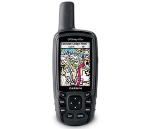
Garmin 62STC GPS Map
Worldwide with Camera and
Europe
Topo Description: When
the terrain gets tough,
you can depend on the
GPSMAP 62sct handheld
navigator to guide you,
with 3-axis
tilt-compensated compass,
barometric altimeter and
a 5 megapixel autofocus
camera with photo
navigation. Inspired by
the powerful GPSMAP 60
series, this rugged and
waterproof GPS combines
high-precision accuracy
with high functionality
to brave the demands of
any terrain you dare to
tackle wherever the
adventure, whatever the
activity. Explore The
TerrainGPSMAP 62st comes
with built-in European
1:100k recreation maps
with street-level detail
and a worldwide basemap
with shaded relief -
ideal tools for serious
climbing or hiking. Map
detail includes national
and local parks and
forests, along with
terrain contours,
elevation information,
trails, rivers, lakes
and points of interest.
It has a 2.6-inch
sunlight-readable colour
screen and supports photo
navigation, so you can
download pictures from
Garmin Connec Photos and
navigate to them.Take
Geotagged PicturesGPSMAP
62sct features a 2.6-inch
sunlight-readable colour
screen with built-in
worldwide basemap with
shaded relief, so you
can navigate anywhere
with ease. You can also
capture locations and
memories with the
5-megapixel autofocus
digital camera. Each
photo is automatically
geotagged with the
location of where it was
taken, allowing you to
navigate back to that
exact spot in the future.
To keep track of your
photos and show their
location on a map,
simply use Garmins free
BaseCamp software.
Alternatively you can
download pictures from
Garmin Connect Photos and
navigate to them.Get Your
BearingsGPSMAP 62sct has
a built-in 3-axis
tilt-compensated
electronic compass,
which helps you get your
orientation and points
you towards your
destination even when you
are standing still,
without holding it level.
Its barometric altimeter
tracks changes in
pressure to pinpoint your
precise altitude. View
elevation and profile on
the altimeter screen and
you can even plot
barometric pressure over
time to keep an eye on
changing weather
conditions. Share
WirelesslyWith GPSMAP
62sct you can share your
waypoints, tracks,
routes and geocaches
wirelessly with other
compatible Garmin GPS
handhelds. So now your
friends can also enjoy
your favourite hike or
cache, simply press send
to transfer your
information to similar
units, and let the games
begin. Keep Your FixWith
a quad helix antenna and
high-sensitivity,
WAAS/EGNOS-enabled GPS
receiver with HotFix
satellite prediction,
GPSMAP 62sct has
unparalleled reception to
locate your position
quickly and precisely and
maintains its GPS
location even in heavy
cover and deep valleys.
The advantage is clear
whether you are in deep
woods or just near tall
buildings and trees, you
can count on GPSMAP 62sct
to help you find your way
when you need it the
most. Enhance Your
AdventuresWith space to
store up to 2000
waypoints and 200 routes,
GPSMAP 62sct's detailed
route planning and
tracking helps you
navigate from
point-to-point and keep
track of your journey as
you go. As you navigate
to a destination on an
active track, you can
view upcoming elevation
changes together with
waypoints and key stages
along the route for a
clear picture of the
journey ahead. And with
customisable display,
you can tailor GPSMAP
62sct's dashboard to show
you the details you need
on your adventure. Add
MapsAdding more maps is
easy with Garmin's wide
array of detailed
topographic, marine and
road maps. You can
conveniently plug in
Garmin GB Discoverer
mapping for OS Explorer
(1:25k) and OS Landranger
(1:50k) detail on your
handheld. Search, select
and navigate to points of
interest and street
addresses and follow the
route on foot, in the
car with turn-by-turn
routing or by bike with
an Ordnance Survey
backdrop. Add BlueChart
g2 preloaded cards for a
great day on the water or
City Navigator NT map
data for routing on roads
in the UK and further
afield (see maps tab for
compatible maps). Or
download customised
sections of premium
raster-based maps onto
your device with BirdsEye
Select and integrate them
with your maps. In
addition, the 62sct is
compatible with Custom
Maps, free software that
transforms paper and
electronic maps into
downloadable maps for
your device. Put your
favourite paper or
digital maps on GPSMAP
62sct by converting
details, labels and
landmarks from other maps
and informal plans like
ski piste routes,
mountain bike trails or
charity treks into
tailored content that is
ready to navigate. Plan
your route, Survey the
terrain, and geotag
photos on your computer,
then load the data to
your outdoor device with
our free downloadable
software BaseCamp. Get
ConnectedYou've been busy
exploring and now you
want to store, save and
share your routes,
tracks and waypoints.
With a simple connection
to your computer and to
the Internet, you can
get a detailed analysis
of your activities and
send tracks to your
outdoor device using
Garmin Connect. Simply
upload activities saved
on GPSMAP 62sct from your
hiking, camping or
geocaching adventure to
keep a record on the web
or swap ideas and
expeditions with others.
This one-stop site offers
an activity table and
allows you to view your
activities on a map using
Google Earth. Explore
other routes uploaded by
millions of Garmin
Connect users and share
your experiences on
Twitter and Facebook.
Getting started is easy,
so get out there,
explore, share and take
your adventures further.
Find FunGPSMAP 62sct
supports geocaching GPX
files to download
geocaches and details
straight to your unit.
Visit OpenCaching.com to
start your geocaching
adventure. Features: *Automatic
routing (turn by turn
routing on roads)(with
optional mapping for
detailed
roads) *Electronic
compass
(tilt-compensated,
3-axis) *Barometric
altimeter *Camera (5
megapixel with autofocus
automatic
geo-tagging) *Geocaching-friendly
(paperless) *Custom maps
compatible *Photo
navigation (navigate to
geotagged
photos) *Hunt/fish
calendar *Sun and moon
information *Tide tables
(with optional
Bluechart) *Area
calculation *Custom POIs
(ability to add
additional points of
interest) *Unit-to-unit
transfer (shares data
wirelessly with similar
units) *Picture
viewer *Garmin Connect
compatible (online
community where you
analyze, categorize and
share data)Garmin
Basecamp Compatible (free
desktop software to plan
and review your
activities) Specifications: Physical
and Performance *Unit
dimensions, WxHxD -
2.4in 6.3in x 1.4in (6.1
x 16.0 x 3.6
cm) *Display size, WxH
- 1.43in x 2.15in (3.6 x
5.5 cm) 2.6in diag (6.6
cm) *Display resolution,
WxH - 160 x 240
pixels *Display type -
transflective, 65-K
colour TFT *Weight - 9.3
oz (262.1 g) with
batteries *Battery - 2
AA NiMH batteries
(included) *Battery life
- 16 hours (2 AA
batteries) *Waterproof -
yes
(IPX7) *High-sensitivity
receiver *Interface -
high-speed USB and NMEA
0183 compatible Maps and
Memory *Preloaded maps
(topographic) *Ability
to add maps *Built-in
memory - 3.5 GB *Accepts
data cards - microSD card
(not
included) *Waypoints/favorites/locations
- 2000 *Routes -
200 *Track log - 10, 000
points, 200 saved tracks
Availability: In Stock
£341.99
Available
-
Garmin 62SC GPS Map
Worldwide with
Camera Description: When
the terrain gets tough,
you can depend on the
GPSMAP 62sc handheld
navigator to guide you,
with 3-axis
tilt-compensated compass,
barometric altimeter and
a 5 megapixel autofocus
camera with photo
navigation. Inspired by
the powerful GPSMAP 60
series, this rugged and
waterproof GPS combines
high-precision accuracy
with high functionality
to brave the demands of
any terrain you dare to
tackle wherever the
adventure, whatever the
activity. Explore and
take Geotagged
PicturesGPSMAP 62sc
features a 2.6-inch
sunlight-readable colour
screen with built-in
worldwide basemap with
shaded relief, so you
can navigate anywhere
with ease. You can also
capture locations and
memories with the
5-megapixel autofocus
digital camera. Each
photo is automatically
geotagged with the
location of where it was
taken, allowing you to
navigate back to that
exact spot in the future.
To keep track of your
photos and show their
location on a map,
simply use Garmins free
BaseCamp software.
Alternatively you can
download pictures from
Garmin Connect Photos and
navigate to them.Get Your
BearingsGPSMAP 62sc has a
built-in 3-axis
tilt-compensated
electronic compass,
which helps you get your
orientation and points
you towards your
destination even when you
are standing still,
without holding it level.
Its barometric altimeter
tracks changes in
pressure to pinpoint your
precise altitude. View
elevation and profile on
the altimeter screen and
you can even plot
barometric pressure over
time to keep an eye on
changing weather
conditions. Share
WirelesslyWith GPSMAP
62sc you can share your
waypoints, tracks,
routes and geocaches
wirelessly with other
compatible Garmin GPS
handhelds. So now your
friends can also enjoy
your favourite hike or
cache, simply press send
to transfer your
information to similar
units, and let the games
begin. Keep Your FixWith
a quad helix antenna and
high-sensitivity,
WAAS/EGNOS-enabled GPS
receiver with HotFix
satellite prediction,
GPSMAP 62sc has
unparalleled reception to
locate your position
quickly and precisely and
maintains its GPS
location even in heavy
cover and deep valleys.
The advantage is clear
whether you are in deep
woods or just near tall
buildings and trees, you
can count on GPSMAP 62sc
to help you find your way
when you need it the
most. Enhance Your
AdventuresWith space to
store up to 2000
waypoints and 200 routes,
GPSMAP 62sc s detailed
route planning and
tracking helps you
navigate from
point-to-point and keep
track of your journey as
you go. As you navigate
to a destination on an
active track, you can
view upcoming elevation
changes together with
waypoints and key stages
along the route for a
clear picture of the
journey ahead. And with
customisable display,
you can tailor GPSMAP
62sc s dashboard to show
you the details you need
on your adventure. Add
MapsAdding more maps is
easy with Garmin's wide
array of detailed
topographic, marine and
road maps. You can
conveniently plug in
Garmin GB Discoverer
mapping for OS Explorer
(1:25k) and OS Landranger
(1:50k) detail on your
handheld. Search, select
and navigate to points of
interest and street
addresses and follow the
route on foot, in the
car with turn-by-turn
routing or by bike with
an Ordnance Survey
backdrop. Add BlueChart
g2 preloaded cards for a
great day on the water or
City Navigator NT map
data for routing on roads
in the UK and further
afield (see maps tab for
compatible maps). Or
download customised
sections of premium
raster-based maps onto
your device with BirdsEye
Select and integrate them
with your maps. In
addition, the 62sc is
compatible with Custom
Maps, free software that
transforms paper and
electronic maps into
downloadable maps for
your device. Put your
favourite paper or
digital maps on GPSMAP
62sc by converting
details, labels and
landmarks from other maps
and informal plans like
ski piste routes,
mountain bike trails or
charity treks into
tailored content that is
ready to navigate. Plan
your route, Survey the
terrain, and geotag
photos on your computer,
then load the data to
your outdoor device with
our free downloadable
software BaseCamp. Get
ConnectedYou've been busy
exploring and now you
want to store, save and
share your routes,
tracks and waypoints.
With a simple connection
to your computer and to
the Internet, you can
get a detailed analysis
of your activities and
send tracks to your
outdoor device using
Garmin Connect. Simply
upload activities saved
on GPSMAP 62sc from your
hiking, camping or
geocaching adventure to
keep a record on the web
or swap ideas and
expeditions with others.
This one-stop site offers
an activity table and
allows you to view your
activities on a map using
Google Earth. Explore
other routes uploaded by
millions of Garmin
Connect users and share
your experiences on
Twitter and Facebook.
Getting started is easy,
so get out there,
explore, share and take
your adventures further.
Find FunGPSMAP 62sc
supports geocaching GPX
files to download
geocaches and details
straight to your unit.
Visit OpenCaching.com to
start your geocaching
adventure.GPSMAP 62sc:
Take it to the
extremeGarmin GPS Map
62SC Worldwide
010-00868-20 Features: *Automatic
routing (turn by turn
routing on roads) (with
optional mapping for
detailed
roads) *Electronic
compass
(tilt-compensated,
3-axis) *Barometric
altimeter
Geocaching-friendly
(paperless) *Camera (5
megapixel with autofocus
automatic
geo-tagging) *Custom
maps compatible *Photo
navigation (navigate to
geotagged
photos) *Hunt/fish
calendar *Sun and moon
information *Tide tables
(with optional
Bluechart) *Area
calculation *Custom POIs
(ability to add
additional points of
interest) *Unit-to-unit
transfer (shares data
wirelessly with similar
units) *Picture
viewer *Garmin Connect
compatible (online
community where you
analyze, categorize and
share data) *Garmin
Basecamp
Compatible Specifications:Physical
and Performance *Unit
dimensions, WxHxD -
2.4" x 6.3" x
1.4" (6.1 x 16.0 x
3.6 cm) *Display size,
WxH - 1.43" x
2.15" (3.6 x 5.5 cm)
2.6" diag (6.6
cm) *Display resolution,
WxH - 160 x 240
pixels *Display type -
transflective, 65-K
colour TFT *Weight - 9.2
oz (260.1 g) with
batteries *Battery - 2
AA batteries (not
included) NiMH or Lithium
recommended *Battery
life - 16
hours *Waterproof - yes
(IPX7) *High-sensitivity
receiver -
yes *Interface -
high-speed USB and NMEA
0183 compatible Maps and
Memory *Basemap *Ability
to add maps *Built-in
memory - 1.7 GB *Accepts
data cards - microSD card
(not
included) *Waypoints/favorites/locations
- 2000 *Routes -
200 *Track log - 10, 000
points, 200 saved tracks
Availability: In Stock
£304.00
Available
-
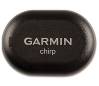
Garmin Chirp Geocaching
Beacon chirp is a
one-of-a-kind wireless
beacon designed
specifically for the
outdoor adventures of
geocaching. Affordable,
durable and waterproof,
chirp can communicate
with, and be programmed
by, any compatible
wireless-enabled Garmin
handheld (sold
separately). chirp stores
hints, multicache
coordinates, counts
visitors and confirms the
cache is nearby. chirp is
password protected and
has a battery life of up
to one year. Get And
Store Hints chirp can be
programmed by any
compatible
wireless-enabled Garmin
handheld to store
geocaching hints and
other information. When
other geocachers arrive
near your cache, they'll
be alerted that the cache
is nearby, and then
they'll be able to access
the hints you've loaded
into chirp. And when you
return, chirp will tell
you how many visitors
have been to your
cache Set Up a
Multicache With chirp,
setting up and
maintaining a multicache
has never been easier.
Using your compatible
Garmin handheld device,
chirp automatically
transmits the coordinates
so other cachers can find
each stage of your
multicache. Or if you're
on a multicache, chirp
lets you download
coordinates. So there's
no need to manually enter
numerous sets of complex
coordinates - there's
just one simple touch and
you're on your way to the
next stage. Built To
Cache - Built to
Last chirp was designed
by geocachers, so it's
built to take the rigours
of the outdoors. Plus,
chirp is password
protected, so you're the
only one with programming
powers. chirp has a
battery life of up to a
year and the battery is
easy to replace, plus
chirp features a
cache-perfect, small
size and is durable and
waterproof. Specifications: Unit
dimensions, WxHxD:
1.3" x 0.9" x
0.3" (3.3 x 2.3 x
0.7 cm) Weight: less than
1.0 oz (28
grams) Waterproof: yes
(IPX7 - 1 metre for 30
minutes) Battery: up to 1
year with continuous use
user replaceable battery
message appears on your
compatible Garmin device
when battery is
low Range: up to 32 feet
(10 metres) Password
protection: yes
Availability: In Stock
£18.99
Available
-
Garmin Birds Eye Select
Retail
Card Description:Enhance
your next adventure in
Great Britain by choosing
tailored extracts of
Ordnance Survey maps for
your Garmin
handheld.Using Garmins
free application,
BaseCamp (version 3.1 or
later), simply select
custom sections of our
bespoke BirdsEye Select
raster imagery and
transfer it straight to
your GPS.A single
purchase allows you to
choose up to 600 sq km of
coverage throughout Great
Britain. Whether you are
heading off on holiday or
embarking upon a series
of expeditions, you can
define the data you need
for your exact
destinations and navigate
with Ordnance Survey
raster mapping to a scale
of 1:25, 000.Our BirdsEye
Select database contains
high-resolution Ordnance
Survey images for a true
representation of your
surroundings. BirdsEye
Select works with your
Garmin handheld maps to
add real-world detail to
roads, buildings and the
terrain for a greater
appreciation of your
environment.Garmin
Birdseye Select Retail
Card
010-11758-00 Specifications: *Detailed
1:25, 000 scale raster
Ordnance Survey maps give
a new level of detail for
your onboard maps
specifically where you
need it - whether a
campsite, remote retreat
or extreme sports
event. *Comprehensive
coverage available,
including England,
Scotland and Wales (OSGB
data). *Choose
customized selections of
raster maps and transfer
to your Garmin handheld
device. *A single
purchase includes 600 sq
km of coverage for your
chosen area in Great
Britain (Additional
quantities can be
purchased if coverage
needed exceeds the
initial size of 600 sq
km). *Layer BirdsEye
Select over other Garmin
vector maps to enhance
features, such as roads,
buildings and terrain
contours in your chosen
area. *Provides
precision detail for the
swift identification of
parking areas, clearings
for camping, trails and
water sources plus
terrain type and land
use. *Displays the
familiar Ordnance Survey
Explorer Map detail,
including trails,
footpaths, view points,
natural reserves, firing
ranges, point of
interest symbols, spot
heights, contour detail
and more. *BaseCamp
software (version 3.1 or
later) must be installed
on the computer (PC or
Mac) in order to select
and transfer the map
data.
Availability: In Stock
£18.99
Available
-
Garmin GB Discoverer The
Norfolk Broads
Mapping Explore Great
Britain's national parks
and trails with detailed
topographic data,
including terrain
contours, topo
elevations, summits,
paths, routable roads
and geographical points.
This product has routable
roads and points of
interest from NAVTEQ and
digital topographic OS
Explorer Map as detailed
as 1:25, 000 scale and
1:50, 000 scale
Landranger maps for the
Norfolk Broads from
Ordnance Survey of Great
Britain. Features: *Includes
terrain contours,
elevations, summits,
trails, trig points,
campsites, geographic
points and
more. *Provides the same
detailed road data used
in our automotive
products, with thousands
of addresses and points
of interest, including
lodging, food and drink,
car parks, banks,
petrol stations,
attractions, campsites
and more. *Includes
Digital Elevation Model
(DEM) for route profile
planning *Provides
turn-by-turn directions
on roads by car or
bike. *Allows user to
search for destinations
by address or by
category: points of
interest include lodging,
food and drink, car
parks, banks, petrol
stations, attractions,
campsites and more.
Availability: In Stock
£59.29
Available
-
Garmin GB Discoverer
National Park Topographic
Mapping Explore Great
Britain's national parks
with detailed topographic
maps and road maps on a
convenient microSD/SD
card. Garmin GB
Discoverer National Parks
contains topographic maps
from Ordnance Survey at
1:50, 000 scale
throughout all the
National Parks in Great
Britain, plus NAVTEQ
road data and points of
interest for all of Great
Britain, providing
turn-by-turn directions
anywhere in the
country.GB Discoverer's
detailed topographic data
includes terrain
contours, topo
elevations, summits,
paths, routable roads
and geographical points.
The premium NAVTEQ road
data is the same detailed
data included in our
leading automotive
products - with thousands
of addresses and points
of interest, including
lodging, food and drink,
car parks, banks,
petrol stations,
attractions, campsites,
and more. Search for an
address or point of
interest, and your
Garmin device displays
turn-by-turn directions
to your
destination.Features *Provides
digital topographic maps
at 1:50, 000 scale for
all of the National Parks
within Great Britain.
*Includes terrain
contours, elevations,
summits, trails, trig
points, campsites,
geographic points and
more. *Includes
detailed road data and
thousands of points of
interest from NAVTEQ.
*Provides turn-by-turn
directions on roads by
car or bike. *Allows
user to search for
destinations by address
or by category: points of
interest include lodging,
food and drink, car
parks, banks, petrol
stations, attractions,
campsites and more
Availability: In Stock
£71.48
Available
-
Garmin TOPO GB
Topographic Map Trek
through the highlands and
the lowlands with
detailed topographic
maps. TOPO Great Britain
includes terrain
contours, topo
elevations, summits,
routable roads, paths,
parks, coastlines,
rivers, lakes and
geographical points.
These detailed maps are
ideal for hiking,
hunting, cycling and
communing with nature.
Coverage includes
topographic detail
throughout Great Britain.
Available on DVD.
Topographic data is
provided by Ordnance
Survey of Great Britain
road maps are provided by
NAVTEQTM. Features: *Includes
topographic coverage
throughout Great
Britain. *Provides
detailed digital
topographic maps with
topographic data from
Ordnance Survey of Great
Britain. *Contains
summit locations with
elevation, detailed
contours, and trig
points. *Allows you to
search by city,
geographic point,
summit, lakes and
more. *Provides
elevation profile on
compatible Garmin devices
so you can estimate
terrain difficulty.
*Contains many trails,
tracks and
paths. *Includes points
of interests such as
parks, scenic lookouts
and picnic sites as well
as lodging, food,
petrol stations and
hopsitals. *(DVD/CD-ROM
only) Includes MapSource,
computer software that
lets you plan trips on
your computer and
transfer waypoints,
routes and tracks between
your computer and your
Garmin device.
Availability: In Stock
£130.13
Available
-
Garmin GPSMAP 62st
Handheld Navigator When
the terrain gets tough,
you can depend on the
GPSMAP 62st handheld
navigator to guide you
through, with 3-axis
tilt-compensated compass,
barometric altimeter and
preloaded European 1:100k
scale recreation maps.
Inspired by the powerful
GPSMAP 60 series, this
rugged and waterproof GPS
combines high-precision
accuracy with high
functionality to brave
the demands of any
terrain you dare to
tackle - wherever the
adventure, whatever the
activity. Explore The
Terrain GPSMAP 62st comes
with built-in European
1:100k recreation maps
with street-level detail
and a worldwide basemap
with shaded relief -
ideal tools for serious
climbing or hiking. Map
detail includes national
and local parks and
forests, along with
terrain contours,
elevation information,
trails, rivers, lakes
and points of interest.
It has a 2.6-inch
sunlight-readable colour
screen and supports photo
navigation, so you can
download pictures from
Garmin ConnectTM Photos
and navigate to them. Get
Your Bearings GPSMAP 62st
has a built-in 3-axis
tilt-compensated
electronic compass,
which helps you get your
orientation and points
you towards your
destination even when
you're standing still,
without holding it level.
Its barometric altimeter
tracks changes in
pressure to pinpoint your
precise altitude. View
elevation and profile on
the altimeter screen and
you can even plot
barometric pressure over
time to keep an eye on
changing weather
conditions. Share
Wirelessly With GPSMAP
62st you can share your
waypoints, tracks,
routes and geocaches
wirelessly with other
compatible Garmin GPS
handhelds. So now your
friends can also enjoy
your favourite hike or
cache - simply press
"send" to
transfer your information
to similar units, and
let the games begin. Keep
Your Fix With a quad
helix antenna and
high-sensitivity,
WAAS-enabled GPS receiver
with HotFix satellite
prediction, GPSMAP 62st
has unparalleled
reception to locate your
position quickly and
precisely and maintains
its GPS location even in
heavy cover and deep
valleys. The advantage is
clear - whether you're in
deep woods or just near
tall buildings and trees,
you can count on GPSMAP
62st to help you find
your way when you need it
the most. Enhance Your
Adventures With space to
store up to 2000
waypoints and 200 routes,
GPSMAP 62st's detailed
route planning and
tracking helps you
navigate from
point-to-point and keep
track of your journey as
you go. As you navigate
to a destination on an
active track, you can
view upcoming elevation
changes together with
waypoints and key stages
along the route for a
clear picture of the
journey ahead. And with
customisable display,
you can tailor GPSMAP
62st's dashboard to show
you the details you need
on your adventure. Add
Maps Adding more maps is
easy with Garmin's wide
array of detailed
topographic, marine and
road maps. You can
conveniently plug in
Garmin GB DiscovererTM
mapping for OS Explorer
(1:25k) and OS Landranger
(1:50k) detail and hit
the trail. The
traditional look and feel
of the Ordnance Survey
map detail complements
Garmin's dynamic search
capabilities. Use GPSMAP
62st to search, select
and navigate to points of
interest and street
addresses and follow the
route on foot, in the
car or by bike with an
Ordnance Survey backdrop.
Add BlueChart g2
preloaded cards for a
great day on the water or
City Navigator NT map
data for turn-by-turn
routing on roads (see
maps tab for compatible
maps). GPSMAP 62st also
supports BirdsEyeTM
Satellite Imagery
(subscription required),
which lets you download
satellite images to your
device and integrate them
with your maps. See the
terrain in terrific
clarity and
high-resolution detail
with satellite and aerial
imagery on your GPSMAP
62st. BirdsEyeTM works
with your BaseCampTM
planning software,
onboard maps and points
of interest to add
real-world images of
buildings, roads,
trails, mountains and
other land features. In
addition, the 62st is
compatible with Custom
Maps, free software that
transforms paper and
electronic maps into
downloadable maps for
your device. Put your
favourite paper or
digital maps on GPSMAP
62st by converting
details, labels and
landmarks from other maps
and informal plans like
ski piste routes,
mountain bike trails or
charity treks into
tailored content that's
ready to navigate. Get
Connected You've been
busy exploring and now
you want to store, save
and share your routes,
tracks and waypoints.
With a simple connection
to your computer and to
the Internet, you can
get a detailed analysis
of your activities and
send tracks to your
outdoor device using
Garmin ConnectTM. Simply
upload activities saved
on GPSMAP 62 from your
hiking, camping or
geocaching adventure to
keep a record on the web
or swap ideas and
expeditions with others.
This one-stop site offers
an activity table and
allows you to view your
activities on a map using
GoogleTM Earth. Explore
other routes uploaded by
millions of Garmin
Connect users and share
your experiences on
Twitter and Facebook.
Getting started is easy,
so get out there,
explore, share and take
your adventures
further. Find Fun GPSMAP
62st supports geocaching
GPX files for downloading
geocaches and details
straight to your unit. By
going paperless, you're
not only helping the
environment but saving
time you would otherwise
waste manually entering
cache details before you
set off. GPSMAP 62st
stores and displays key
information, including
location, terrain,
difficulty, hints and
descriptions, which
means no more manually
entering coordinates or
paper print outs! Simply
upload the GPX file to
your unit and start
hunting for caches. Slim
and lightweight, 62st is
the perfect companion for
all your outdoor
pursuits. GPSMAP 62st:
Take it to the
extreme Features:
Physical &
Performance: Unit
dimensions,
WxHxD: 2.4" x
6.3" x 1.4"
(6.1 x 16.0 x 3.6
cm) Display size,
WxH: 1.43" x
2.15" (3.6 x 5.5 cm)
2.6" diag (6.6
cm) Display resolution,
WxH: 160 x 240
pixels Display
type: transflective,
65-K colour
TFT Weight: 9.2 oz
(260.1 g) with
batteries Battery: 2 AA
batteries (not included)
NiMH or Lithium
recommended Battery
life: 20
hours Waterproof: yes
(IPX7) Floats: no High-sensitivity
receiver: yes Interface: high-speed
USB and NMEA 0183
compatible Maps
&
Memory: Basemap: yes Preloaded
maps: yes
(topographic) Ability
to add
maps: yes Built-in
memory: 500 MB Accepts
data cards: microSDTM
card (not
included) Waypoints/favorites/locations: 2000 Routes: 200 Track
log: 10, 000 points, 200
saved tracks
Features &
Benefits: Automatic
routing (turn by turn
routing on roads): yes
(with optional mapping
for detailed
roads) Electronic
compass: yes
(tilt-compensated,
3-axis) Touchscreen: no Barometric
altimeter: yes Camera: no Geocaching-friendly: yes
(paperless) Custom maps
compatible: yes Photo
navigation (navigate to
geotagged
photos): yes Outdoor
GPS games: no Hunt/fish
calendar: yes Sun and
moon
information: yes Tide
tables: Yes (with
optional
Bluechart) Area
calculation: yes Custom
POIs (ability to add
additional points of
interest): yes Unit-to-unit
transfer (shares data
wirelessly with similar
units): yes Picture
viewer: yes Garmin
ConnectTM compatible
(online community where
you analyze, categorize
and share data): yes
Availability: In Stock
£313.40
Available
-
Garmin GPSMAP 62 Handheld
Navigator When the
terrain gets tough, you
can depend on the GPSMAP
62 handheld navigator to
guide you through.
Inspired by the powerful
GPSMAP 60 series, this
rugged and waterproof GPS
combines high-precision
accuracy with high
functionality to brave
the demands of any
terrain you dare to
tackle - wherever the
adventure, whatever the
activity. Explore The
Terrain GPSMAP 62
features a 2.6-inch
sunlight-readable colour
screen with built-in
worldwide basemap with
shaded relief, so you
can navigate anywhere
with ease. With photo
navigation, you can
download pictures from
Garmin ConnectTM Photos
and navigate to
them. Keep Your Fix With
a quad helix antenna and
high-sensitivity,
WAAS/EGNOS-enabled GPS
receiver with HotFix
satellite prediction,
GPSMAP 62 has
unparalleled reception to
locate your position
quickly and precisely and
maintains its GPS
location even in heavy
cover and deep valleys.
The advantage is clear -
whether you're in deep
woods or just near tall
buildings and trees, you
can count on GPSMAP 62 to
help you find your way
when you need it the
most. Enhance Your
Adventures With space to
store up to 2000
waypoints and 200 routes,
GPSMAP 62's detailed
route planning and
tracking helps you
navigate from
point-to-point and keep
track of your journey as
you go. As you navigate
to a destination on an
active track, you can
view upcoming elevation
changes together with
waypoints and key stages
along the route for a
clear picture of the
journey ahead. And with
customisable display,
you can tailor GPSMAP
62's dashboard to show
you the details you need
on your
adventure. Adventure
Further GPSMAP 62 has a
built-in worldwide
basemap with shaded
relief. Adding more maps
is easy with Garmin's
wide array of detailed
topographic, marine and
road maps, which can be
loaded to internal
memory. Get
Connected You've been
busy exploring and now
you want to store, save
and share your routes,
tracks and waypoints.
With a simple connection
to your computer and to
the Internet, you can
get a detailed analysis
of your activities and
send tracks to your
outdoor device using
Garmin ConnectTM. Simply
upload activities saved
on GPSMAP 62 from your
hiking, camping or
geocaching adventure to
keep a record on the web
or swap ideas and
expeditions with others.
This one-stop site offers
an activity table and
allows you to view your
activities on a map using
GoogleTM Earth. Explore
other routes uploaded by
millions of Garmin
Connect users and share
your experiences on
Twitter and Facebook.
Getting started is easy,
so get out there,
explore, share and take
your adventures
further. Find Fun GPSMAP
62 supports geocaching
GPX files for downloading
geocaches and details
straight to your unit. By
going paperless, you're
not only helping the
environment but saving
time you would otherwise
waste manually entering
cache details before you
set off. GPSMAP 62 stores
and displays key
information, including
location, terrain,
difficulty, hints and
descriptions, which
means no more manually
entering coordinates or
paper print outs! Simply
upload the GPX file to
your unit and start
hunting for caches. Slim
and lightweight, 62 is
the perfect companion for
all your outdoor
pursuits. GPSMAP 62: Take
it to the
extreme Features:
Physical &
Performance: Unit
dimensions,
WxHxD: 2.4" x
6.3" x 1.4"
(6.1 x 16.0 x 3.6
cm) Display size,
WxH: 1.43" x
2.15" (3.6 x 5.5 cm)
2.6" diag (6.6
cm) Display resolution,
WxH: 160 x 240
pixels Display
type: transflective,
65-K colour
TFT Weight: 9.2 oz
(260.1 g) with
batteries Battery: 2 AA
batteries (not included)
NiMH or Lithium
recommended Battery
life: 20
hours Waterproof: yes
(IPX7) Floats: no High-sensitivity
receiver: yes Interface: USB
and NMEA 0183
compatible Maps
&
Memory: Basemap: yes Preloaded
maps: no Ability to add
maps: yes Built-in
memory: 1.7 GB Accepts
data
cards: no Waypoints/favorites/locations: 2000 Routes: 200 Track
log: 10, 000 points, 200
saved tracks
Features &
Benefits: Automatic
routing (turn by turn
routing on roads): yes
(with optional mapping
for detailed
roads) Electronic
compass: no Touchscreen: no Barometric
altimeter: no Camera: no Geocaching-friendly: yes
(paperless) Custom maps
compatible: yes Photo
navigation (navigate to
geotagged
photos): yes Outdoor
GPS games: no Hunt/fish
calendar: yes Sun and
moon
information: yes Tide
tables: Yes (with
optional
Bluechart) Area
calculation: yes Custom
POIs (ability to add
additional points of
interest): yes Unit-to-unit
transfer (shares data
wirelessly with similar
units): no Picture
viewer: yes Garmin
ConnectTM compatible
(online community where
you analyze, categorize
and share data): yes
Availability: In Stock
£201.08
Available
-
Garmin GPSMAP 62s
Handheld Navigator When
the terrain gets tough,
you can depend on the
GPSMAP 62s handheld
navigator to guide you
through, with 3-axis
tilt-compensated compass
and barometric altimeter.
Inspired by the powerful
GPSMAP 60 series, this
rugged and waterproof GPS
combines high-precision
accuracy with high
functionality to brave
the demands of any
terrain you dare to
tackle - wherever the
adventure, whatever the
activity. Explore The
Terrain GPSMAP 62s
features a 2.6-inch
sunlight-readable colour
screen with built-in
worldwide basemap with
shaded relief, so you
can navigate anywhere
with ease. With photo
navigation, you can
download pictures from
Garmin ConnectTM Photos
and navigate to them. Get
Your Bearings GPSMAP 62s
has a built-in 3-axis
tilt-compensated
electronic compass,
which helps you get your
orientation and points
you towards your
destination even when
you're standing still,
without holding it level.
Its barometric altimeter
tracks changes in
pressure to pinpoint your
precise altitude. View
elevation and profile on
the altimeter screen and
you can even plot
barometric pressure over
time to keep an eye on
changing weather
conditions. Share
Wirelessly With GPSMAP
62s you can share your
waypoints, tracks,
routes and geocaches
wirelessly with other
compatible Garmin GPS
handhelds. So now your
friends can also enjoy
your favourite hike or
cache - simply press
"send" to
transfer your information
to similar units, and
let the games begin. Keep
Your Fix With a quad
helix antenna and
high-sensitivity,
WAAS/EGNOS-enabled GPS
receiver with HotFix
satellite prediction,
GPSMAP 62s has
unparalleled reception to
locate your position
quickly and precisely and
maintains its GPS
location even in heavy
cover and deep valleys.
The advantage is clear -
whether you're in deep
woods or just near tall
buildings and trees, you
can count on GPSMAP 62s
to help you find your way
when you need it the
most. Enhance Your
Adventures With space to
store up to 2000
waypoints and 200 routes,
GPSMAP 62s's detailed
route planning and
tracking helps you
navigate from
point-to-point and keep
track of your journey as
you go. As you navigate
to a destination on an
active track, you can
view upcoming elevation
changes together with
waypoints and key stages
along the route for a
clear picture of the
journey ahead. And with
customisable display,
you can tailor GPSMAP
62s's dashboard to show
you the details you need
on your adventure. Add
Maps Adding more maps is
easy with Garmin's wide
array of detailed
topographic, marine and
road maps. You can
conveniently plug in
Garmin GB DiscovererTM
mapping for OS Explorer
(1:25k) and OS Landranger
(1:50k) detail and hit
the trail. The
traditional look and feel
of the Ordnance Survey
map detail complements
Garmin's dynamic search
capabilities. Use GPSMAP
62s to search, select
and navigate to points of
interest and street
addresses and follow the
route on foot, in the
car or by bike with an
Ordnance Survey backdrop.
Add BlueChart g2
preloaded cards for a
great day on the water or
City Navigator NT map
data for turn-by-turn
routing on roads (see
maps tab for compatible
maps). GPSMAP 62s also
supports BirdsEyeTM
Satellite Imagery
(subscription required),
which lets you download
satellite images to your
device and integrate them
with your maps. See the
terrain in terrific
clarity and
high-resolution detail
with satellite and aerial
imagery on your GPSMAP
62s. BirdsEyeTM works
with your BaseCampTM
planning software,
onboard maps and points
of interest to add
real-world images of
buildings, roads,
trails, mountains and
other land features. In
addition, the 62s is
compatible with Custom
Maps, free software that
transforms paper and
electronic maps into
downloadable maps for
your device. Put your
favourite paper or
digital maps on GPSMAP
62s by converting
details, labels and
landmarks from other maps
and informal plans like
ski piste routes,
mountain bike trails or
charity treks into
tailored content that's
ready to navigate. Get
Connected You've been
busy exploring and now
you want to store, save
and share your routes,
tracks and waypoints.
With a simple connection
to your computer and to
the Internet, you can
get a detailed analysis
of your activities and
send tracks to your
outdoor device using
Garmin ConnectTM. Simply
upload activities saved
on GPSMAP 62 from your
hiking, camping or
geocaching adventure to
keep a record on the web
or swap ideas and
expeditions with others.
This one-stop site offers
an activity table and
allows you to view your
activities on a map using
GoogleTM Earth. Explore
other routes uploaded by
millions of Garmin
Connect users and share
your experiences on
Twitter and Facebook.
Getting started is easy,
so get out there,
explore, share and take
your adventures
further. Find Fun GPSMAP
62s supports geocaching
GPX files for downloading
geocaches and details
straight to your unit. By
going paperless, you're
not only helping the
environment but saving
time you would otherwise
waste manually entering
cache details before you
set off. GPSMAP 62s
stores and displays key
information, including
location, terrain,
difficulty, hints and
descriptions, which
means no more manually
entering coordinates or
paper print outs! Simply
upload the GPX file to
your unit and start
hunting for caches. Slim
and lightweight, 62s is
the perfect companion for
all your outdoor
pursuits. GPSMAP 62s:
Take it to the
extreme Features: Physical
& Performance: Unit
dimensions,
WxHxD: 2.4" x
6.3" x 1.4"
(6.1 x 16.0 x 3.6
cm) Display size,
WxH: 1.43" x
2.15" (3.6 x 5.5 cm)
2.6" diag (6.6
cm) Display resolution,
WxH: 160 x 240
pixels Display
type: transflective,
65-K colour
TFT Weight: 9.2 oz
(260.1 g) with
batteries Battery: 2 AA
batteries (not included)
NiMH or Lithium
recommended Battery
life: 20
hours Waterproof: yes
(IPX7) Floats: no High-sensitivity
receiver: yes Interface: high-speed
USB and NMEA 0183
compatible Maps
&
Memory: Basemap: yes Preloaded
maps: no Ability to add
maps: yes Built-in
memory: 1.7 GB Accepts
data cards: microSDTM
card (not
included) Waypoints/favorites/locations: 2000 Routes: 200 Track
log: 10, 000 points, 200
saved tracks
Features &
Benefits: Automatic
routing (turn by turn
routing on roads): yes
(with optional mapping
for detailed
roads) Electronic
compass: yes
(tilt-compensated,
3-axis) Touchscreen: no Barometric
altimeter: yes Camera: no Geocaching-friendly: yes
(paperless) Custom maps
compatible: yes Photo
navigation (navigate to
geotagged
photos): yes Outdoor
GPS games: no Hunt/fish
calendar: yes Sun and
moon
information: yes Tide
tables: Yes (with
optional
Bluechart) Area
calculation: yes Custom
POIs (ability to add
additional points of
interest): yes Unit-to-unit
transfer (shares data
wirelessly with similar
units): yes Picture
viewer: yes Garmin
ConnectTM compatible
(online community where
you analyze, categorize
and share data): yes
Availability: In Stock
£278.02
 Denmark