-
Home
-
Contributors
-
International
-
Account
-
Information
More From Contributor
- the world's top ranking city for standard ...
Includes:: English; all the text on the reverse is in German. Each title also
Includes:: a code for a free download onto a smartphone. To see other titles in this series please click on the series link.USEFUL TIP: the same cartography, reduced slightly to 1:60, 000, is used in Kümmerly + Frey’s hiking series with highlighting for all the waymarked trails rather than, as in this series, just a selection of 33 special routes recommended by the publishers. ...
Includes:: English. ...
Includes:: brief notes & a list of useful phone numbers. Map legend & the text include English. Unfortunately some of the street names are difficult to read, particularly on the enlargement for the city centre, almost obliterated by symbols highlighting various places of interest. Better know for its gnomes & bankers, Zurich is apparently full of night clubs! ...
Includes:: English. ...

Zurich K+F Hiking Map 6
marked, plus various types of accommodation: campsites, youth hostels, “Friends of Nature” houses, and secluded hotels and restaurants. Road network indicates local bus routes with stops. Railways, narrow gauge mountain railways, cable car lines, and chair lifts are shown, with various symbols highlighting places of interest, viewpoints, picnic sites, swimming pools, etc.Each title covers an area of approximately 60 x 42 km (37 x 26 miles). The maps have a 1km Swiss national grid, plus latitude and longitude margin ticks at 5’ intervals. *Map legend includes English.* On the reverse, an index of towns and villages includes names of geographical features such as mountains, alpine passes, glaciers, lakes, rivers, as well as places of interest. Also provided is an
overview road map of surrounding region.
This page now acts as a permanent archive for this product. Add more information using the comments box below to ensure it can still be found by future generations.
Use our search facility to see if it is available from an alternative contributor.
- External links may include paid for promotion
- Availability: Out Of Stock
- Supplier: Stanfords
- SKU: 9783259022061
Product Description
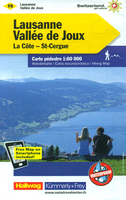
Zurich area at 1:60, 000 in Kümmerly + Frey’s hiking series of Switzerl&, with most titles now printed on light, waterproof & tear-resistant plastic paper. The series offers a popular alternative to Swiss survey maps & cartography which many walkers find easier to follow. Coverage of the whole country is designed so that each title presents a popular hiking area. The maps have contours at 50 or 25-metre intervals according to the terrain, enhanced by graphic relief & shading. An overprint distinguishes between sign-posted hiking paths, mountain path where proper walking shoes are necessary, & alpine paths requiring special equipment. Most titles now also indicate national & regional long-distance hiking routes, each annotated with its official number. Mountain huts are marked, plus various types of accommodation: campsites, youth hostels, “ Friends of Nature” houses, & secluded hotels & restaurants. Road network indicates local bus routes with stops. Railways, narrow gauge mountain railways, cable car lines, & chair lifts are shown, with various symbols highlighting places of interest, viewpoints, picnic sites, swimming pools, etc. Each title covers an area of Approx. 60 x 42 km (37 x 26 miles). The maps have a 1km Swiss national grid, plus latitude & longitude margin ticks at 5’ intervals. * Map legend
Includes:: English.* On the reverse, an index of towns & villages
Includes:: names of geographical features such as mountains, alpine passes, glaciers, lakes, rivers, as well as places of interest. Also provided is an overview road map of surrounding region.
Reviews/Comments
Add New
Intelligent Comparison
We couldn't find anything!
Perhaps this product's unique.... Or perhaps we are still looking for comparisons!
Click to bump this page and we'll hurry up.
Price History
Vouchers
Do you know a voucher code for this product or supplier? Add it to Insights for others to use.


 United Kingdom
 France
 Germany
 Netherlands
 Sweden
 USA
USA
 Italy
Italy
 Spain
Spain


 Denmark