More From Contributor

£18.95
Map No. 103, Zurich
- St. Gallen, in the Swiss topographic survey at 1:100, 000 published in 23 standard sheets (Nos. 26
-

...
Archived Product
£20.99
Swiss topographic survey at 1:100, 000 from Swisstopo, highly regarded for it superb use of graphic relief & hill shading, ...
Archived Product
£5.95
Zurich in the Wallpaper City Guide series, published by Phaidon & encompassing a collection of pocket-size guides dedicated to the best design elements in major cities. Compiled by experts at the Wallpaper magazine, the guides are widely recognized for appealing to design-conscious travellers & are aimed at those interested in art, design & architecture. Each guide identifies the best bars, restaurants, hotels, places to shop, leisure activities & excursions with a unique emphasis on the finest examples of unusual architecture & design. Each Wallpaper City Guide has the same layout, with separate tabs allowing readers & travellers to access individual sections easily. The tabs consist of Landmarks, Hotels, 24 Hours, Urban Life, Architour, Shopping, Sports & Escapes. High quality colour photographs appear alongside brief descriptions of each hotel, bar or attraction, highlighting distinctive & unusual styles of architecture & design. Extra pages are provided at the back of each guide, allowing readers to record their own notes & sketches. ...
Archived Product
£19.99
Zurich area at 1:60, 000 in Kümmerly + Frey’s series of cycling maps published in co-operation with the Association for Transport & Environment & showing the official “ Cycling in Switzerland” routes. The aim of the series is to present a network of routes with as few problems as possible caused by motor traffic. The maps have a detailed base, with contours plus graphic relief & shading providing an excellent representation of the terrain. Routes are classified according to the density of motorized traffic, the difficulty of the terrain, & road restrictions. Unsurfaced roads are indicated, gradient marks show steep inclines, & local danger spots are highlighted. The maps show facilities for transporting cycles by train, bus, ferries, mountain railways, chair lifts, & cable cars. Border crossings indicate those open only to hikers & cyclist during daylight hours. Bike rental facilities are marked & towns with special bicycle-friendly accommodation are highlighted. Other tourist information

Includes::
various types of accommodations (campsites, youth hostels, “ Friends of Nature” houses, etc), viewpoints, picnic sites, swimming pools, & places of interest. Each title covers an area of Approx. 60 x 42 km (37 x 26 miles). The maps have a 1km grid for GPS users, with latitude & longitude shown as margin ticks. Map legend

Includes::
English. On the reverse, an index of towns & villages also lists names of geographical features such as mountains, alpine passes, glaciers, etc. Also included is general information on the country’s long-distance cycling routes & on transporting bikes by train (text

Includes::
English). To see the list of titles in this series please click on the series link.


...
Archived Product
£5.99
Tourist street plan of Zurich in Hallwag’s City Flash series: laminated, waterproof & tear-resistant, presented in a handy concertina format, with street plans, maps of the main shopping street, the airport & the city’s environs, plus a transport network diagram. The main plan, divided between the two sides of the map, covers the city with its suburbs at 1:16, 000, extending from Oerlikon in the north to Tiefenbrunnen on Lake Zurich & from Altstetten in the west to Hottingen in the east. The city centre is shown enlarged to 1:9, 000. Both plan show tram & bus routes with stops & line numbers, car parks & various places of interest. The enlargement also indicates one way streets & taxi ranks. The index lists only a selection of streets, but the map

Includes::
lists of the city’s museums & other places of interest. Zurich’s main shopping street, Bahnhof Strasse leading from the central railway station to the lake, is shown with colour coded names of restaurants & cafes, banks, various shops including clothing & watches, etc. Also included are: a detailed plan of the airport showing access & parking facilities, a map of the city’s outer suburbs showing road connections to the airport, a diagram of the city’s entire public transport network, plus general tourist information on emergency phone numbers, etc.* Hallwag City Flash street plans* are produced in a handy concertina format & are waterproof & tear-resistant. The maps are double-sided & combine a street plan of the city’s central district with an enlargement for the main shopping/entertainment area, a road map of the environs, a diagrams of the metro and/or other public transport lines, a plan of the airport, lists of main places of interest, plus emergency numbers & other useful tourist information.

...
Archived Product
£10.00
Zurich Crumpled City Map from a collection of street plans of major cities printed on soft, very lightweight (approximately only 20g) & yet extremely tear-resistant & 100% waterproof material, specifically designed to be scrunched & crammed into pockets, handbags & backpacks, either on its own or in the pouch from the same material provided with each map. Creases are a fully intentional part of the quirkiness of the Crumpled City maps – the more battered they are they better they look. Parks & other green spaces are highlighted, as are metro stations, & important buildings are named. Each map also highlights 10 recommended “soulsights”, imaginatively chosen to present the essence of each city rather than the most obvious tourist destinations. The accompanying index placed next to the map lists locations of tourist interest: selected streets & squares, monuments & historical places, museums & galleries, parks, etc. Whilst cartographically these Crumpled City maps provide perhaps not the most precise representation of the street network, they are handy for sightseeing, light & durable, can be used as a table cloth when picnicking in the Luxembourg Gardens, Hyde Park, the Retiro or the Central Park, or just as an unusual decoration… Selected cities are also presented on more colourful ‘junior’ maps, specially designed for children. Drawings highlight not only important buildings & famous locations but also places which will specifically appeal to children: toy shops, bookshops, best ice cream, etc. Each title has a list of the recommended not-to-be missed locations with addresses &, where available, websites. To see the full list of cities covered by this unique series please click on the series link. ...
Archived Product
£4.99
Central Zurich in a series of handy pocket street plans from Freytag & Berndt. Each map is laminated, so waterproof & tear-resistant, & highlights the publishers’ recommendations of five best choices in five categories: shopping, restaurants & cafes, culture, nightlife & sights. On one side is an indexed street plan annotated with colour-coded markers highlighting the publishers’ recommendations, all listed on the reverse of the map with brief notes in several languages. In larger cities the plans cover only the central districts. Also provided are a small road map of the city’s environs, if appropriate a diagram of the metro network, & a Fact Box with phone numbers for tourist offices, car hire & emergency services. Map legend & notes on the recommendations include English. To see other titles in this series please click on the series link. ...
Archived Product
£8.99
The double-sided city maps include all essential information:- detailed & clear representation of town centre- appealing 3D-display of selected typical buildings- brief description of 16 highlights in 4 languages complemented with attractive pictures- useful additional information for a successful trip (vicinity map, public transport, travel information, climate chart, index of important streets)- up-to-date amendments via QR-Code (airports, local traffic, fairgrounds…). ...
Archived Product
£16.95
One of a series of beautiful, h&-drawn plans, offering bird's-eye views of popular cities. Every building is drawn to scale with full architectural details, from street arcades to rooftops & inner courtyards. The plans were drawn in 1950s to 1970s & offer a unique opportunity to see these cities as they were before many of the often controversial redevelopments. ...
Archived Product
£19.99
Zurich area at 1:60, 000 in Kümmerly + Frey’s hiking series of Switzerl&, with most titles now printed on light, waterproof & tear-resistant plastic paper. The series offers a popular alternative to Swiss survey maps & cartography which many walkers find easier to follow. Coverage of the whole country is designed so that each title presents a popular hiking area. The maps have contours at 50 or 25-metre intervals according to the terrain, enhanced by graphic relief & shading. An overprint distinguishes between sign-posted hiking paths, mountain path where proper walking shoes are necessary, & alpine paths requiring special equipment. Most titles now also indicate national & regional long-distance hiking routes, each annotated with its official number. Mountain huts are marked, plus various types of accommodation: campsites, youth hostels, “ Friends of Nature” houses, & secluded hotels & restaurants. Road network indicates local bus routes with stops. Railways, narrow gauge mountain railways, cable car lines, & chair lifts are shown, with various symbols highlighting places of interest, viewpoints, picnic sites, swimming pools, etc. Each title covers an area of Approx. 60 x 42 km (37 x 26 miles). The maps have a 1km Swiss national grid, plus latitude & longitude margin ticks at 5’ intervals. * Map legend

Includes::
English.* On the reverse, an index of towns & villages

Includes::
names of geographical features such as mountains, alpine passes, glaciers, lakes, rivers, as well as places of interest. Also provided is an overview road map of surrounding region.


...
Archived Product

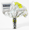
Zurich City Spot Guide SUPERCEDED

This is a savvy city breakers' pocket guide to seeing and doing more in beautiful Zurich - the world's top ranking city for standard of living - with a fun-seeking and cost-conscious slant. It features practical accommodation, restaurant and nightlife listings to suit varied budgets and tastes; imaginative suggestions that reveal the city's hidden gems; and a compact format that quickly locates the top must-see and do attractions.
RIP - This product is no longer available on our network. It was last seen on 25.09.2019

This page now acts as a permanent archive for this product. Add more information using the comments box below to ensure it can still be found by future generations.

Use our search facility to see if it is available from an alternative contributor.
  • Availability: Out Of Stock
  • Supplier: Stanfords
  • SKU: 9781848480629
Availability: In Stock
£6.99

Product Description

This is a savvy city breakers' pocket guide to seeing & doing more in beautiful Zurich
- the world's top ranking city for standard of living
- with a fun-seeking & cost-conscious slant. It features practical accommodation, restaurant & nightlife listings to suit varied budgets & tastes; imaginative suggestions that reveal the city's hidden gems; & a compact format that quickly locates the top must-see & do attractions.

Reviews/Comments

Add New

Intelligent Comparison

Oooops!
We couldn't find anything!
Perhaps this product's unique.... Or perhaps we are still looking for comparisons!
Click to bump this page and we'll hurry up.

Price History

Vouchers

No voucher codes found.
Do you know a voucher code for this product or supplier? Add it to Insights for others to use.

Facebook

Jargon Buster

compact - Carefuly designed to ensure an item has a minimal physical size
World - A physical grouping, commonly used to describe earth and everything associated with ti
Fun - Something that provides amusement or enterainment
Compact - something that has a lot combined within a small space.
Accommodation - A room in which someone can live in, for example in a hotel
Practical - Weather a task is easy to carry out and realistically succeed.
Pocket - A bag shaped insert in clothing used to carry items

Supplier Information

Stanfords
Stanfords was established in 1853 and opened their iconic Covent Garden flagship store in 1901. They have become the top retailer of maps, travel books and accessories in the UK and arguably offer the largest selection of maps and travel books worldwide. Famous names such as Captain Robert Falcon Scott, Ranulph Fiennes and Michael Palin have purchased from Stanfords. They now have a shop in Bristol and both stores together with other venues operate a calendar of events including talks, book signings and exhibitions. As a specialist map retailer, the map selection is comprehensive and includes road maps, street maps and walking maps from worldwide destinations, as well as a selection of world atlases and wall maps. Books include travel guides and travel literature. Stanfords also stock globes, from miniatures made of blue marble to magnificent floor-standing globes. The website features a selection of interesting articles on travel topics.
Page Updated: 2023-11-12 20:15:36

Community Generated Product Tags

Oh No! The productWIKI community hasn't generated any tags for this product yet!
Menu