
 United Kingdom
 France
 Germany
 Netherlands
 Sweden
 USA
USA
 Italy
Italy
 Spain
Spain
More From Contributor


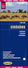


Zimbabwe National Parks Map
Zimbabwe’s national parks and tourist areas presented on separate panels, annotated with GPS coordinates for important locations, entry gates, accommodation facilities, viewpoints, etc. Scales which vary according to the size of the park are clearly marked on each panel.A small overview map of Zimbabwe shows the location of each area covered by an individual panel which presents the road network to and within each park, indicating tarred and unsurfaced roads and 4x4 seasonal tracks. Driving distances are shown on most routes and entry gates are marked, indicating where appropriate permit requirements. Where useful, important road junctions are annotated with their GPS waypoints and the panels also have latitude and longitude lines. Symbols show locations of petrol stations,
hotels/lodges/chalets, campsites, animal viewing points, and other places of interest.The map covers: Zambezi NP with Victoria Falls, Mana Pools NP, Hwange NP, Gonarezhou NP, Kazuma Pan NP, Hurungwe and Charara Safari areas, Matusadona NP, Lake Kyle Recreational Park, Chizarira NP, Matobo NP, and Nyanga NP. All information is in English.
hotels/lodges/chalets, campsites, animal viewing points, and other places of interest.The map covers: Zambezi NP with Victoria Falls, Mana Pools NP, Hwange NP, Gonarezhou NP, Kazuma Pan NP, Hurungwe and Charara Safari areas, Matusadona NP, Lake Kyle Recreational Park, Chizarira NP, Matobo NP, and Nyanga NP. All information is in English.

Product Description
Reviews/Comments
Add New
Vouchers
No voucher codes found.
Do you know a voucher code for this product or supplier? Add it to Insights for others to use.
Do you know a voucher code for this product or supplier? Add it to Insights for others to use.
 Denmark