
 United Kingdom
 France
 Germany
 Netherlands
 Sweden
 USA
USA
 Italy
Italy
 Spain
Spain
More From Contributor


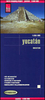
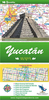

Yucatan ITMB
Double-sided, indexed road map of the region, printed on durable waterproof paper. Coverage divides the area into north and south sections, and includes all of Belize. General relief is portrayed by the publisher’s characteristic altitude tinting, and selected altitudes are marked. Reefs and swamp/mangrove areas are indicated and national parks/reserve areas are marked. Road detail includes tertiary roads and selected tracks, with locations of selected petrol stations and intermediate distances marked on many routes. Main railways and major ferry connections are also included, and time-zone and provincial boundaries are shown. Symbols show campgrounds, trailer parks, airports, airstrips, points of interest, archaeological sites, lighthouses, harbours, viewpoints, etc.
Latitude and longitude lines are drawn at 30’ intervals. Map legend is in English and Spanish.This title is part of a series of detailed touring maps of Mexico published by ITMB.
Latitude and longitude lines are drawn at 30’ intervals. Map legend is in English and Spanish.This title is part of a series of detailed touring maps of Mexico published by ITMB.

Product Description
Reviews/Comments
Add New
Vouchers
No voucher codes found.
Do you know a voucher code for this product or supplier? Add it to Insights for others to use.
Do you know a voucher code for this product or supplier? Add it to Insights for others to use.
 Denmark