
 United Kingdom
 France
 Germany
 Netherlands
 Sweden
 USA
USA
 Italy
Italy
 Spain
Spain
More From Contributor


Yukon & Northwest Territories South West ITMB
Canada’s Yukon Territory at 1:1, 000, 000 on a double-sided map from ITMB with altitude colouring to show its topography, plus street plans of White Horse, Dawson City and Watson Lake annotated with hotels and other facilities.The map divides Yukon north/south with a generous overlap between the sides. Altitude colouring with bands in feet shows the topography, with plenty of names of mountain ranges, etc. Peak heights are given in metres. Roads are annotated, where appropriate, with the likely seasonal closure months and winter only tracks are included. The map gives driving distances in both miles and kilometres and shows locations of petrol stations and border crossings to Alaska. Also marked are local airstrips and float plane bases. Symbols indicate places with tourist
accommodation including RV grounds and campsites. Coverage includes the adjoining regions of Northwest Territories to show road access to Inuvik, Tuktoyaktuk, and the hiking trail from the Macmillan Pass to Norman Wells. Latitude and longitude lines are drawn at 1° intervals. Each side has a separate index. Also provided is a distance table plus street plans of White Horse, Dawson City and Watson Lake annotated with hotels and other facilities.To see other maps is this series please click on the series link.
accommodation including RV grounds and campsites. Coverage includes the adjoining regions of Northwest Territories to show road access to Inuvik, Tuktoyaktuk, and the hiking trail from the Macmillan Pass to Norman Wells. Latitude and longitude lines are drawn at 1° intervals. Each side has a separate index. Also provided is a distance table plus street plans of White Horse, Dawson City and Watson Lake annotated with hotels and other facilities.To see other maps is this series please click on the series link.
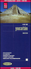
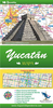
Product Description
Reviews/Comments
Add New
Vouchers
No voucher codes found.
Do you know a voucher code for this product or supplier? Add it to Insights for others to use.
Do you know a voucher code for this product or supplier? Add it to Insights for others to use.
 Denmark