More From Contributor
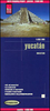
£23.99
Map No. 10020, Ytre Oslofjord, in the new topographic survey of Norway at 1:50, 000 covering the country on 195 double-sided sheets & first published by Nordeca in 2011
- 2012; fully GPS compatible, indicating waymarked footpaths, campsites, tourist huts, illuminated ski runs, etc. The maps, now published by Nordeca, the successors to Statens Kartverk & its subsequent owners the Ugland Group, are printed on light, waterproof & tear-resistant synthetic paper. Each map covers an area of 62x 45 kilometres (39 x 28 miles approx.), with a 2-km overlap between the sheets. The maps have contours at 20m intervals (10m glacier contours), plus colouring & graphics to show cultivated areas, bogs, forests, etc. In addition to all the information expected of topographic mapping at this scale the maps distinguish between waymarked & unmarked footpaths & show campsites, tourist huts (serviced/self service/no supplies), country hotels & restaurants, & illuminated ski trails. The series uses EUREF89 (WGS84) datum & the maps have a 1-km UTM grid. Map legend is in Norwegian & English. Each title comes in a sturdy protective card envelope.
...
Archived Product
£16.99
Topographic survey of Sweden at 1:50, 000, the Terrängkartan, from the Lantmäteriet, covering most of the country in 244 double-sided maps. Please note: the mountainous regions of central & northern Sweden are not covered by this series but presented in a separate “ Fjällkartan
- Mountain Map” series also listed on our website. Each 1:50, 000 topographic survey map covers an area of 37.5 x 40km. The maps have contours at 5 metre intervals, plus relief shading & graphics for rocky outcrops & boulders. Further graphics and/or colouring show different types of land use or vegetation (forests, arable l&, orchards, marshes, peat bogs, etc). An unusual feature of this survey is the colouring indicating buildings below or above two storeys high & “leisure/holiday homes”. The maps indicate privately maintained roads & include all other information expected of topographic survey at this scale. The maps have a 1-km UTM grid, plus latitude & longitude lines 5’ intervals. Map legend

Includes::
English. For coverage of the country’s most visited hiking areas in central & northern Sweden please see Lantmäteriet’s Mountain Map series, listed separately on our website.


...
Archived Product
£16.99
Sverigeserien is an outdoor map series consisting of 116 sheets with coverage of southern & central Sweden & the northern coastline. The map is suitable for outdoor activities such as hiking, excursions, trail running, hunting, fishing, riding, cycling, mountain biking, paddling, skating & much more. Every sheet covers an area of 45x 68km. These topographical maps in scale 1:50 000 contain all the information needed for outdoor activities: Terrain information, hiking trails, illuminated tracks, camping, shelters, golf courses, leisure baths, historical remains, roads in different categories, railway lines & much more. Easy to read topography with contour lines, vertical interval 5 m. Sverigeserien is a high-quality map series & is durable for frequent use! Updated content with map data from Lantmäteriet (National Land Survey of Sweden) & printed on Polyart which is water & tear resistant. This means that the map can be folded repeatedly without breaking & can withstand the challenging weather in Sweden during both winter & summer. Legend is in Swedish, English & German. ...
Archived Product
£4.79
Yucatan Peninsula at 1:650, 000 on an indexed road map with topographic & tourist information, printed on light, waterproof & tear-resistant plastic paper. The map is published by Rough Guides with cartography from the highly acclaimed World Mapping Project by the German publishers Reise Know-How. Subtle altitude colouring with contours & spot heights presents topography. Swamps, mangroves & coral reefs in the coastal waters are also marked. Road network

Includes::
local tracks & indicates driving distances on main routes & locations of petrol stations. Railways lines are included & local airports are marked. National parks & other protected areas are highlighted & a range of symbols mark various places of interest including viewpoints, campsites, beaches, surfing & diving sites, etc. Special symbols indicate the region

...
Archived Product
£11.19
The Yucatan in the Countries, Regions & Cities series from Rough Guides; comprehensively detailed guidebooks specifically designed for independent travellers & serving a range of worldwide destinations. Widely recognised for their free editorial style, Rough Guide authors are allowed to express their personal opinions on a range of subjects. Although sometimes controversial, this editorial stance allows readers to experience more detailed & personal takes on each destination, a feature often more limited in other guidebooks. Cultural & historical nuances are explored in significant depth throughout the text & descriptions on the ambience of individual settings alongside personal recommendations, particularly in cities, are notably prevalent. Each Rough Guide in the Countries, Regions & Cities series has a similar layout. A ...
Archived Product
£14.99
Yucatan & Mayan Mexico in the Cadogan guide series; covering a range of destinations – primarily in Europe
- & combining solid
...
Archived Product
£9.99
Yucatan at 1:1, 000, 00 from Borch on an indexed, laminated & waterproof map of the peninsula with street plans of its main towns, enlargements for the Maya Riviera & Cozumel, plus plans of major Maya sites. The main map covers the peninsula, extending westwards to Villahermosa & south to Belize City, with an inset at the same scale extending it to Flores in northern Guatemala to include Tikal & other Maya remains in that region. The map highlights numerous Maya temples & other archaeological sites, places of interest, beaches along the Riviera Maya coast, national parks & nature reserves, campsites, etc. A separate map at 1:2, 500, 000 provides a wider overview of the area, extending across to the Pacific coast & eastwards to Tegucigalpa, to include the whole of Guatemala, Belize, San Salvador & western Honduras. On the reverse, enlargements show in greater detail the Cancún area with Isla Mujeres at 1:100, 000 & Cozumel Island at 1:250, 000, highlighting hotels, beaches, yachting facilities, etc. Street plans show the centre of Mérida at 1:10, 000 plus the whole city at 1:100, 000, & central Campeche at 1:10, 000, all with places of interest, selected hotels, etc. All the maps & plans are indexed, with lists of streets or localities, plus places of interest, beaches, hotels, etc. Three plans show the Maya sites at Tikal (1:6, 200), Uxmal (1:5, 500) & Chichen-Itza (1:6, 500). Also included is information on the area’s climate & a small administrative map of the whole of Mexico showing time zones. ...
Archived Product
£9.99
Double-sided, indexed road map of the region, printed on durable waterproof paper. Coverage divides the area into north & south sections, &

Includes::
all of Belize. General relief is portrayed by the publisher’s characteristic altitude tinting, & selected altitudes are marked. Reefs & swamp/mangrove areas are indicated & national parks/reserve areas are marked. Road detail

Includes::
tertiary roads & selected tracks, with locations of selected petrol stations & intermediate distances marked on many routes. Main railways & major ferry connections are also included, & time-zone & provincial boundaries are shown. Symbols show campgrounds, trailer parks, airports, airstrips, points of interest, archaeological sites, lighthouses, harbours, viewpoints, etc. Latitude & longitude lines are drawn at 30’ intervals. Map legend is in English & Spanish. This title is part of a series of detailed touring maps of Mexico published by ITMB.


...
Archived Product
£6.99
Yucatan Peninsula in the Footprint Focus Guides, which are targeted at cities, regions & countries worldwide that have no, or very limited, coverage from other publishers. Widely recognised for their reliability & independent writing style, Footprint Focus guides all have the same layout. Smaller than their sister Handbooks, the Focus guides are intended to streamline the information contained so that you have more of what you need, without losing Footprint ...
Archived Product
£11.50
Yucatan at 1:650, 000 on light, waterproof & tear-resistant synthetic paper, published by Reise Know-How`s as part of their highly acclaimed ” World Mapping Project”. Road network & numerous highlighted places of interest are clear to see on the light background with subtle altitude colouring. Additional topographic information

Includes::
graphics for swamp & mangrove areas, plus coral reefs. National parks & other protected areas are highlighted. Road network

Includes::
small local roads & cart tracks, shows distances on main & selected secondary routes, & indicates locations of petrol stations. A wide range of symbols, with special markings for Maya temples, indicate various places of interest including campsites, beaches & scuba diving / surfing sites, viewpoints, etc. Latitude & longitude lines are drawn at 30’ intervals. The index highlights important locations & has a separate list protected areas & geographical features. Map legend

Includes::
English.”WORLD MAPPING PROJECT” is an extensive series of maps at varying scales, aiming to provide coverage of countries & regions worldwide using clear, well presented cartography with both topographic & tourist information.


...
Archived Product

Yucatan

Yucatan map at 1:650, 000 on light, waterproof and tear-resistant synthetic paper, published by Reise Know-How's as part of their highly acclaimed World Mapping Project. The road network and numerous highlighted places of interest are clear to see on the light background with subtle altitude colouring.Additional topographic information includes graphics for swamp and mangrove areas, plus coral reefs. National parks and other protected areas are highlighted. Road network includes small local roads and cart tracks, shows distances on main and selected secondary routes, and indicates locations of petrol stations. A wide range of symbols, with special markings for Maya temples, indicate various places of interest including campsites, beaches and scuba diving / surfing sites,
viewpoints, etc. Latitude and longitude lines are drawn at 30
RIP - This product is no longer available on our network. It was last seen on 25.09.2019

This page now acts as a permanent archive for this product. Add more information using the comments box below to ensure it can still be found by future generations.

Use our search facility to see if it is available from an alternative contributor.
  • External links may include paid for promotion
  • Availability: Out Of Stock
  • Supplier: Stanfords
  • SKU: 9783831770656
Availability: In Stock
£9.50

Product Description

Yucatan map at 1:650, 000 on light, waterproof & tear-resistant synthetic paper, published by Reise Know-How's as part of their highly acclaimed World Mapping Project. The road network & numerous highlighted places of interest are clear to see on the light background with subtle altitude colouring. Additional topographic information

Includes::
graphics for swamp & mangrove areas, plus coral reefs. National parks & other protected areas are highlighted. Road network

Includes::
small local roads & cart tracks, shows distances on main & selected secondary routes, & indicates locations of petrol stations. A wide range of symbols, with special markings for Maya temples, indicate various places of interest including campsites, beaches & scuba diving / surfing sites, viewpoints, etc. Latitude & longitude lines are drawn at 30

Reviews/Comments

Add New

Intelligent Comparison

Oooops!
We couldn't find anything!
Perhaps this product's unique.... Or perhaps we are still looking for comparisons!
Click to bump this page and we'll hurry up.

Price History

Vouchers

No voucher codes found.
Do you know a voucher code for this product or supplier? Add it to Insights for others to use.

Facebook

Jargon Buster

Paper - A thin sheet mainly used for writing. Available in a variety of colours. Made mainly from wood pulp.
Graphics - A general term for visual aspects of an item/display
Waterproof - Resistant to water, usualy specified by depth in metres
World - A physical grouping, commonly used to describe earth and everything associated with ti
Network - A link and communication between things. Often computers or people.
Small - something that takes up less space than normal.
Road - a manmade lane or a path that is used to speed up travel.
Resistant - Something that can repel against something.
Altitude - Something that can be quite high in relation to sea or ground level.
Wide - Something with a large width.
Subtle - Something that is delicate and not to harsh, can be difficult to describe.

Supplier Information

Stanfords
Stanfords was established in 1853 and opened their iconic Covent Garden flagship store in 1901. They have become the top retailer of maps, travel books and accessories in the UK and arguably offer the largest selection of maps and travel books worldwide. Famous names such as Captain Robert Falcon Scott, Ranulph Fiennes and Michael Palin have purchased from Stanfords. They now have a shop in Bristol and both stores together with other venues operate a calendar of events including talks, book signings and exhibitions. As a specialist map retailer, the map selection is comprehensive and includes road maps, street maps and walking maps from worldwide destinations, as well as a selection of world atlases and wall maps. Books include travel guides and travel literature. Stanfords also stock globes, from miniatures made of blue marble to magnificent floor-standing globes. The website features a selection of interesting articles on travel topics.
Page Updated: 2023-11-12 20:15:36

Community Generated Product Tags

Oh No! The productWIKI community hasn't generated any tags for this product yet!
Menu