More From Contributor

£15.95
World Time Zones Map showing in bright, vivid colours & large print various zones across the world with time differences from GMT (excluding summertime changes). The information provided by the map is reduced by lack of any country boundaries. All cities are shown with their English names. The map comes with very wide margins at the top & bottom, so its height can be reduced by trimming. ...
Archived Product
£2.99
The Coconut Tin Card Company is the creation of London based illustrator Finn Dean, award winning illustrator of evocative cityscapes & landscapes, which blend 20th century aesthetic with contemporary imagery. All cards are blank inside & come with a white envelope & are cello wrapped. ...
Archived Product
£22.99
World Radio is a compact 10-band world radio for when you are on the road, that comes with head phones, a slim line carry case & a built in alarm clock. World Radio has a digital display tuner & covers FM/AM 8 shortwave bands. Product requires & comes with 2x AA batteries. ...
Archived Product
£10.99
The world upside-down & Pacific-centred on a folded political map from Hema with bright colouring for countries & light blue oceans, offering the world as seen from Down Under
- with Australia & New Zealand on top & in the centre. The choice of Mercator projection does, of course, greatly distort Greenland or the Arctic islands of Canada, Russia & Norway, but this only adds to the fun of seeing the world turned “the wrong way up”. All place names are in their English versions. No physical information is included beyond lakes & main rivers. Latitude & longitude lines are drawn at 20° intervals. Try viewing this map “the right way up” & then back to upside-down & see how one’s perception of what’s where changes!
...
Archived Product
£14.99
A paperback edition of this definitive collection of vegetarian cuisine from around the globe, featuring over 220 authentic ...
Archived Product
£45.00
Jimmy Cornell is the undisputed authority on long distance voyaging. In the new edition of this book, he & his son Ivan help the would-be voyager plan their trip step by step. Aimed at those seriously contemplating an extended cruise (and those dreaming about the possibility), this book will give an idea of what is involved in developing the right strategy. Amongst many important aspects, Jimmy & Ivan consider:- World weather systems- Strategies for sailing long or short circuits in the Atlantic, Pacific & Indian Oceans- The pros & cons of different routes at different times of year (taking into account weather, currents, wind directions & strengths, likelihood of fog, icebergs, gales, etc)- The pros & cons, attractions & dangers of different routes (such as the problem of piracy)- Practicalities (repair facilities, common gear breakage on extended voyages, places to leave the boat to fly home if necessary, health considerations, provisioning for a long trip, personal safety measures, & much more)- Jimmy`s top ten list of common things that ruin a voyage Written from a completely international point of view, World Voyage Planner can help sailors from any country going to any other country to achieve a safe & enjoyable cruise. ...
Archived Product
£9.99
Philip's World Wall Map (Junior Edition) is supplied laminated on one side & rolled into a sturdy cardboard tube. It is ideal for mounting on a classroom wall or for use at home. The clarity of the map detail ensures that it is highly accessible for children, teachers & parents alike. This brightly coloured wall map has been specially created for young children of primary & early secondary school age. It shows the whole of the World in political colours at a scale of 1:38M (1 cm on the map = 380 km on the ground), with clear large-size lettering & symbols. Individual countries are picked out in bright distinctive colours for easy identification, with major town & city names clearly shown, as well as major rivers. Larger-scale political maps are provided for the crowded regions of Europe & the Caribbean (each at a scale of 1:20M), & there are additional maps of the Arctic & Antarctica (each at a scale of 1:50M) & a Pacific-centred map of the continents. Main map projection: Hammer Equal Area. ...
Archived Product
£9.99
Philip's World Wall Map (School Edition) is supplied laminated on one side & rolled into a sturdy cardboard tube. It is ideal for mounting on a classroom wall or for use at home. The clarity of the map detail ensures that it is highly accessible for children, teachers & parents alike. Philip's World Wall Map (School Edition) shows the whole of the World in political colours at a scale of 1:37.3M (1 cm on the map = 373 km on the ground), with clear lettering & symbols for easy reference. Individual countries are picked out in distinctive colours to aid identification, with city & town names clearly shown, as well as rivers & sea contours. Beneath the main map is a physically coloured map of the World at a scale of 1:92.6M (1 cm on the map = 926 km on the ground), showing rivers, hills & mountains, together with smaller thematic maps covering the important topics of population, wealth, climate regions & natural vegetation. Main map projection: Winkel-Tripel. ...
Archived Product
£16.99
This is a dynamic portrait of the world`s greatest human conflict, now in paperback. ” World War I” is a dramatic account of the Great War combining emotive photography with personal accounts to evoke both the futility & spirit of the conflict. Every aspect of World War I
- sea, land & the home front
- is explored. Re-live major campaigns through timelines, examine the decisions & military actions that decided each outcome & read compelling eyewitness accounts of soldiers & civilians that paint a vivid picture both of crucial battles & day-to-day routines. Plus, letters home & haunting war poetry highlight the most important aspect of ”the war to end all wars”, its appalling human cost. Also featuring a guide to the battlefield sites, memorials, cemeteries & visitor centres at Verdun, the Somme, Ypres & other locations commemorating the fallen, ” World War I” is an exceptional guide to this important historical event.

...
Archived Product
£6.99
Compact practical travel guide from Bradt to the Western Front of WWI with descriptions & details of museums, monuments, & memorial sites supplemented by maps & information panels with interesting historical background notes. The guide is arranged in three sections, starting with a WWI timeline & practical information including operators of special tours. Part Two covers Belgium in four chapters
- Ypres & the Ypres Salient including Passchendaele & the Tyne Cot cemetery; Poperinge, Heuvelland & Messines; Diksmuide, Veurne & Nieuport; plus Mons. The section on France has five chapters: Le Nord & Lille; Arras, Lens & the Channel Ports; the Somme; Aisne with Chemin des Dames & Soissons; plus Marne, Champagne & Verdun. An appendix provides a list of various WWI-related websites. The guide

Includes::
an overall map of the whole region, plus more detailed maps for some of the chapters.


...
Archived Product

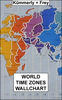
World Vintage School Chart

Assembled and Ready-to-Hang art for your wall! this vintage school Chart will brighten any office or living space.- Printed on Heavy-Weight Italian paper stock- Double the size of cavallini`s best selling Wrap- Made in the U.S.A. With sustainably sourced Wood
RIP - This product is no longer available on our network. It was last seen on 25.09.2019

This page now acts as a permanent archive for this product. Add more information using the comments box below to ensure it can still be found by future generations.

Use our search facility to see if it is available from an alternative contributor.
  • External links may include paid for promotion
  • Availability: Out Of Stock
  • Supplier: Stanfords
  • SKU: 9781619928992
Availability: In Stock
£45.00

Product Description

Assembled & Ready-to-Hang art for your wall! this vintage school Chart will brighten any office or living space.- Printed on Heavy-Weight Italian paper stock- Double the size of cavallini`s best selling Wrap- Made in the U.S.A. With sustainably sourced Wood

Reviews/Comments

Add New

Intelligent Comparison

Oooops!
We couldn't find anything!
Perhaps this product's unique.... Or perhaps we are still looking for comparisons!
Click to bump this page and we'll hurry up.

Price History

Vouchers

No voucher codes found.
Do you know a voucher code for this product or supplier? Add it to Insights for others to use.

Facebook

Jargon Buster

Paper - A thin sheet mainly used for writing. Available in a variety of colours. Made mainly from wood pulp.
Italian - A word used ot descibe something from Italy
Wall - A physical barrier between two areas
World - A physical grouping, commonly used to describe earth and everything associated with ti
Wood - A hard material found in trees. Used for tool making, fuel and construction.
Office - A room where people work
heavy - A concept of weight indicating an item may require some effort to lift or move
weight - A measure of the force applied on an object by gravity. Measured metric in grams and kilos or imperial in lbs and oz
Size - is the measurement of how big an object is in space.
Weight - a measurement of how heavy an object appears due to the pull of gravity. For example the weight of an object on planet earth will be different to the weight of the object on the moon
Vintage - An older product that has become more quirky with time.

Supplier Information

Stanfords
Stanfords was established in 1853 and opened their iconic Covent Garden flagship store in 1901. They have become the top retailer of maps, travel books and accessories in the UK and arguably offer the largest selection of maps and travel books worldwide. Famous names such as Captain Robert Falcon Scott, Ranulph Fiennes and Michael Palin have purchased from Stanfords. They now have a shop in Bristol and both stores together with other venues operate a calendar of events including talks, book signings and exhibitions. As a specialist map retailer, the map selection is comprehensive and includes road maps, street maps and walking maps from worldwide destinations, as well as a selection of world atlases and wall maps. Books include travel guides and travel literature. Stanfords also stock globes, from miniatures made of blue marble to magnificent floor-standing globes. The website features a selection of interesting articles on travel topics.
Page Updated: 2023-11-12 20:15:36

Community Generated Product Tags

Oh No! The productWIKI community hasn't generated any tags for this product yet!
Menu