
 United Kingdom
 France
 Germany
 Netherlands
 Sweden
 USA
USA
 Italy
Italy
 Spain
Spain
More From Contributor


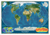

World Regions C. 1890 MEDIUM
Medium size cloth-backed version of a reproduction by Old Folding Maps of “The World on Mercator’s Projection” map published by James Wyld in 1861. The map presents the world with international borders highlighted in colour. Hachures indicate main mountain ranges and the map includes plenty of place names, particularly in the coastal regions and in the already well-explored Pacific Ocean. The interior of Africa is still largely unknown. In USA the map shows individual states; in Australia the south-eastern states are already marked, but the west of the country is still called New Holland.This reproduction was taken from what used to be called a “cloth-dissected” map, made when the map itself was cut into sections and each section then individually pasted onto an overall cloth
backing for the whole map. In this version the whole map is backed onto cloth in one piece but the gaps between the sections have been reproduced in the printing to preserve the style and the feeling of the original. Each individual cloth-backed map is sold folded in a colourful case covered with a unique design marbled paper – no two cases are identical.PLEASE NOTE: this title is also available in a smaller size but with many place names difficult to read even with a magnifying glass. To see the list of all the titles in this series from Old Folding Maps please click on the series link.
backing for the whole map. In this version the whole map is backed onto cloth in one piece but the gaps between the sections have been reproduced in the printing to preserve the style and the feeling of the original. Each individual cloth-backed map is sold folded in a colourful case covered with a unique design marbled paper – no two cases are identical.PLEASE NOTE: this title is also available in a smaller size but with many place names difficult to read even with a magnifying glass. To see the list of all the titles in this series from Old Folding Maps please click on the series link.

Product Description
Reviews/Comments
Add New
Vouchers
No voucher codes found.
Do you know a voucher code for this product or supplier? Add it to Insights for others to use.
Do you know a voucher code for this product or supplier? Add it to Insights for others to use.
 Denmark