
 United Kingdom
 France
 Germany
 Netherlands
 Sweden
 USA
USA
 Italy
Italy
 Spain
Spain
More From Contributor


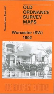
Worcester South-West 1902
Worcester South-West in 1902 in a fascinating series of reproductions of old Ordnance Survey plans in the Alan Godfrey Editions, ideal for anyone interested in the history of their neighbourhood or family. Worcester is covered by four maps. This title covers the south-western quarter, stretching from St Andrew`s church westward to Laughern Brook, and from The Butt southward to Boughton Park. Features include River Severn, Worcester Bridge, tramway, County Cricket Ground, stretch of GWR railway with Henwick station, St John`s cemetery, St John`s church, Vernon Park, Pitmaston House, Bromwich Farm, Bridge Mills, Royal Albert Orphan Asylum, St John`s Nurseries, cattle market, Butts Siding, etc. On the reverse is a selection of street directory entries, including Bransford
Road, Bridge Street, Broad Street, Bromyard Road, The Butts, Henwick Road, McIntyre Road, St John`s and Tybridge Street; plus a timetable for the Worcester-Leominster line. About the Alan Godfrey Editions of the 25” OS Series:Selected towns in Great Britain and Ireland are covered by maps showing the extent of urban development in the last decades of the 19th and early 20th century. The plans have been taken from the Ordnance Survey mapping and reprinted at about 15 inches to one mile (1:4, 340). On the reverse most maps have historical notes and many also include extracts from contemporary directories. Most maps cover about one mile (1.6kms) north/south, one and a half miles (2.4kms) across; adjoining sheets can be combined to provide wider coverage.FOR MORE INFORMATION AND A
COMPLETE LIST OF ALL AVAILABLE TITLES PLEASE CLICK ON THE SERIES LINK.

Product Description
Reviews/Comments
Add New
Intelligent Comparison
Archived Product

Worcester North-West 1902 Stanfords
£3.50
Archived Product
Worcester South-East 1902 Stanfords
£3.50
Archived Product
Worcester North-East 1902 Stanfords
£3.50
Archived Product

Manchester South-West 1894 Stanfords
£3.50
Archived Product

Manchester South-West 1916 Stanfords
£3.50
Archived Product
Manchester South-West 1916 Stanfords
£2.95
Archived Product
Leicester South West 1902-1911 Stanfords
£3.50
Archived Product
Leicester South West 1902-1911 Stanfords
£2.95
Vouchers
No voucher codes found.
Do you know a voucher code for this product or supplier? Add it to Insights for others to use.
Do you know a voucher code for this product or supplier? Add it to Insights for others to use.
 Denmark