
 United Kingdom
 France
 Germany
 Netherlands
 Sweden
 USA
USA
 Italy
Italy
 Spain
Spain
More From Contributor


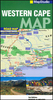
Western Cape
Road map of the Western Cape Province with an enlargement for the Cape Peninsula and 27 street plans of the central areas in main towns. The map is annotated numerous places of interest, vineyards, etc. GPS coordinates are marked on important road junctions. The map is double-sided, dividing the province east/west, and shows its road and rail networks. Unsurfaced minor roads and selected 4WD tracks are included and GPS coordinates are provided for over 150 road junctions. Railways are shown with stations.Numerous places of interest are highlighted, including wineries, historical sites, nature reserves, bird watching sites, etc. Topography is indicated only by mountain passes marked along the roads and occasional spot heights. Nature reserves and other protected areas are
prominently marked. The map is indexed and, in addition to the GPS coordinates shown on it, has latitude and longitude margin ticks at intervals of 1
prominently marked. The map is indexed and, in addition to the GPS coordinates shown on it, has latitude and longitude margin ticks at intervals of 1
Product Description
Reviews/Comments
Add New
Intelligent Comparison
Archived Product
Western Crete Stanfords
£12.99
Archived Product
Western Canada Stanfords
£8.95
Archived Product
Western Europe Stanfords
£15.19
Archived Product
Western Europe Stanfords
£5.49
Vouchers
No voucher codes found.
Do you know a voucher code for this product or supplier? Add it to Insights for others to use.
Do you know a voucher code for this product or supplier? Add it to Insights for others to use.
 Denmark