
 United Kingdom
 France
 Germany
 Netherlands
 Sweden
 USA
USA
 Italy
Italy
 Spain
Spain
More From Contributor

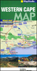
Western Cape Map Studio Pocket Map
Western Cape Province on an indexed pocket map from Map Studio, providing an overview of its road and rail networks, with enlargements presenting the Table Mountain area and the Winelands in greater detail.The main map at 1:1, 300, 000 has elevation colouring only within the province’s borders, but with names of mountain ranges and marking for mountain passes also shown in the adjoining areas of Northern and Eastern Cape. Driving distances are indicated on main routes and selected local roads. Railway lines are shown with stations. Symbols highlight various places of interest. The map is indexed and has latitude and longitude lines at intervals of 1º. On the reverse are enlargement of the Table Mountain area with Cape Town at 1:35, 000 showing hiking trails, plus the Cape Winelands
at 1:170, 000 with locations of numerous wine estates and shops, tourist accommodation, etc.
at 1:170, 000 with locations of numerous wine estates and shops, tourist accommodation, etc.
Product Description
Reviews/Comments
Add New
Vouchers
No voucher codes found.
Do you know a voucher code for this product or supplier? Add it to Insights for others to use.
Do you know a voucher code for this product or supplier? Add it to Insights for others to use.
 Denmark