
 United Kingdom
 France
 Germany
 Netherlands
 Sweden
 USA
USA
 Italy
Italy
 Spain
Spain
More From Contributor


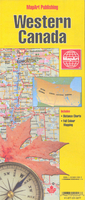
Western Canada MapArt
Double-sided overview map of Western Canada, showing on one side the western part of Ontario (from approx. 90º, the boundary of the Central Time Zone), Manitoba and Saskatchewan, and on the reverse Alberta and British Columbia, plus the Alaska panhandle below 60 º.The map shows the region’s road network, including selected local roads. Rest and service areas are marked and 24h border crossings are indicated. Numerous national or provincial parks and other protected area are highlighted, indicating camping facilities and regulations. Time zone boundaries are shown and latitude and longitude lines grid drawn at intervals of 1 º. Each of the four provinces has a separate index and a distance table. *Please note:* following a number changes among Canadian cartographic publishers
maps previously published by MapArt Publishing may now be available under one of the following imprints: MapArt, Canadian Cartographics Corporation or JDM Géo Inc. Within a series, therefore, some titles may still be published as MapArt whilst others will be available as Canadian Cartographics Corporation or JDM Géo Inc.
maps previously published by MapArt Publishing may now be available under one of the following imprints: MapArt, Canadian Cartographics Corporation or JDM Géo Inc. Within a series, therefore, some titles may still be published as MapArt whilst others will be available as Canadian Cartographics Corporation or JDM Géo Inc.

Product Description
Reviews/Comments
Add New
Vouchers
No voucher codes found.
Do you know a voucher code for this product or supplier? Add it to Insights for others to use.
Do you know a voucher code for this product or supplier? Add it to Insights for others to use.
 Denmark