
 United Kingdom
 France
 Germany
 Netherlands
 Sweden
 USA
USA
 Italy
Italy
 Spain
Spain
More From Contributor


Ware 1896
Ware in 1896 in a fascinating series of reproductions of old Ordnance Survey plans in the Alan Godfrey Editions, ideal for anyone interested in the history of their neighbourhood or family. The map is double-sided with part of the town shown on the reverse. At the top of the main map are the River Lea and the housing estates spread across its bank. Below are rural areas with the estates of Chadwell House, Limekiln Farm, Highfields, Presdales and Amwellbury Farm. Post Wood stretches from Presdales close to the centre of the map down to Amwellbury in the bottom right corner; on the right side of the map are the chalk pits, a reminder that Ware was an industrial town. On the reverse is the remaining of part of the Ware map. From the centre of the map stretching to the far right, the
sheer volume of malthouses and maltkilns gives evidence to the town’s primary industry. Within the town itself features include St. Mary`s church, Collett Hall, Christ Church School and the Infirmary with an infectious diseases wing, etc. The map includes an introduction to Ware`s history by Alan Godfrey.About the Alan Godfrey Editions of the 25” OS Series:Selected towns in Great Britain and Ireland are covered by maps showing the extent of urban development in the last decades of the 19th and early 20th century. The plans have been taken from the Ordnance Survey mapping and reprinted at about 15 inches to one mile (1:4, 340). On the reverse most maps have historical notes and many also include extracts from contemporary directories. Most maps cover about one mile (1.6kms)
north/south, one and a half miles (2.4kms) across; adjoining sheets can be combined to provide wider coverage.FOR MORE INFORMATION AND A COMPLETE LIST OF ALL AVAILABLE TITLES PLEASE CLICK ON THE SERIES LINK.

Product Description
Reviews/Comments
Add New
Intelligent Comparison
Archived Product
Marple 1896 Stanfords
£2.95
Archived Product

Marple 1896 Stanfords
£3.50
Archived Product
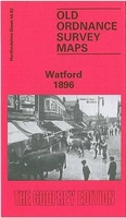
Watford 1896 Stanfords
£3.50
Vouchers
No voucher codes found.
Do you know a voucher code for this product or supplier? Add it to Insights for others to use.
Do you know a voucher code for this product or supplier? Add it to Insights for others to use.
 Denmark