
 United Kingdom
 France
 Germany
 Netherlands
 Sweden
 USA
USA
 Italy
Italy
 Spain
Spain
More From Contributor


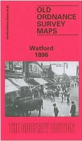
Watford 1896
Watford in 1896 in a fascinating series of reproductions of old Ordnance Survey plans in the Alan Godfrey Editions, ideal for anyone interested in the history of their neighbourhood or family. The map is double-sided, to give maximum coverage of the town. The main map covers the town centre, extending westward to Foxholes, and northward to Butts Close. Features include St Mary`s church, The Priory, Windmill Hill, The Grove, Holy Saviour`s church, Whinbush Grove, Lavender Distillery, Leather Dressing Works, engine shed, Market Place, High Street, Rosenburg, Infirmary, Workhouse, cemetery, etc. On the reverse is a portion of adjacent sheet 12.02 extending coverage eastward to include the station.About the Alan Godfrey Editions of the 25” OS Series:Selected towns in Great
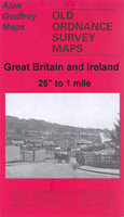
Britain and Ireland are covered by maps showing the extent of urban development in the last decades of the 19th and early 20th century. The plans have been taken from the Ordnance Survey mapping and reprinted at about 15 inches to one mile (1:4, 340). On the reverse most maps have historical notes and many also include extracts from contemporary directories. Most maps cover about one mile (1.6kms) north/south, one and a half miles (2.4kms) across; adjoining sheets can be combined to provide wider coverage.FOR MORE INFORMATION AND A COMPLETE LIST OF ALL AVAILABLE TITLES PLEASE CLICK ON THE SERIES LINK.
Britain and Ireland are covered by maps showing the extent of urban development in the last decades of the 19th and early 20th century. The plans have been taken from the Ordnance Survey mapping and reprinted at about 15 inches to one mile (1:4, 340). On the reverse most maps have historical notes and many also include extracts from contemporary directories. Most maps cover about one mile (1.6kms) north/south, one and a half miles (2.4kms) across; adjoining sheets can be combined to provide wider coverage.FOR MORE INFORMATION AND A COMPLETE LIST OF ALL AVAILABLE TITLES PLEASE CLICK ON THE SERIES LINK.

Product Description
Reviews/Comments
Add New
Intelligent Comparison
Archived Product

Stratford 1893 Stanfords
£3.50
Archived Product

Slateford 1893 Stanfords
£3.50
Archived Product

Stratford 1867 Stanfords
£3.50
Archived Product
Ware 1896 Stanfords
£3.50
Archived Product

Catford 1914 Stanfords
£3.50
Archived Product
Watford Stanfords
£3.50
Archived Product

Stafford 1879 Stanfords
£3.50
Archived Product
Dartford 1905 Stanfords
£2.95
Vouchers
No voucher codes found.
Do you know a voucher code for this product or supplier? Add it to Insights for others to use.
Do you know a voucher code for this product or supplier? Add it to Insights for others to use.
 Denmark