
 United Kingdom
 France
 Germany
 Netherlands
 Sweden
 USA
USA
 Italy
Italy
 Spain
Spain
More From Contributor


Marple 1896
Marple in 1896 in a fascinating series of reproductions of old Ordnance Survey plans in the Alan Godfrey Editions, ideal for anyone interested in the history of their neighbourhood or family. Selected towns in Great Britain and Ireland are covered by maps showing the extent of urban development in the last decades of the 19th and early 20th century.In this title: the map covers most of the village of Marple, a few miles south-east of Stockport. Coverage includes the village centre with Hollins Mill, Hollins House, old shafts, Mineral Mill, lime works, Macclesfield Canal, Marple Locks. The eastern half of the map, east of the river, is in Derbyshire. Coverage extends north to Lower Marple, where features include railway with station, spindle manufactory, St Martin's church,
Marple Bridge. Further east are Bottom's Hall, Mellor Mill, Cataract Bridge, Clough Mill, Townscliff. On the reverse is the directory of Marple Bridge (which is rather small!) and extracts from a Cheshire Trade Directory for the regionAbout the Alan Godfrey Editions of the 25
Marple Bridge. Further east are Bottom's Hall, Mellor Mill, Cataract Bridge, Clough Mill, Townscliff. On the reverse is the directory of Marple Bridge (which is rather small!) and extracts from a Cheshire Trade Directory for the regionAbout the Alan Godfrey Editions of the 25
Product Description
Reviews/Comments
Add New
Intelligent Comparison
Archived Product

Marple 1896 Stanfords
£3.50
Archived Product
Ware 1896 Stanfords
£3.50
Archived Product

Morpeth 1896 Stanfords
£3.50
Archived Product

Morley 1906 Stanfords
£3.50
Archived Product
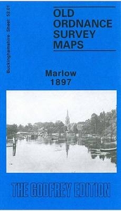
Marlow 1897 Stanfords
£3.50
Vouchers
No voucher codes found.
Do you know a voucher code for this product or supplier? Add it to Insights for others to use.
Do you know a voucher code for this product or supplier? Add it to Insights for others to use.
 Denmark