More From Contributor
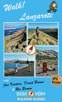
£12.99
Kate & Alan Hobbs have reviewed & refreshed their Walk! Dartmoor classic guide book for its new 2016 edition. 40 fully detailed walking routes with OS maps & gps waypoints for you to enjoy adventuring on Dartmoor. Walk! Dartmoor with Kate & Alan Hobbs covers walks of varying length across Dartmoor
- from the dramatic high moors, gentle riversides, idyllic country lanes, unspoilt villages, to sites of ancient archaeology & former industries, & all with spectacular views. This user friendly illustrated guide has a summary of walking routes & is rated by time, effort, distance & hills, as well as the availability of refreshments en route & the vertigo risk. Each walk is described in full & there are timings listed in the book to help with navigation & progress. Walk! Dartmoor contains a 1:40, 000 scale Ordnance Survey map for each route. Within the heart of Devon lies Dartmoor`s 365 square miles of natural beauty, one of the largest areas of exposed granite in southern Engl&. Apart from its spectacular scenery, Dartmoor is rich in flora & fauna. Come with us to explore Dartmoor`s dramatic high moors, gentle riversides, idyllic country lanes & unspoilt villages, discovering spectacular views, ancient archaeology & traces of bygone industries. All 40 walking routes include: walking route summary, ratings for Effort Time Distance Ascents/ Descents Refreshments & Vertigo risk, fully detailed walk description including frequent timings to aid navigation & check your progress, GPS waypoints at every key point on every route, full colour 1:40, 000 scale Ordnance Survey licenced mapping for each route, short walk & stroll alternatives.
...
Archived Product
£12.99
Buying Walk Devon qualifies you for a free Tour & Trail Super-Durable Map in Discovery Walking Guides Great Map Giveaway
- see
...
Archived Product
£12.99
Walk Dorset is Charles Davis’ Discovery Walking Guide surveying the many walks available in the rural landscape of Dorset. The guide covers a range of walks including routes on the Purbeck Way & Wessex Ridgeway, coastal walks near Piddle & Frome, island trips to Portland & ideas for rambles on weekend breaks in & around Chedington, Cranbourne, Evershot, Milton Abbas, Powerstock & Shaftesbury, often touching the very heart of Thomas Hardy country. There are also short walk & stroll alternatives for those seeking more leisurely days out. The guide describes a total of 20 GPS waymarked walking routes in & around Dorset & each has been thoroughly researched. A detailed introduction provides information on identifying Dorset & the county’s landscape & history. There is also useful guidance about map & walking information including details of walk location regional maps & using GPS on Dartmoor. Each walk gives an overview of the route & colour keys indicating difficulty, times, total distance, vertigo risks, ascents & descents & if refreshments are available on route. Appendices provide walkers with a summary of GPS Waypoints Lists, a list of recognised walking paths in Dorset & how to get to the county by road or rail. Detailed walk descriptions are accompanied by 1:40, 000 scale Ordnance Survey extracts mapping the route & GPS waypoints at every key point on the walk as well as colour photographs illustrating some of the highlights of each walk covered in the guide. ...
Archived Product
£12.99
La Gomera is the ultimate get-away-from-it-all island: easy-going, unspoilt, friendly, isolated from the hustle & bustle of modern living, & so laid back it`s virtually supine
- even the volcanoes have been dormant for millions of years. The walks, however, are a bit more energetic. For the new 4th edition of Walk! La Gomera Charles Davis has teamed up with Jan Kostura. Jan brings his wide experience & passion for the Canaries, checking, re-walking & revising existing routes, & adding a couple of his own adventures, including a new Top Three Gomeran walk. Two routes have been dropped as having become too dangerous, but the good news is that many of the more harum-scarum walks have been enhanced through path clearing & the addition of railings to the vertiginous stretches. Other good news is that the devastating forest fires of 2012 have proved not nearly as damaging as we feared, leaving most of our itineraries unscathed. In short, there is every reason to take off & explore La Gomera, or to return with this new edition to revive acquaintances & make some new discoveries at the same time. All the trails have been surveyed & mapped using GPS satellite navigation. The authors & their co-walkers have walked all these routes, ensuring accuracy & up to date information for hikers. Clear descriptions guide the walker both to the starting point & throughout the routes, with gradings, distances, timings & altitudes all symbolized, as are vertigo alerts & refreshment possibilities on or at ends of the routes. There are 34 detailed walking adventures with routes ranging from a couple of 90 minute 4 kilometre walks, up to challenging trails taking over 6 hours, covering 20 kilometres including ascents & descents of 1060 metres. Each route

Includes::
its own map sections with the route & waypoints clearly marked. Map sections are developed from the La Gomera Tour & Trail Super-Durable Map, the most up to date & toughest map of the isl&. GPS waypoint files for all the 34 routes are available in three formats as a free zip file download from the Discovery Walking Guides website.


...
Archived Product
£12.99
Walk La Palma is Charles Davis’ Discovery Walking Guide exploring the walking possibilities one of the steepest islands & unspoilt walking destinations in Europe. The guide covers a range of walks including routes in Barranco de la Madera, the southern Volcanoes, Santo Domingo, Cubo de la Galga & Roque Palmero. The routes pass through diverse landscapes including the craters of volcanoes, sub-tropical forests & coastal paths along the island’s 1080 kilometres of way-marked paths. There are also easier short walk & family alternatives for those seeking more leisurely days out. The guide describes a total of 34 GPS waymarked walking routes on La Palma & each has been thoroughly researched. An extensive introduction provides information on the island’s climate, when to go, getting there & around, equipment, risks, flora & fauna, rating & drinking, tourist attractions & a note on the historic town of Santa Cruz de la Palma. There is also useful guidance about map & walking information including details of walk location regional maps & using GPS on La Palma. Each walk gives an overview of the route & colour keys indicating difficulty, times, total distance, vertigo risks, ascents & descents & if refreshments are available on route. Detailed appendices provide walkers with a summary of GPS Waypoints Lists, recommended maps & books, useful websites, accommodation, camping advice, restaurants, mountain bike itineraries, taxis & bus timetables, with way-marked routes that cross them. Detailed walk descriptions are accompanied by 1:40, 000 scale extracts mapping the route & GPS waypoints at every key point on the walk as well as colour photographs illustrating some of the highlights of each walk covered in the guide. ...
Archived Product
£12.99
Walk! Lanzarote guide from Discovery Walking Guides, with colour extracts of contoured maps cross-referenced to detailed descriptions of 39 walks on the isl&. For GPS users the publishers offer a free downloadable zip file with all the waypoints. For each of the 39 walks the guide provides a very detailed description, cross-referenced to the accompanying map extract which is overprinted with the route & annotated with waypoints. The mapping is taken from the publishers ...
Archived Product
£12.99
“ Walk! Madeira” is Shirley & Mike Whitehead’s Discovery Walking Guide to Madeira. Forty walks have been selected routes that pass through a range of landscapes with easier short walk & family alternatives for those seeking more leisurely days out. The guide describes a total of 40 GPS waymarked walking routes across Madeira & each has been thoroughly researched. An extensive introduction provides information on Madeira, when to go, flora & fauna, food & drink & tourist sites. There is also useful guidance about map & walking information including details of walk location regional maps & using GPS. Each walk gives an overview of the route & colour keys indicating difficulty, times, total distance, vertigo risks, ascents & descents & if refreshments are available on route. Appendices provide walkers with a summary of GPS Waypoints Lists, useful telephone numbers & addresses, bus & ferry timetables, cycling routes & relevant websites. Detailed walk descriptions are accompanied by 1:40, 000 scale extracts mapping the route & GPS waypoints at every key point on the walk as well as colour photographs illustrating some of the highlights of each walk covered in the guide. All trails have been recommended by the Madeira Forestry Service & Funchal Ecological Park. ...
Archived Product
£12.99
Looking for one Mallorca guide book that has all the walking adventures you could want? New for 2014 Walk! Mallorca is your choice. 53 fully detailed walking routes ranging from east strolls up to serious mountain hikes packed into 160 pages that you can fit into your pocket. At just GBP12.99 (or less) don`t go to Mallorca without Walk! Mallorca. Charles Davis has selected 53 walks ranging from Peguera in the west, across the Tramuntana to Cap de Formentor in the north east & down to Playa Alcudia to produce his new (2014) Walk! Mallorca. Walks range from family friendly strolls through energetic leisure walking up to big mountain hikes, giving a range of adventures for all walking abilities. Every walking route has; Walking Route Summary; Ratings for Effort, Time, Distance, Ascents/ Descents & Refreshments; Fully detailed walk description with frequent timings to aid navigation; full colour 1:40, 000 scale Tour & Trail Map of the route; GPS waypoints for the key points on all routes. Walk! Mallorca routes:- Very Easy Grade 1 walks 1 Calvia: Mirador de n` Alzamora 2hrs 7km circular, 2 Soller Port de Soller 21/4hours 9km circular.3 Campanet: Font des Ufanes 1hr 4km circular, 4 Port de Pollenca: The Siller Pass 13/4hrs 7km linear. Easy Grade 2 walks 5 Calvia: Pujol des Gats 2hrs 7km linear, 6 Port de Soller: The Ultimate Picnic Walk 31/4hrs 14km linear, 7 Soller: Capelleta & Campo 1.7hrs 6km circular, 8 Sa Calobra: Torrent de Pareis 1.7hr 4km linear. 9 Lluc: Binifaldo 3hrs 11.5km circular. 10 Mortitx: L` Havanor 11/2hrs 6.5km linear. 11 Port de Pollenca: The Boquer Valley 11/2hrs 6km linear. 12 Alcudia: Ses Fontanelles 1.3hrs 7km circular. Leisure Grade 3 walks 13 Peguera: Sa Bruta 1.6hrs 5.5km circular. 14 Puigpunyent: The Cami Vell de Estellencs 21/2hrs 10km circular. 15 Son Marroig: Sa Foradada 11/2hrs 6km linear. 16 Port de Soller: Mirador de Ses Barques fr Coll d`en Marques 13/4hrs 6km circular. 17 Soller: Cami de Castello 21/4hrs 9.5km circular. 18 Cuber: L` Ofre 23/4hrs 10.8km linear. 19 Cuber: Canaleta de Massanella 31/2hrs 11km linear. 20 Sa Calobra: La Mola de Tuent 1hr 2.5km linear. 21 Cala Tuent: Sa Costera 3hrs 10km linear. 22 Bunyola: Penyal d` Honor 31/2hrs 12.5km circular. 23 Orient: Castell d` Alaro 1.7hr 5km linear. 24 Binifaldo: Serra d`en Massot 13/4hrs 5.5km circular.25 Pollenca: Puig de Maria 1.2 hr 4km linear. 26 Cap de Formentor: El Fumat & Cala en Gossalba 2.2hrs 6km circular. Energetic Grade 4 walks 27 Galilea: Puig de na Baucana 11/4hrs 4.5km linear. 28 Esporles to Banyalbufar via Port d`es Canonge: Cami des Pescadors & Sa Volta des General 4hrs 13km linear. 29 Soller: Three Villages & One Thundering Great Climb 4hrs 14km circular. 30 Cuber: Sa Rateta 31/2hrs 10.5km circular. 31 Cuber: Tossals Verds 4hrs 13km circular. 32 Caimari: Lluc via the Cami Vell & Torrent des Picarols 6hrs 20km circular. 33 Mortitx: Rafal d` Ariant & The Mortitx Gorge 31/2hrs 9.5km linear/circular. 34 Alcudia: Puig Sant Marti 2hrs 6.5km circular. 35 Alcudia: Talaia d` Alcudia 2hrs 8km circular. 36 Cala San Vicenc: La Mola & Puig d` Aguila 3hrs 7km circular. 37 A Great Day Out: Boots, Boats & Trams: Soller to Cala Tuent 41/2hrs 16km linear walk with circular boat-ride return. Top Grade 5 walks 38 Puigpunyent: Galatzo from the South 2.6hrs 8km linear. 39 Esporles: Sa Fita del Ram 4hrs 13km linear. 40 Valldemossa: The Archduke`s Path 3.5hrs 13.3km circular. 41 Valldemossa: Teix 4hrs 12km circular. 42 Mirador de ses Barques: Balitx Valley & Torre de na Seca 3hrs 13.5km linear.43 Orient: Pasture, Passes & a Peak 31/2hrs 12km circular. 44 Binifaldo: Puig Tomir 5hrs 13km circular. 45 Lluc: Massanella 5hrs 11km linear. 46 Alcudia: Talaia de Alcudia & Penya Roja 21/4hrs 8km circular. Linear Walks on the GR221 47 Banyalbufar to Esporles 2hrs 7.7km linear. 48 The Sa Comuna Ridge from Valldemossa 11/2hrs 4km linear. 49 Valldemossa to Deia 3hrs 7.9km linear. 50 Deia to Soller 31/4hrs 12.5k ...
Archived Product
£12.99
Walk Mallorca West is part of a two volume series of Discovery Walking Guides by Charles Davis exploring the walking possibilities in the west of Mallorca. The guide covers a range of walks including routes in the Cami de Calvia, Sa Trapa, Peguera & the northern ports of Estellencs, Sa Pedra de s ...
Archived Product
£12.99
Walk! Menorca is a 'GPS Ready' walking guidebook detailing thirty five routes across the isl&. Ratings are given for the difficulty levels, time, distance, ascent/descent, refreshment & vertigo risks for each hike listed. Access details by car or public transport are provided for each route, although, to get the most out of the isl&, you are recommended to set out on foot. Maps are displayed cut into manageable & readable sections, relevant to the text description on adjacent pages. Now in its 2nd edition, Walk! Menorca features new walks & updated information on aknowledged routes such as the reopening of the Cami de Cavalls & the closure of the Lluc al Lari fort & access lanes. ...
Archived Product

Walk! Lanzarote

Walk! Lanzarote is a GPS ready walking guidebook detailing thirty five routes across the island. Ratings are given for the difficulty levels, time, distance, ascent/descent, refreshment and vertigo risks for each hike listed. Access details by car or public transport are provided for each route and maps are displayed cut into manageable and readable sections, relevant to the text description on adjacent pages. The book gives an introduction to staying and walking on this lesser known World Heritage Site, including explaining the guide
RIP - This product is no longer available on our network. It was last seen on 25.09.2019

This page now acts as a permanent archive for this product. Add more information using the comments box below to ensure it can still be found by future generations.

Use our search facility to see if it is available from an alternative contributor.
  • Availability: Out Of Stock
  • Supplier: Stanfords
  • SKU: 9781904946533
Availability: In Stock
£12.99

Product Description

Walk! Lanzarote is a GPS ready walking guidebook detailing thirty five routes across the isl&. Ratings are given for the difficulty levels, time, distance, ascent/descent, refreshment & vertigo risks for each hike listed. Access details by car or public transport are provided for each route & maps are displayed cut into manageable & readable sections, relevant to the text description on adjacent pages. The book gives an introduction to staying & walking on this lesser known World Heritage Site, including explaining the guide

Reviews/Comments

Add New

Price History

Vouchers

No voucher codes found.
Do you know a voucher code for this product or supplier? Add it to Insights for others to use.

Facebook

Jargon Buster

GPS - Global Positioning System - Global position using satellites
World - A physical grouping, commonly used to describe earth and everything associated with ti
Car - A machine used for transport which runs on roads
Transport - Something that carries people or goods.

Supplier Information

Stanfords
Stanfords was established in 1853 and opened their iconic Covent Garden flagship store in 1901. They have become the top retailer of maps, travel books and accessories in the UK and arguably offer the largest selection of maps and travel books worldwide. Famous names such as Captain Robert Falcon Scott, Ranulph Fiennes and Michael Palin have purchased from Stanfords. They now have a shop in Bristol and both stores together with other venues operate a calendar of events including talks, book signings and exhibitions. As a specialist map retailer, the map selection is comprehensive and includes road maps, street maps and walking maps from worldwide destinations, as well as a selection of world atlases and wall maps. Books include travel guides and travel literature. Stanfords also stock globes, from miniatures made of blue marble to magnificent floor-standing globes. The website features a selection of interesting articles on travel topics.
Page Updated: 2023-11-12 20:15:36

Community Generated Product Tags

Oh No! The productWIKI community hasn't generated any tags for this product yet!
Menu