
 United Kingdom
 France
 Germany
 Netherlands
 Sweden
 USA
USA
 Italy
Italy
 Spain
Spain
More From Contributor


Vienna F&B
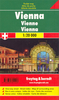
Indexed street plan of the city including some of its outer suburbs. Cartography is an enlargement of Freytag and Berndt`s plan at 1:25, 000 and shows public transport but no one-way streets. An inset shows the city centre at a more detailed scale, with main buildings highlighted by small drawings. The plan also includes a diagram of the metro network and a map with main traffic arteries across Vienna. Map legend includes English.

Product Description
Reviews/Comments
Add New
Intelligent Comparison
Archived Product

Vienna F&B Stanfords
£9.99
Archived Product
Vienna Stanfords
£4.99
Archived Product
Vienna Stanfords
£7.95
Archived Product
Vienna Stanfords
£6.50
Archived Product
Vienna Stanfords
£4.99
Archived Product
Vienna Stanfords
£10.39
Archived Product
Vienna Stanfords
£6.99
Archived Product
Vienna Stanfords
£5.99
Vouchers
No voucher codes found.
Do you know a voucher code for this product or supplier? Add it to Insights for others to use.
Do you know a voucher code for this product or supplier? Add it to Insights for others to use.
 Denmark