
 United Kingdom
 France
 Germany
 Netherlands
 Sweden
 USA
USA
 Italy
Italy
 Spain
Spain
More From Contributor


Vienna
Vienna street plan at 1:15, 000 from Hallwag, with a very clear enlargement of the city center, a diagram of the metro and suburban rail network, plus a road map of the environs including the Vienna Woods and the Schwechat airport.The plan covers the city with many of its outer district, particularly to the north and west of the city centre where it extends to Grinzing and Baumgarten. Coverage south extends to include the whole of the grounds of the Sch
Product Description
Reviews/Comments
Add New
Intelligent Comparison
Archived Product
Vienna Stanfords
£4.99
Archived Product
Vienna Stanfords
£6.50
Archived Product
Vienna Stanfords
£4.99
Archived Product
Vienna Stanfords
£10.39
Archived Product
Vienna Stanfords
£6.99
Archived Product
Vienna Stanfords
£5.99
Archived Product
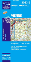
Vienne Stanfords
£11.50
Archived Product
Vietnam Stanfords
£9.95
Vouchers
No voucher codes found.
Do you know a voucher code for this product or supplier? Add it to Insights for others to use.
Do you know a voucher code for this product or supplier? Add it to Insights for others to use.
 Denmark