More From Contributor

£7.99
DK Eyewitness Top 10 Travel Guide: Vienna will lead you straight to the very best on offer. Whether you`re looking for the things not to miss at the Top 10 sights, or want to find the best nightspots; this guide is the perfect pocket-sized companion. Rely on dozens of Top 10 lists
- from the Top 10 museums to the Top 10 events & festivals
- there`s even a list of the Top 10 things to avoid. The guide is divided by area with restaurant reviews for each, as well as recommendations for hotels, bars & places to shop. You`ll find the insider knowledge every visitor needs & explore every corner effortlessly with DK Eyewitness Top 10 Travel Guide: Vienna & its FREE pull-out map. DK Eyewitness Top 10 Travel Guide: Vienna
- showing you what others only tell you.


...
Archived Product
£7.99
Vienna in the Eyewitness Top 10 series from Dorling Kindersley is a condensed format guide book featuring dozens of illustrated, top ten lists for the traveller regardless of their disposable budget. To save you time & money a Top 10 Things to Avoid is also included. Top 10 lists are given for things to see & do both in & around town, as well as the top ten features of particular locations or events. Practicalities are not forgotten as Top 10s are also provided for topics such as planning your trip, getting around & shopping. Accommodation lists provide the ten most recommended places to stay for a range of budgets, whilst restaurant top tens feature as the guide works its way through the location in question. Simple, small street plans illustrate the location of the top ten recommends within their neighbourhoods & basic, fold out maps form the inside covers. An additional pull out feature of the guide suggests ideas on how to spend your day & a phrase section is included which will help the traveller to acclimatise. ...
Archived Product
£9.99
Street plan of the whole of the administrative area of the city, showing the entire public transport system, but no one-way streets. A separate index, attached to the map cover,

Includes::
list of useful addresses, as well as an enlargement of the city centre, a map of the through roads across the city & a diagram of the public transport network. Map legend

Includes::
English.


...
Archived Product
£4.99
Indexed street plan of the city including some of its outer suburbs. Cartography is an enlargement of Freytag & Berndt`s plan at 1:25, 000 & shows public transport but no one-way streets. An inset shows the city centre at a more detailed scale, with main buildings highlighted by small drawings. The plan also

Includes::
a diagram of the metro network & a map with main traffic arteries across Vienna. Map legend

Includes::
English.


...
Archived Product
£4.99
Central Vienna in a series of handy pocket street plans from Freytag & Berndt. Each map is laminated, so waterproof & tear-resistant, & highlights the publishers’ recommendations of five best choices in five categories: shopping, restaurants & cafes, culture, nightlife & sights. On one side is an indexed street plan annotated with colour-coded markers highlighting the publishers’ recommendations, all listed on the reverse of the map with brief notes in several languages. In larger cities the plans cover only the central districts. Also provided are a small road map of the city’s environs, if appropriate a diagram of the metro network, & a Fact Box with phone numbers for tourist offices, car hire & emergency services. Map legend & notes on the recommendations include English. To see other titles in this series please click on the series link. ...
Archived Product
£15.99
Spiral bound street atlas, presenting the city on 102 map-pages. Bus, U-Bahn, tram & rail lines are clearly marked, & one-way streets are shown. Additional maps show the environs of the city, major traffic arteries & the airport. A plan of the metro, suburban & regional rail networks is on the back cover. The city centre is also presented at a more detailed scale of 1:10, 000. Selected building numbers are marked. Map legend

Includes::
English.

...
Archived Product
£4.50
Streetmap at 1:25, 000 of the central region of the city, from Donaufeld in the north-east to Oberlaa district in the south & Penzing in the west. Detail

Includes::
public buildings & locations of interest, tram & bus routes, railways & metro lines, pedestrian zones, information centres, post offices, hospitals, parks. Map legend

Includes::
English. On the reverse is a small road map of the city & its environs & a plan at 1:8, 500 of the city centre. Street index included. 29 locations of interest are marked on the maps & given brief descriptions.


...
Archived Product
£4.99
Vienna on a laminated, tear-resistant Insight Flexi Map, with a street plans of the city, road maps of its environs & of the north-eastern part of Austria, a diagram of the U- & S-Bahn networks, plus extensive tourist information. The street plan at 1:17, 500 covers the central districts of the city within the outer ring of the boulevards (the G ...
Archived Product
£3.74
Vienna on a laminated, tear-resistant Insight Flexi Map, with a street plans of the city, road maps of its environs & of the north-eastern part of Austria, a diagram of the U- & S-Bahn networks, plus extensive tourist information. The street plan at 1:17, 500 covers the central districts of the city within the outer ring of the boulevards (the G ...
Archived Product
£5.99
Insight Guides Flexi Map Vienna: This easy to use, full-colour, water-proof map is all you need to navigate Vienna. It also


...
Archived Product

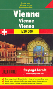
Vienna F&B Pocket Atlas

Pocket-sized, indexed street atlas, presenting the city on 102 pages. Bus and tram lines are very clearly marked, but one-way streets are not shown. Additional maps show the environs of the city, major traffic arteries, metro and suburban rail network and the city centre at a more detailed scale of 1:15, 000. Map legend includes English.
RIP - This product is no longer available on our network. It was last seen on 25.09.2019

This page now acts as a permanent archive for this product. Add more information using the comments box below to ensure it can still be found by future generations.

Use our search facility to see if it is available from an alternative contributor.
  • Availability: Out Of Stock
  • Supplier: Stanfords
  • SKU: 9783850841443
Availability: In Stock
£9.99

Product Description

Pocket-sized, indexed street atlas, presenting the city on 102 pages. Bus & tram lines are very clearly marked, but one-way streets are not shown. Additional maps show the environs of the city, major traffic arteries, metro & suburban rail network & the city centre at a more detailed scale of 1:15, 000. Map legend

Includes::
English.

Reviews/Comments

Add New

Price History

Vouchers

No voucher codes found.
Do you know a voucher code for this product or supplier? Add it to Insights for others to use.

Facebook

Jargon Buster

Network - A link and communication between things. Often computers or people.
Tram - A large vehicle common in cities for public transport, also known as a cable car.
Pocket - A bag shaped insert in clothing used to carry items

Supplier Information

Stanfords
Stanfords was established in 1853 and opened their iconic Covent Garden flagship store in 1901. They have become the top retailer of maps, travel books and accessories in the UK and arguably offer the largest selection of maps and travel books worldwide. Famous names such as Captain Robert Falcon Scott, Ranulph Fiennes and Michael Palin have purchased from Stanfords. They now have a shop in Bristol and both stores together with other venues operate a calendar of events including talks, book signings and exhibitions. As a specialist map retailer, the map selection is comprehensive and includes road maps, street maps and walking maps from worldwide destinations, as well as a selection of world atlases and wall maps. Books include travel guides and travel literature. Stanfords also stock globes, from miniatures made of blue marble to magnificent floor-standing globes. The website features a selection of interesting articles on travel topics.
Page Updated: 2023-11-12 20:15:36

Community Generated Product Tags

Oh No! The productWIKI community hasn't generated any tags for this product yet!
Menu