More From Contributor
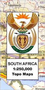
£10.99
Tyrol & Vorarlberg provinces at 1:200, 000 in a series of road maps of Austria from Freytag & Berndt, the country’s leading publishers, ...
Archived Product
£10.99
rol Province ” Top 10 Tips” on an indexed road map at 1:150, 000 from Freytag & Berndt, with highlighting for cycle routes, scenic ...
Archived Product
£21.99
A 1000-km long mountain bike trail in the very heart of the Austrian Alps in a 172-page German language guide from Verlag Esterbauer. ...
Archived Product
£23.99
Map No. 10135, Tysfjord, in the new topographic survey of Norway at 1:50, 000 covering the country on 195 double-sided sheets & ...
Archived Product
£3.50
Tywyn in 1900 in a fascinating series of reproductions of old Ordnance Survey plans in the Alan Godfrey Editions, ideal for anyone ...
Archived Product
£14.95
The Western Fells is part of a planned 8-part Cicerone series of Lakeland Fellranger volumes written by Mark Richards that provide ...
Archived Product
£8.99
This is a unique notebook from Cavallini & Co. with a beautiful & robust cover featuring a vintage map of the world. It


...
Archived Product
£14.99
NGS Classic political map of the world, standard size 110.5 x 77cm (43.5” x 30” approx) – paper version, with the publishers’ characteristic ...
Archived Product
£3.50
A h&-drawn pre-Battle of the Somme map from the Royal Engineers of Thiepval Wood in a series of British Army trench maps from the ...
Archived Product
£6.99
The Alpine areas of Europe on a large overview road map at 1:800, 000 from Marco Polo Travel Publishing with special features to ...
Archived Product

Tzaneen

Map No. 2330, Tzaneen, in South Africa’s official topographic survey at 1:250, 000 from the country’s national survey organization, the Chief Directorate of Surveys and Mapping. The maps have altitude colouring and contours at 50m or 100m intervals,
RIP - This product is no longer available on our network. It was last seen on 25.09.2019

This page now acts as a permanent archive for this product. Add more information using the comments box below to ensure it can still be found by future generations.

Use our search facility to see if it is available from an alternative contributor.
  • Availability: Out Of Stock
  • Supplier: Stanfords
  • SKU: XL00000033868
Availability: In Stock
£29.99

Product Description

Map No. 2330, Tzaneen, in South Africa’s official topographic survey at 1:250, 000 from the country’s national survey organization, the Chief Directorate of Surveys & Mapping. The maps have altitude colouring & contours at 50m or 100m intervals, depending on the map edition, plus spot heights. Deserts, marshes, dry pans, perennial & seasonal water features, etc, as well as protected areas are shown. The maps present the country’s road & rail networks & include the usual information expected on topographic mapping at this scale, although in more rapidly developing areas road information may not necessarily be up to date. Also indicated are magisterial district & provincial boundaries. Latitude & longitude values are shown in the margins at 5` intervals together with South African grid co-ordinates. Typically, each sheet covers an area of one degree of latitude & two degrees of longitude. The projection used is Gauss Conformal. The legend is in English & Afrikaans.

Reviews/Comments

Add New

Intelligent Comparison

Oooops!
We couldn't find anything!
Perhaps this product's unique.... Or perhaps we are still looking for comparisons!
Click to bump this page and we'll hurry up.

Price History

Vouchers

No voucher codes found.
Do you know a voucher code for this product or supplier? Add it to Insights for others to use.

Facebook

Jargon Buster

Dry - A term used to describe an item with has little or no water present
Dry - A term used in wine making to describe the lack of sugar (sweetness)
Date - A day on a calendar
Date - A social activity whith a current or potential partner
water - A chemical substance. Chemical formula H2O.
South Africa - A country at the southern tip of Africa.
Road - a manmade lane or a path that is used to speed up travel.
Altitude - Something that can be quite high in relation to sea or ground level.
Degree - An angle measurement, also can be the measurement of an extent that something happens, can also relate to an university academic measurement.
degree - The extremity of something or the angle. Can also relate to a university achievement.
perennial - A plant that lives for more than two years. Tending to bloom during spring and summer to die back to root over winter.

Supplier Information

Stanfords
Stanfords was established in 1853 and opened their iconic Covent Garden flagship store in 1901. They have become the top retailer of maps, travel books and accessories in the UK and arguably offer the largest selection of maps and travel books worldwide. Famous names such as Captain Robert Falcon Scott, Ranulph Fiennes and Michael Palin have purchased from Stanfords. They now have a shop in Bristol and both stores together with other venues operate a calendar of events including talks, book signings and exhibitions. As a specialist map retailer, the map selection is comprehensive and includes road maps, street maps and walking maps from worldwide destinations, as well as a selection of world atlases and wall maps. Books include travel guides and travel literature. Stanfords also stock globes, from miniatures made of blue marble to magnificent floor-standing globes. The website features a selection of interesting articles on travel topics.
Page Updated: 2023-11-12 20:15:36

Community Generated Product Tags

Oh No! The productWIKI community hasn't generated any tags for this product yet!
Menu