
 United Kingdom
 France
 Germany
 Netherlands
 Sweden
 USA
USA
 Italy
Italy
 Spain
Spain
More From Contributor


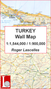
Turkey Wall Map PAPER
Turkey Wall Map from Roger Lascelles, combining a map the whole country at 1:1, 544, 000 with more detailed presentation of its more frequently visited western half at 1:900, 000, plus a street plan of central Istanbul.On one side is a road map of the whole country at 1:1, 544, 000 showing its road and rail networks. Symbols highlight Turkey’s main places of interest, including selected campsites, World Heritage and other historical sites, national parks, thermal spas, beaches, etc. Topography is indicated by relief shading with names of main mountain ranges. The map has latitude and longitude lines at intervals of 1°.On the reverse the western half of the country, extending to Ankara but without Cappadocia, is shown in greater detail with a few more roads and locations.
Neither map is indexed. Also provided is a street plan of Istanbul covering mainly its old historical part with the city’s famous sights.
Neither map is indexed. Also provided is a street plan of Istanbul covering mainly its old historical part with the city’s famous sights.

Product Description
Reviews/Comments
Add New
Intelligent Comparison
Archived Product
China Wall Map PAPER Stanfords
£13.50
Archived Product
European Union Wall Map PAPER Stanfords
£11.50
Vouchers
No voucher codes found.
Do you know a voucher code for this product or supplier? Add it to Insights for others to use.
Do you know a voucher code for this product or supplier? Add it to Insights for others to use.
 Denmark