
 United Kingdom
 France
 Germany
 Netherlands
 Sweden
 USA
USA
 Italy
Italy
 Spain
Spain
More From Contributor

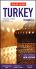


Turkey Michelin
Turkey at 1:1, 000, 000 from Michelin on a double-sided road map with street plans showing locations of main tourist sights in Istanbul and Ankara, a distance table, a comprehensive index, plus basic rules for motorists.The map is double-sided, with a good overlap between the sides, and provides coverage of the whole of the Mediterranean coast of Turkey on its western half. Topography is presented by subtle relief shading, with peak heights, names of mountain ranges, colouring for the main forested areas and boundaries of national parks or other protected zones.Road network is graded into six types, including selected local tracks. Driving distances are shown on main and many secondary roads. Railway lines are included and local airports are marked. Also shown are ferry and
shipping routes, both between Turkish ports and to the Greek islands of the eastern and southern Aegean. The map prominently shows the country administrative boundaries with names of the provinces. Symbols highlight various places of interest, including UNESCO World Heritage sites and archaeological remains. The map has latitude and longitude lines at intervals of 1° and a comprehensive index of localities. Map legend includes English.Also provided is a distance table, a list of main motoring regulations, plus street plans of central districts of Istanbul and Ankara naming major streets and indicating locations of tourist sites. In Istanbul the tram line connecting the old part of the city with the eastern side of the Golden Horn is also conveniently marked.
shipping routes, both between Turkish ports and to the Greek islands of the eastern and southern Aegean. The map prominently shows the country administrative boundaries with names of the provinces. Symbols highlight various places of interest, including UNESCO World Heritage sites and archaeological remains. The map has latitude and longitude lines at intervals of 1° and a comprehensive index of localities. Map legend includes English.Also provided is a distance table, a list of main motoring regulations, plus street plans of central districts of Istanbul and Ankara naming major streets and indicating locations of tourist sites. In Istanbul the tram line connecting the old part of the city with the eastern side of the Golden Horn is also conveniently marked.

Product Description
Reviews/Comments
Add New
Intelligent Comparison
Archived Product
Hungary Michelin Stanfords
£5.99
Archived Product
Crete Michelin Stanfords
£5.99
Archived Product
Greece Michelin Stanfords
£5.99
Archived Product
Norway Michelin Stanfords
£5.99
Archived Product
Quebec Michelin Stanfords
£5.99
Archived Product
Peru Michelin Stanfords
£5.99
Archived Product

Cuba Michelin Stanfords
£5.99
Archived Product
Tunisia Michelin Stanfords
£5.99
Vouchers
No voucher codes found.
Do you know a voucher code for this product or supplier? Add it to Insights for others to use.
Do you know a voucher code for this product or supplier? Add it to Insights for others to use.
 Denmark