
 United Kingdom
 France
 Germany
 Netherlands
 Sweden
 USA
USA
 Italy
Italy
 Spain
Spain
More From Contributor


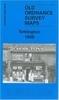


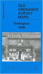
Tottington 1908
Tottington in 1908 in a fascinating series of reproductions of old Ordnance Survey plans in the Alan Godfrey Editions, ideal for anyone interested in the history of their neighbourhood or family. Selected towns in Great Britain and Ireland are covered by maps showing the extent of urban development in the last decades of the 19th and early 20th century.In this title: the map covers part of Tottington and links up with the group of Bury maps. The River Irwell runs up the east side of the map, with a section of the LYR railway, including Olive's Siding. On the west side of the map is the company's Tottington Branch, with Tottington and Green Mount stations. Part of Tottington village is shown, including St Anne's church, Spring Mill, St John's church, Old Doctors, Quakers Field,
Stormer Hill Bleach Works. Other features include Kirklees Mill, Kirklees, Tottington Mill, Knowles Siding, Green Mount, Brandlesholme Hall Farm, Brandlsholme New Hall, Wood Road. On the reverse is a 1918 directory of Tottington, plus a 1914 railway timetable for the Bury to Holcombe Brook line. About the Alan Godfrey Editions of the 25
Stormer Hill Bleach Works. Other features include Kirklees Mill, Kirklees, Tottington Mill, Knowles Siding, Green Mount, Brandlesholme Hall Farm, Brandlsholme New Hall, Wood Road. On the reverse is a 1918 directory of Tottington, plus a 1914 railway timetable for the Bury to Holcombe Brook line. About the Alan Godfrey Editions of the 25
Product Description
Reviews/Comments
Add New
Intelligent Comparison
Archived Product
Tottington 1908 Stanfords
£3.50
Archived Product

Bollington 1907 Stanfords
£3.50
Archived Product
Patrington 1904 Stanfords
£2.95
Archived Product

Patrington 1904 Stanfords
£3.50
Vouchers
No voucher codes found.
Do you know a voucher code for this product or supplier? Add it to Insights for others to use.
Do you know a voucher code for this product or supplier? Add it to Insights for others to use.
 Denmark