
 United Kingdom
 France
 Germany
 Netherlands
 Sweden
 USA
USA
 Italy
Italy
 Spain
Spain
More From Contributor


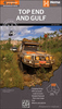


Top End And Gulf
Northern half of Northern Territory, extending south to Wycliffe Well on the Stuart Highway, west to the Great Northern Highway and Halls Creek in Western Australia, and east to cover the Gulf Country of Queensland. The map shows roads and 4WD tracks, indicating accommodation, general stores and meal facilities, fuel supplies, places of interest, etc. Topography is shown by subtle relief shading and names of mountain ranges and selected peaks. National parks and Aboriginal Lands are highlighted. Latitude and longitude lines are drawn at 30' intervals with ticks at 5
Product Description
Reviews/Comments
Add New
Intelligent Comparison
Archived Product

Top End And Gulf Hema Stanfords
£12.99
Archived Product
Top End And Gulf, NT/QLD Stanfords
£8.99
Vouchers
No voucher codes found.
Do you know a voucher code for this product or supplier? Add it to Insights for others to use.
Do you know a voucher code for this product or supplier? Add it to Insights for others to use.
 Denmark