More From Contributor
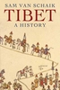
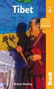
£9.95
Large double-sided map of Tibet with insets of the Lhasa Valley, the Norbulingka, the Potala area & the Barkor area. Elevation tinting in pastel shades shows the general relief, with selected mountain peak altitudes marked. International, disputed, & provincial/regional borders are all clearly marked, as are railways. Main roads are marked with their distances; connecting roads, tracks and ...
Archived Product
£9.50
Overview map of Tibet at 1:3, 000, 000 from the Kathmandu based Nepa Maps. Coverage extends east to Kunming & Chengdu to include the neighbouring areas of adjoining provinces, north to beyond Kashgar showing the southern route across the Xinjiang province, &

Includes::
the whole of Nepal & Bhutan. The map has colouring indicating different provinces of China; topographic information is provided by markings for selected peaks. Various places of interest are highlighted. The map shows a large number of place names, all in Latin alphabet only, listed in an extensive index. Latitude & longitude are shown as margin ticks at 2° intervals. The index is next to the map.

...
Archived Product
£13.59
Tibet in the Countries & Regions series from Lonely Planet, market-leading comprehensive guides aimed at independent travellers & serving a large range of international destinations. Frank & informal in style, the guides explore an extensive range of sights, activities, accommodation, restaurants & nightlife & are designed for practical use while travelling on the road. Written & researched by a team of experts, each book is independent in its recommendations & suggestions, often offering individual takes on individual destinations. Widely recognised for their reliability, each Lonely Planet country & region guide has the same layout. Introductory sections profile the destination with individual chapters on particular highlights, getting started, (including when to go) itineraries, history, culture, arts, food & drink & the environment. Each guide is organised geographically by region, with individual sections detailing an extensive range of sights, places of interest, attractions, restaurants, nightlife, accommodation & any local activities. The guides have detailed explanations of historical context where relevant. There is also practical guidance on ...
Archived Product
£9.50
Tibet at 1:1, 500, 000 with the Lhasa Valley at 1:50, 000 on light, waterproof & tear-resistant plastic paper, with both topographic & tourist information. The map, part of Reise Know-How's highly acclaimed World Mapping Project is double-sided, to provide the best balance between a good scale & a convenient size sheet. Topography is indicated by altitude colouring with numerous spot heights & names of mountain ranges & passes. Salt lakes, swamps, seasonal rivers & glacier are also shown. Detailed presentation of the road network

Includes::
minor roads & tracks. Railway connection to Lhasa is also shown. Internal administrative units are shown with their boundaries & names. National parks & other protected areas are highlighted. A wide range of symbols mark various places of interest including sacred places, palaces, dzongs, archaeological sites, temples, museums, etc. Latitude & longitude lines are drawn at 1

...
Archived Product
£13.99
The stories range from delightful & funny to cautionary & inspiring, & provide readers with a road map that deepens & enriches their travels. Enjoy riveting tales by world-renowned writers. One author witnesses an ancient sky burial; another works as an extra on a Chinese movie set. One of the essays describes a visit to the Potala Palace, home of the Dalai Lama, & another describes holy Mount Kailash. ...
Archived Product
£10.50
Tibet on an indexed overview map at 1:1, 500, 000 from the Kathmandu-based Nepa Maps, with coverage extending west/east from Dawa/ Dapa & Montser/ Moincer (west of Mt. Kailash) to Nakchu north-east of Lhasa. In the north the map extends to approx, 33º, & south of the Tibetan border coverage

Includes::
the whole of Nepal, & Bhutan, with Sikkim & the Indian Himalaya, plus parts of the adjoining Indian states. Topography is shown by shading based on the satellite imagery, with plenty of peak heights marked on the map. In Tibet the map shows the network of main & secondary road connections, the railway route to Lhasa, plus local airports. Symbols indicate locations with tourist accommodation & various places of interest are highlighted. Relief shading & tourist information continues in Nepal, Bhutan, Sikkim & Uttaranchal, but in India south of the Nepali border only road & rail connections are shown. All place names are in the Latin alphabet, with both Tibetan & Chinese versions given for selected locations. The map has latitude & longitude margin ticks at 30’ intervals. The index is next to the map & lists places & lakes, plus (mainly in Nepal) peaks, base camps & passes.

...
Archived Product
£9.99
Tibet at 1:2, 000, 000 on an indexed map from Gizi Map presenting the region with relief shading to show its topography. Names of many settlements are shown in two or three versions: in the Latin alphabet transliteration of the Chinese & the Tibetan versions, plus for larger places also in Chinese. Coverage of Tibet at 1:2, 000, 000 is published by Gizi Map in two editions: geographical (with altitude colouring) or road (with relief shading to make road network stand out better from the background)
- both version have the same information. The presentation of the topography is supplemented by graphics for deserts, swamps, salt flats, etc. plus plenty of names of mountain ranges, peaks, passes, etc. Road network is graded into seven types, including selected country tracks & shows distances on main routes. Railway lines are included, local airports are marked, & the maps also show the division of the Tibet Autonomous Region into prefectures. Symbols highlight various places of interest including UNESCO World Heritage sites, temples, natural curiosities, etc. Latitude & longitude lines are drawn at 1° intervals. The index is on the reverse &

Includes::
a separate list of places of interest. Map legend

Includes::
English, Chinese & Tibetan. Also provided is a street plan of central Lhasa including the Norbulingka, highlighting selected hotels & various places of interest. The road edition also has an enlargement of the Mount Kailas area at 1:150, 000 with the trekking circuit from Darchen. The map is part Gizi Map’s series covering China at 1:2, 000, 000.PLEASE NOTE: both versions, the geographical & the road edition, are also available as wall maps.


...
Archived Product
£25.00
Situated north of the Himalayas, Tibet is famous for its unique culture & its controversial assimilation into modern China. Yet Tibet in the twenty-first century can only be properly understood in the context of its extraordinary history. Sam van Schaik brings the history of Tibet to life by telling the stories of the people involved, from the glory days of the Tibetan empire in the seventh century through to the present day. He explores the emergence of Tibetan Buddhism & the rise of the Dalai Lamas, Tibet`s entanglement in the ` Great Game` in the early twentieth century, its submission to Chinese Communist rule in the 1950s, & the troubled times of recent decades. Tibet sheds light on the country`s complex relationship with China & explains often-misunderstood aspects of its culture, such as reborn lamas, monasteries & hermits, ” The Tibetan Book of the Dead”, & the role of the Dalai Lama. Van Schaik works through the layers of history & myth to create a compelling narrative, one that offers readers a greater understanding of this important & controversial corner of the world. ...
Archived Product
£14.99
Southern Tibet at 1:400, 000 on a laminated, waterproof & tear-resistant map from terra Quest, with contours, relief shading & colouring providing a very vivid picture of the region’s topography. The map, double-sided & arranged in three separate panels, covers an area from Medro Gungkar, east of Lhasa, to the Friendship Bridge crossing to Nepal, west of Mount Everest. Topography is presented by contours, enhanced by relief shading & colouring for glaciers & different types of vegetation, with plenty of names of mountain ranges, peaks & passes. National parks & other protected areas are prominently highlighted. The map shows the region’s road network & the rail link to Lhasa, & also indicates main trekking routes, e.g. treks to the Everest & Cho Oyu Base Camps, the trek south from Ganden to Samye, or the route from Damshung to Nam Tso lake. Interesting locations are highlighted, & the map shows availability of tourist accommodation & various facilities, etc. Latitude & longitude lines are drawn at 5’ intervals. Map legend

Includes::
English. The map is laminated in a format similar to the old cloth-dissected maps so that sections of it can be easily folded back without damage.

...
Archived Product

Tibet

This new, thoroughly updated edition of Bradt`s Tibet encompasses the wider region of ethnic Tibet with more detailed coverage of the Amdo and Kham regions than is found in other guides. It also includes essential information on new border openings and is particularly strong on map data, which is extremely difficult to find in Tibet itself, including new theme maps covering a range of topics, from Tibetan regions to the Three Parallel Rivers UN World Heritage Sites, sacred landscapes, permafrost and major river sources.Bradt`s Tibet benefits from years of consistent research. Michael Buckley has been visiting and researching Tibet for more than 30 years and has a raft of books to his name. Thanks to his knowledge and expertise, Bradt`s Tibet offers a more extensive language appendix
than is found in other guidebooks, plus essential guidelines on cultural etiquette (including a special section on hand gestures to use), local customs and travelling with minimum impact on Tibet`s culture and environment. There is also an appendix on fauna and an extensive list of recommended further resources, including books, music, films and even virtual realityExploring ethnic Tibet independently is a challenge. The `land of snows` possesses the world`s highest peaks (including Everest) and its deepest gorges as well as some of the wildest and roughest road routes in high Asia. Bradt`s Tibet provides all the practical information you need to explore ethnic Tibet independently, whether motoring, mountain-biking or trekking. Tibet has always fascinated travellers and armchair
travellers because it is so difficult to access due to its remoteness and extreme altitude. Now, under Chinese rule, Tibet is a sensitive destination for Westerners. Visitors needs all the information that they can lay their hands on-and this guidebook provides plenty. With flight routes and rail access to Tibet expanding, and new border crossings opening, Michael Buckley and Bradt`s Tibet provide all of the information you need to make the most of a trip.
RIP - This product is no longer available on our network. It was last seen on 25.09.2019

This page now acts as a permanent archive for this product. Add more information using the comments box below to ensure it can still be found by future generations.

Use our search facility to see if it is available from an alternative contributor.
  • Availability: Out Of Stock
  • Supplier: Stanfords
  • SKU: 9781784770655
Availability: In Stock
£17.99

Product Description

This new, thoroughly updated edition of Bradt`s Tibet encompasses the wider region of ethnic Tibet with more detailed coverage of the Amdo & Kham regions than is found in other guides. It also

Includes::
essential information on new border openings & is particularly strong on map data, which is extremely difficult to find in Tibet itself, including new theme maps covering a range of topics, from Tibetan regions to the Three Parallel Rivers UN World Heritage Sites, sacred landscapes, permafrost & major river sources. Bradt`s Tibet benefits from years of consistent research. Michael Buckley has been visiting & researching Tibet for more than 30 years & has a raft of books to his name. Thanks to his knowledge & expertise, Bradt`s Tibet offers a more extensive language appendix than is found in other guidebooks, plus essential guidelines on cultural etiquette (including a special section on hand gestures to use), local customs & travelling with minimum impact on Tibet`s culture & environment. There is also an appendix on fauna & an extensive list of recommended further resources, including books, music, films & even virtual reality Exploring ethnic Tibet independently is a challenge. The `land of snows` possesses the world`s highest peaks (including Everest) & its deepest gorges as well as some of the wildest & roughest road routes in high Asia. Bradt`s Tibet provides all the practical information you need to explore ethnic Tibet independently, whether motoring, mountain-biking or trekking. Tibet has always fascinated travellers & armchair travellers because it is so difficult to access due to its remoteness & extreme altitude. Now, under Chinese rule, Tibet is a sensitive destination for Westerners. Visitors needs all the information that they can lay their hands on-and this guidebook provides plenty. With flight routes & rail access to Tibet expanding, & new border crossings opening, Michael Buckley & Bradt`s Tibet provide all of the information you need to make the most of a trip.

Reviews/Comments

Add New

Intelligent Comparison

Oooops!
We couldn't find anything!
Perhaps this product's unique.... Or perhaps we are still looking for comparisons!
Click to bump this page and we'll hurry up.

Price History

Vouchers

No voucher codes found.
Do you know a voucher code for this product or supplier? Add it to Insights for others to use.

Facebook

Jargon Buster

Flight - The process of of an object moving through the air
Hand - A part of the body at the end of the arm
Hand - A pointer which indicates time on a clock face
strong - A descriptive word for an item that has physical strength
World - A physical grouping, commonly used to describe earth and everything associated with ti
Language - the method of communication used in different areas. Humans and computers have many different languages.
Road - a manmade lane or a path that is used to speed up travel.
Parallel - Two objects that run symmetrically alongside each other.
Altitude - Something that can be quite high in relation to sea or ground level.
Practical - Weather a task is easy to carry out and realistically succeed.
Language - The way humans communicate either written and spoken.
Environment - The conditions and surrounding area.

Supplier Information

Stanfords
Stanfords was established in 1853 and opened their iconic Covent Garden flagship store in 1901. They have become the top retailer of maps, travel books and accessories in the UK and arguably offer the largest selection of maps and travel books worldwide. Famous names such as Captain Robert Falcon Scott, Ranulph Fiennes and Michael Palin have purchased from Stanfords. They now have a shop in Bristol and both stores together with other venues operate a calendar of events including talks, book signings and exhibitions. As a specialist map retailer, the map selection is comprehensive and includes road maps, street maps and walking maps from worldwide destinations, as well as a selection of world atlases and wall maps. Books include travel guides and travel literature. Stanfords also stock globes, from miniatures made of blue marble to magnificent floor-standing globes. The website features a selection of interesting articles on travel topics.
Page Updated: 2023-11-12 20:15:36

Community Generated Product Tags

Oh No! The productWIKI community hasn't generated any tags for this product yet!
Menu