
 United Kingdom
 France
 Germany
 Netherlands
 Sweden
 USA
USA
 Italy
Italy
 Spain
Spain
More From Contributor


Tibet Bradt Guide
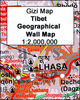
Tibet in the Travel Guide series from Bradt; encompassing a comprehensive range of titles to destinations worldwide, with a particular focus on Africa, Central and South America. Bradt are one of the country’s leading independent publishers and have an ethos that focuses on responsible travel, in alliance with a philosophy of sustainability; both in the destinations the guides cover but also in encouraging tourists to limit the impact they have on the local environment. Bradt guides have a reputation for appealing to more independent travelers and often cover destinations that are not available from other publishers.Each guide opens with two comprehensive chapters on Background and Practical Information, covering details of the country’s geography, culture, natural history,
government and politics, economy, people, language, religion, education and culture. Important practical advice includes when to visit, highlights, suggested itineraries, tour operators, red tape, embassies and consulates, getting there and away, health, safety, what to take, money, budgeting, getting around, accommodation, eating and drinking, public holidays, shopping, arts and entertainment, media and communications, business, travel culture and cultural etiquette.Individual sections are organized geographically by region and typically open with information on practicalities and orientation, before focusing on what to see and where to go. Information on what to see, where to stay, where to eat and how to find your way around is provided, with a range of
budgets catered for. Simple black and white maps locate key visitor sites and places of accommodation. Bradt Travel Guides include appendices that provide an in-depth introduction to the language of each country, a glossary of terms and a listing of books and internet resources providing further information on the destination.

Product Description
Reviews/Comments
Add New
Vouchers
No voucher codes found.
Do you know a voucher code for this product or supplier? Add it to Insights for others to use.
Do you know a voucher code for this product or supplier? Add it to Insights for others to use.
 Denmark