More From Contributor

£9.99
Tibet at 1:2, 000, 000 on an indexed map from Gizi Map presenting the region with relief shading to show its topography. Names of many settlements are shown in two or three versions: in the Latin alphabet transliteration of the Chinese & the Tibetan versions, plus for larger places also in Chinese. Coverage of Tibet at 1:2, 000, 000 is published by Gizi Map in two editions: geographical (with altitude colouring) or road (with relief shading to make road network stand out better from the background)
- both version have the same information. The presentation of the topography is supplemented by graphics for deserts, swamps, salt flats, etc. plus plenty of names of mountain ranges, peaks, passes, etc. Road network is graded into seven types, including selected country tracks & shows distances on main routes. Railway lines are included, local airports are marked, & the maps also show the division of the Tibet Autonomous Region into prefectures. Symbols highlight various places of interest including UNESCO World Heritage sites, temples, natural curiosities, etc. Latitude & longitude lines are drawn at 1° intervals. The index is on the reverse &

Includes::
a separate list of places of interest. Map legend

Includes::
English, Chinese & Tibetan. Also provided is a street plan of central Lhasa including the Norbulingka, highlighting selected hotels & various places of interest. The road edition also has an enlargement of the Mount Kailas area at 1:150, 000 with the trekking circuit from Darchen. The map is part Gizi Map’s series covering China at 1:2, 000, 000.PLEASE NOTE: both versions, the geographical & the road edition, are also available as wall maps.


...
Archived Product
£25.00
Situated north of the Himalayas, Tibet is famous for its unique culture & its controversial assimilation into modern China. Yet Tibet in the twenty-first century can only be properly understood in the context of its extraordinary history. Sam van Schaik brings the history of Tibet to life by telling the stories of the people involved, from the glory days of the Tibetan empire in the seventh century through to the present day. He explores the emergence of Tibetan Buddhism & the rise of the Dalai Lamas, Tibet`s entanglement in the ` Great Game` in the early twentieth century, its submission to Chinese Communist rule in the 1950s, & the troubled times of recent decades. Tibet sheds light on the country`s complex relationship with China & explains often-misunderstood aspects of its culture, such as reborn lamas, monasteries & hermits, ” The Tibetan Book of the Dead”, & the role of the Dalai Lama. Van Schaik works through the layers of history & myth to create a compelling narrative, one that offers readers a greater understanding of this important & controversial corner of the world. ...
Archived Product
£14.99
Southern Tibet at 1:400, 000 on a laminated, waterproof & tear-resistant map from terra Quest, with contours, relief shading & colouring providing a very vivid picture of the region’s topography. The map, double-sided & arranged in three separate panels, covers an area from Medro Gungkar, east of Lhasa, to the Friendship Bridge crossing to Nepal, west of Mount Everest. Topography is presented by contours, enhanced by relief shading & colouring for glaciers & different types of vegetation, with plenty of names of mountain ranges, peaks & passes. National parks & other protected areas are prominently highlighted. The map shows the region’s road network & the rail link to Lhasa, & also indicates main trekking routes, e.g. treks to the Everest & Cho Oyu Base Camps, the trek south from Ganden to Samye, or the route from Damshung to Nam Tso lake. Interesting locations are highlighted, & the map shows availability of tourist accommodation & various facilities, etc. Latitude & longitude lines are drawn at 5’ intervals. Map legend

Includes::
English. The map is laminated in a format similar to the old cloth-dissected maps so that sections of it can be easily folded back without damage.

...
Archived Product
£7.95
The name Tibet traditionally conjures up a kaleidoscope of timeless images: extraordinary & dramatic landscapes, snow-capped mountains, Buddhist monks & monasteries. But stark new images have now been created by the tide of political events: Chinese soldiers outside the Potala Palace, young Tibetan refugees, the struggles of a nation in exile. This new title in the acclaimed New Horizons series explores the cultural & historical roots of the Tibetan people, their customs & beliefs, & their relations with the wider world, in order to give a fuller understanding of this remarkable land & its indomitable spirit. ...
Archived Product
£17.99
Tibet in the Travel Guide series from Bradt; encompassing a comprehensive range of titles to destinations worldwide, with a particular focus on Africa, Central & South America. Bradt are one of the country’s leading independent publishers & have an ethos that focuses on responsible travel, in alliance with a philosophy of sustainability; both in the destinations the guides cover but also in encouraging tourists to limit the impact they have on the local environment. Bradt guides have a reputation for appealing to more independent travelers & often cover destinations that are not available from other publishers. Each guide opens with two comprehensive chapters on Background & Practical Information, covering details of the country’s geography, culture, natural history, government & politics, economy, people, language, religion, education & culture. Important practical advice

Includes::
when to visit, highlights, suggested itineraries, tour operators, red tape, embassies & consulates, getting there & away, health, safety, what to take, money, budgeting, getting around, accommodation, eating & drinking, public holidays, shopping, arts & entertainment, media & communications, business, travel culture & cultural etiquette. Individual sections are organized geographically by region & typically open with information on practicalities & orientation, before focusing on what to see & where to go. Information on what to see, where to stay, where to eat & how to find your way around is provided, with a range of budgets catered for. Simple black & white maps locate key visitor sites & places of accommodation. Bradt Travel Guides include appendices that provide an in-depth introduction to the language of each country, a glossary of terms & a listing of books & internet resources providing further information on the destination.

...
Archived Product
£13.50
Tibet Road Edition Wall Map at 1:2, 000, 000 from Gizi Map, size 124 x 84cm )49” x 33” approx), presenting the region with bold altitude colouring to show its topography. Names of many settlements are shown in two or three versions: in the Latin alphabet transliteration of the Chinese & the Tibetan versions, plus for larger places also in Chinese. Coverage of Tibet at 1:2, 000, 000 is published by Gizi Map in two editions: geographical (with altitude colouring) or road (with relief shading to make road network stand out better from the background)
- both version have the same information. The presentation of the topography is supplemented by graphics for deserts, swamps, salt flats, etc. plus plenty of names of mountain ranges, peaks, passes, etc. Road network is graded into seven types, including selected country tracks & shows distances on main routes. Railway lines are included, local airports are marked, & the maps also show the division of the Tibet Autonomous Region into prefectures. Symbols highlight various places of interest including UNESCO World Heritage sites, temples, natural curiosities, etc. Latitude & longitude lines are drawn at 1° intervals. The index is on the reverse &

Includes::
a separate list of places of interest. Map legend

Includes::
English, Chinese & Tibetan. Also provided is a street plan of central Lhasa including the Norbulingka, highlighting selected hotels & various places of interest. The road edition also has an enlargement of the Mount Kailas area at 1:150, 000 with the trekking circuit from Darchen. The map is part Gizi Map’s series covering China at 1:2, 000, 000.PLEASE NOTE: both versions, the geographical & the road edition, are also available in a folded format.


...
Archived Product
£19.99
Tibet Handbook in the Handbooks series from Footprint; comprehensive & leading guides designed & written for independent travellers who enjoy exploring off the beaten track. Footprint guides have an established reputation, built up since 1921, for catering for more adventurous & individual travellers. An unrestrictive editorial style also gives authors the freedom to capture & explore local cultures, sights & areas that are often not covered in other guides. Widely recognised for their reliability & independent writing style, Footprint guides all have the same layout. Introductory sections introduce the reader to the destination, with chapters on planning on your trip & essentials, including practical information & guidance on subjects such as when & where to go, itineraries, sport & activities, arts, getting there & around, eating & drinks, sleeping & a dedicated section on the anticipated carbon footprint involved in travelling to the destination. Each guide is organised geographically by region or country, with individual sections having a particular focus on an extensive range of sights & places of interest. Further, there are also details of accommodation, nightlife, restaurants & any notable local activities. Information boxes throughout the text give readers an insight into local customs, stories & sights of particular interest.A ‘ Background’ section explores the history, economy, government, education, culture, people, land & environment of the destination in significant depth. There is also a ‘ Footnotes’ chapter with a basic language guide for travellers & information about the author. A useful distance chart tailored to the destination is also included in the inside back cover. * Please note:* the series is gradually being revised, reverting to its previous style of ” Handbooks”, published in a hardback format. ...
Archived Product
£9.99
Tibet at 1:1, 680, 000 on an indexed, double-sided map from ITMB printed on light, waterproof & tear-resistant synthetic paper, with a map of the Lhasa Valley & enlargements of the Potala – Barkor area & the Norbulingka. The map is double-sided, dividing the region east/west, with a small overlap & Lhasa included on both sides. Coverage

Includes::
most of Nepal & the map indicates the disputed areas along the border with India. All place names are shown only transliterated, with a few locations given alternative Tibetan names. Topography is indicated by altitude colouring (bands in feet), with plenty of names of topographic

Features:
mountain ranges, peaks & mountain passes (heights in metres), etc. Additional graphics show glaciers, salt pans, swamps & deserts, & national parks or protected areas are marked. The map shows the region’s road network, including selected tracks, indicates locations of border crossings & gives distances on main routes. Railway lines are included & local airports are marked. Symbols show locations of various places of interest, including monasteries. The map has latitude & longitude lines at 1° intervals & each side has a separate index. Insets provide a map of the Lhasa Valley at 1:80, 000 with a further enlargement for the Potala – Barkor area, both annotated with various facilities & places of interest. Another panel shows a more detailed plan of the Norbulingka Palace & Park.


...
Archived Product
£8.99
In the five years since February 2009, over 100 Tibetan monks have self-immolated in protest of the Chinese occupation in their lands. Most have died from their wounds. ” If Tibetans saw even a sliver of an opportunity to hold demonstrations, then they would not resort to self-immolation, ” Woeser, the dissident Tibetan poet, has written in The New York Times. The Tibetans she references

Includes::
herself: a prominent voice of the Tibetan movement, & one of the few Tibetan authors to write in Chinese, Woeser has been placed under house arrest in & lives under close surveillance. Tibet On Fire is her account of the oppression Tibetans face, & the ideals driving both the self immolators & other Tibetans like herself. Angry & clear, Tibet On Fire is a clarion call for the world to take note.

...
Archived Product
£11.50
Tibet at 1:1, 500, 000 with the Lhasa Valley at 1:50, 000 on light, waterproof & tear-resistant map with both topographic & tourist information. The map, part of Reise Know-How`s highly acclaimed ” World Mapping Project”, is double-sided, to provide the best balance between a good scale & a convenient size sheet. Place names of larger towns are shown transliterated & with their alternative Tibetan versions, plus in the Chinese & Tibetan scripts. All other names are in Latin alphabet only. Topography is indicated by altitude colouring with numerous spot heights & names of mountain ranges & passes. Salt lakes, swamps, seasonal rivers & glacier are also shown. Detailed presentation of the road network

Includes::
minor roads & tracks. Railway connection to Lhasa is also shown. Internal administrative units are shown with their boundaries & names. National parks & other protected areas are highlighted. A wide range of symbols mark various places of interest including sacred places, palaces, dzongs, archaeological sites, temples, museums, etc. Latitude & longitude lines are drawn at 1º intervals. The map is indexed & its map legend

Includes::
English. An inset at 1:50, 000 shows Lhasa & the surrounding valley, indicating numerous places of interest. Within the city various tourist facilities are also marked: hotels, banks, bus stations, etc. To see other titles in this series please click on the series link.


...
Archived Product

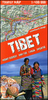
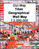
Tibet Bradt Guide SUPERCEDED

Exploring ethnic Tibet independently is a challenge. The proverbial 'land of snows', it possesses some of the wildest and roughest road routes in high Asia, and so trekking, motoring and mountain-biking are all covered in this new edition. Political and cultural issues make Tibet a sensitive destination for Westerners to visit, so Michael Buckley's advice includes guidelines on cultural etiquette, local customs and travelling with minimum impact on Tibet's culture and environment.
RIP - This product is no longer available on our network. It was last seen on 25.09.2019

This page now acts as a permanent archive for this product. Add more information using the comments box below to ensure it can still be found by future generations.

Use our search facility to see if it is available from an alternative contributor.
  • Availability: Out Of Stock
  • Supplier: Stanfords
  • SKU: 9781841621647
Availability: In Stock
£13.99

Product Description

Exploring ethnic Tibet independently is a challenge. The proverbial 'land of snows', it possesses some of the wildest & roughest road routes in high Asia, & so trekking, motoring & mountain-biking are all covered in this new edition. Political & cultural issues make Tibet a sensitive destination for Westerners to visit, so Michael Buckley's advice

Includes::
guidelines on cultural etiquette, local customs & travelling with minimum impact on Tibet's culture & environment.

Reviews/Comments

Add New

Intelligent Comparison

Oooops!
We couldn't find anything!
Perhaps this product's unique.... Or perhaps we are still looking for comparisons!
Click to bump this page and we'll hurry up.

Price History

Vouchers

No voucher codes found.
Do you know a voucher code for this product or supplier? Add it to Insights for others to use.

Facebook

Jargon Buster

Road - a manmade lane or a path that is used to speed up travel.
Environment - The conditions and surrounding area.

Supplier Information

Stanfords
Stanfords was established in 1853 and opened their iconic Covent Garden flagship store in 1901. They have become the top retailer of maps, travel books and accessories in the UK and arguably offer the largest selection of maps and travel books worldwide. Famous names such as Captain Robert Falcon Scott, Ranulph Fiennes and Michael Palin have purchased from Stanfords. They now have a shop in Bristol and both stores together with other venues operate a calendar of events including talks, book signings and exhibitions. As a specialist map retailer, the map selection is comprehensive and includes road maps, street maps and walking maps from worldwide destinations, as well as a selection of world atlases and wall maps. Books include travel guides and travel literature. Stanfords also stock globes, from miniatures made of blue marble to magnificent floor-standing globes. The website features a selection of interesting articles on travel topics.
Page Updated: 2023-11-12 20:15:36

Community Generated Product Tags

Oh No! The productWIKI community hasn't generated any tags for this product yet!
Menu