
 United Kingdom
 France
 Germany
 Netherlands
 Sweden
 USA
USA
 Italy
Italy
 Spain
Spain
More From Contributor


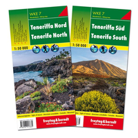
Tenerife F&B 2-Map Set WKE7
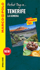
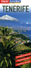
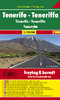
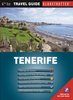
Tenerife at 1:50, 000 on a clear, large, double-sided, GPS compatible road map from Freytag & Berndt with hiking trails, plus street plans of Santa Cruz de Tenerife, Los Christianos, Playa de las Américas and Puerto de la Cruz.The map divides the island east/west with a good overlap between the sides and has contours with relief shading, spot heights and plenty of names of geographical features to show the island’s topography. Major roads clearly numbered, with motorway junctions prominently named. Scenic routes are highlighted and locations of petrol stations and services are marked.A selection of hiking trails is also highlighted, with symbols marking various places of interest, including beaches, campsites and mountain refuges, etc. For GPS users the map has a UTM grid
and margin ticks at 2’ showing latitude and longitude. Map legend includes English. Place names are in clear print, larger than used on most maps.A separate booklet attached to the map cover has an index which shows all locations with their postcodes and GPS coordinates. The booklet also includes multilingual descriptions of the island’s main sights and street plan of Santa Cruz de Tenerife, Los Christianos, Playa de las Américas and Puerto de la Cruz.
and margin ticks at 2’ showing latitude and longitude. Map legend includes English. Place names are in clear print, larger than used on most maps.A separate booklet attached to the map cover has an index which shows all locations with their postcodes and GPS coordinates. The booklet also includes multilingual descriptions of the island’s main sights and street plan of Santa Cruz de Tenerife, Los Christianos, Playa de las Américas and Puerto de la Cruz.

Product Description
Reviews/Comments
Add New
Vouchers
No voucher codes found.
Do you know a voucher code for this product or supplier? Add it to Insights for others to use.
Do you know a voucher code for this product or supplier? Add it to Insights for others to use.
 Denmark