
 United Kingdom
 France
 Germany
 Netherlands
 Sweden
 USA
USA
 Italy
Italy
 Spain
Spain
More From Contributor


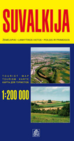
Suvalkija
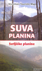
One of the titles in a series of detailed touring maps of Lithuania with street plans of main towns. The maps, produced by Baltic States’ leading cartographic publisher, Jana Seta, show the country’s road network indicating three different kinds of unsurfaced roads and mark locations of petrol stations. Railway lines are shown with stations. Symbols highlight various types of accommodation including campsites, towns and other places of particular interest, border crossings, etc. National parks and protected areas are shown but, beyond rivers and other waterways, no topographic information is provided. Map legend includes English.Each map also includes plans of larger towns in the region, showing main streets and indicating locations of petrol stations, selected accommodation
and places of interest. On the reverse there are photos and descriptions of all the regions’ main places of interest: historical monuments, local architecture, churches, natural features, etc. Although all the text is in Lithuanian only, the descriptions are cross-referenced to the map, providing a useful indicator of places worth visiting.In this titles: plans of Kaunas, Kazlu Ruda, Marijampole, Prienai, Šakiai, and Vilkaviškis.
and places of interest. On the reverse there are photos and descriptions of all the regions’ main places of interest: historical monuments, local architecture, churches, natural features, etc. Although all the text is in Lithuanian only, the descriptions are cross-referenced to the map, providing a useful indicator of places worth visiting.In this titles: plans of Kaunas, Kazlu Ruda, Marijampole, Prienai, Šakiai, and Vilkaviškis.

Product Description
Reviews/Comments
Add New
Vouchers
No voucher codes found.
Do you know a voucher code for this product or supplier? Add it to Insights for others to use.
Do you know a voucher code for this product or supplier? Add it to Insights for others to use.
 Denmark