
 United Kingdom
 France
 Germany
 Netherlands
 Sweden
 USA
USA
 Italy
Italy
 Spain
Spain
More From Contributor


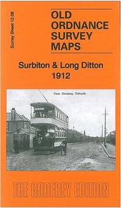
Surbiton & Long Ditton 1912
Surbiton and Long Ditton in 1912 in a fascinating series of reproductions of old Ordnance Survey plans in the Alan Godfrey Editions, ideal for anyone interested in the history of their neighbourhood or family. Selected towns in Great Britain and Ireland are covered by maps showing the extent of urban development in the last decades of the 19th and early 20th century.In this title: the map covers the centre of Surbiton, Surbiton Hill and parts of Long Ditton and Tolworth. Coverage extends from Surbiton Station and Victoria Road southward to Tolworth Park Road, and from St Mary's church Long Ditton eastward to Red Lion Road. Features include railway with Surbiton station, St Matthew's church, Christ Church, The Gables, Neals Farm, Tolworth Dairy Farm, tramways, isolation hospital,
Southborough Park, St Mary's church Long Ditton with Manor House, etc. On the reverse are street directories for Brighton Road and Ditton Road, plus a list of private residents for Long Ditton, from a 1905 directory.About the Alan Godfrey Editions of the 25
Southborough Park, St Mary's church Long Ditton with Manor House, etc. On the reverse are street directories for Brighton Road and Ditton Road, plus a list of private residents for Long Ditton, from a 1905 directory.About the Alan Godfrey Editions of the 25
Product Description
Reviews/Comments
Add New
Intelligent Comparison
Archived Product
Surbiton And Long Ditton 1912 Stanfords
£3.50
Vouchers
No voucher codes found.
Do you know a voucher code for this product or supplier? Add it to Insights for others to use.
Do you know a voucher code for this product or supplier? Add it to Insights for others to use.
 Denmark