More From Contributor
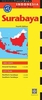
£35.00
Superyacht Master covers the requirements of the navigation & radar modules for the Officer of the Watch (Yachts) & the Master (Yachts) Certificates required for captains & crew of commercial yachts over 24m & under 3, 000 tons. It is the only book written specifically for these modules & will be required reading for all those undertaking a deck career in the superyacht industry or in similar sized commercial craft. This book is intended for the next level of navigators after Yachtmaster & is an extension of the current series of very successful & highly regarded course instruction books available from Adlard Coles Nautical. ` At long last someone has written an in-depth reference manual on radar operation for the masters of large yachts. Every superyacht should have a copy on the bridge!` John Wyborn, Director, The Crew Training Centre, Antibes ...
Archived Product
£29.99
This is an essential guide for all yachts spending time in Europe. The Mediterranean Volume 1 covers: The Atlantic Islands Gibraltar Spain The Balearics The Baltic & Scandinavia Northern Europe including England Superyacht Services Guides include only the industry recomended trades & services. Please check Volume 2 for Eastern Med & Middle East coverage. ...
Archived Product
£20.00
Bordered by Russia, Turkey, Azerbaijan & Armenia, & situated at a crossroads on an ancient East-West trading route, Georgia`s rich & diverse history is nowhere more evident than through its cuisine & legendary hospitality. Central & unique to the culinary tradition of Georgia is the `supra`, a coming together of family & friends to share heart-warming toasts, great conversation, free-flowing drink &, most importantly, dish upon dish of mouth-watering food. In this, her first book, Tiko Tuskadze, chef-owner of London`s celebrated Little Georgia restaurant, opens her kitchen to share her love for the food of her home country & the recipes & stories that have been passed down through her family for generations. The book opens with an introduction to the delicious, yet little-known, food of Georgia & an exploration & explanation of the traditions & cultural significance of the supra. Tiko shares over 100 of the dishes that come together to make Georgian cuisine a true celebration of its country`s unique climate, history & culture. Recipes follow the authentic procession of dishes, starting with pates & sauces then salads, which are traditionally laid out on the table before guests arrive; moving on to sections on soups, bread & cheese, meat dishes, poultry dishes, fish dishes, vegetable dishes & ending with a few fruity treats. The recipes range from the iconic Khachapuri (cheese bread), Kebabi (lamb kebabs) & Khinkali (dumplings), to lesser-known classics, such as Ajapsandali (aubergine stew) & Ckmeruli (poussin in garlic & walnut sauce). With wonderful stories & beautiful illustrations throughout, this book is the ultimate resource for anyone interested in discovering this unique & varied cuisine with the dual values of family & celebration firmly at its heart. ...
Archived Product
£30.00
SUQAR (which means `sugar` in Arabic) shares the secrets of more than 100 sweet treats inspired by Middle Eastern flavours
- ranging
...
Archived Product
£20.50
Sur le traces de la Bête du Gévaudan, FFRP topo-guide ref. no. P43A, one of the titles in an extensive series of light, A5-size, high quality paperback guides published by the Fédération Française de la Randonnée Pédestre in association with local authorities, ramblers’ clubs, etc. The guides have *colour extracts from the French topographic survey at 1:25, 000 or 1:50, 000 overprinted with local hiking routes*. Each guide offers a selection of day walks of different length & difficulty of terrain, all clearly graded. * Several titles also include a section of a long-distance GR route or a shorter GRP (GR de Pays) route or circuit.* The descriptions provide information on various places of interest along the routes & directions for special points marked on the accompanying maps. * All the text is in French*, but there is also a fair amount of information conveyed by symbols: waymarking, parking facilities, villages with local shops, cafes & restaurants, etc. Most guides have numerous colour photos & drawings of local flora & fauna. Guides with day walks are indicated on the accompanying series grid by yellow, blue or green boxes.* In this title* 35 walks in the area west & south-west of Le-Puy-en-Velay. ...
Archived Product
£7.99
Surabaya, Indonesia’s second largest city on Java, on a double-sided, indexed street plan at 1:20, 000 from Periplus, plus a road map of the city’s environs. The map divides the city north/south & extends out to include Ir. Juanda International Airport in the south-eastern corner. Main traffic arteries across the city are highlighted & locations of petrol stations are marked. Symbols indicate various places of interest & facilities, including numerous hotels, banks, restaurants, shopping centres, foreign consulates, places of worship, etc. Accompanying panel provides a road map of Surabaya’s environs at 1:125, 000. ...
Archived Product
£2.95
Surbiton & Long Ditton in 1912 in a fascinating series of reproductions of old Ordnance Survey plans in the Alan Godfrey Editions, ideal for anyone interested in the history of their neighbourhood or family. Selected towns in Great Britain & Ireland are covered by maps showing the extent of urban development in the last decades of the 19th & early 20th century. In this title: the map covers the centre of Surbiton, Surbiton Hill & parts of Long Ditton & Tolworth. Coverage extends from Surbiton Station & Victoria Road southward to Tolworth Park Road, & from St Mary's church Long Ditton eastward to Red Lion Road. Features include railway with Surbiton station, St Matthew's church, Christ Church, The Gables, Neals Farm, Tolworth Dairy Farm, tramways, isolation hospital, Southborough Park, St Mary's church Long Ditton with Manor House, etc. On the reverse are street directories for Brighton Road & Ditton Road, plus a list of private residents for Long Ditton, from a 1905 directory. About the Alan Godfrey Editions of the 25 ...
Archived Product
£3.50
Surbiton & Long Ditton in 1912 in a fascinating series of reproductions of old Ordnance Survey plans in the Alan Godfrey Editions, ideal for anyone interested in the history of their neighbourhood or family. The map covers the centre of Surbiton, Surbiton Hill & parts of Long Ditton & Tolworth. Coverage extends from Surbiton Station & Victoria Road southward to Tolworth Park Road, & from St Mary`s church Long Ditton eastward to Red Lion Road. Features include railway with Surbiton station, St Matthew`s church, Christ Church, The Gables, Neals Farm, Tolworth Dairy Farm, tramways, isolation hospital, Southborough Park, St Mary`s church Long Ditton with Manor House, etc. On the reverse are street directories for Brighton Road & Ditton Road, plus a list of private residents for Long Ditton, from a 1905 directory. About the Alan Godfrey Editions of the 25” OS Series: Selected towns in Great Britain & Ireland are covered by maps showing the extent of urban development in the last decades of the 19th & early 20th century. The plans have been taken from the Ordnance Survey mapping & reprinted at about 15 inches to one mile (1:4, 340). On the reverse most maps have historical notes & many also include extracts from contemporary directories. Most maps cover about one mile (1.6kms) north/south, one & a half miles (2.4kms) across; adjoining sheets can be combined to provide wider coverage.FOR MORE INFORMATION & A COMPLETE LIST OF ALL AVAILABLE TITLES PLEASE CLICK ON THE SERIES LINK. ...
Archived Product
£45.00
Lifestyle journalist Veerle Helsen went out-of-office for six months, bought an old camper & travelled along the Spanish & Portuguese coastline by herself. Ever true to her motto ”surf, see, sleep & eat”, she combines three of her passions in this book: surfing, travelling & discovering hidden gems. How about a heavenly holiday mansion where there`s a tree growing through the roof? Or an architectural public swimming pool that`s hidden between rocks & the sea? She searched & found camper spots so quiet she could stay there for days without seeing another soul. Secret beaches that aren`t indicated on the map where you sit back & watch the waves. Veerle Helsen dismisses the classic tourist image of Spain & Portugal & writes about a completely different world. Untouched, fierce & free. With little beach bars serving the very fish they caught earlier that day. With roads wrapping themselves around cliffs & dunes, sheltered by pine trees & maintaining the view of sandcastles on the beach. She drove a large car, her drone beside her on the passenger seat & her surf board on the roof. This guide transcends the cliches & avoids the classic tourist traps. Sea you soon! ” Just imagine: a beach in the middle of nowhere. You can see a camper with sea view. You can hear Portuguese music coming from the speakers. The canopy is out & there are some chairs underneath. On the table is a plate of freshly grilled fish & a glass of vinho verde. Welcome to my surfer`s life.” ” Living to the rhythm of the sea” ” The waves, the flowing shapes, the poetry of the sea: surfing is, in fact, a distinctly female sport.” ...
Archived Product
£17.99
Jane & Myles Lamberth are living their dream
- running a bustling seaside cafe, creating a gorgeous home & enjoying a carefree
...
Archived Product

Surabaya

Surabaya at 1:15, 000 is an indexed, double-sided city map from Periplus, showing main roads, local streets, bus terminals and railways with stations in Indonesia's second-largest city, on the island of Java.The city is divided into two, the north on one side, the south on the reverse, both showing districts and neighbourhoods. The street plan is annotated with places of interest, hotels, restaurants, shopping, parks, places of worship, etc. The legend includes a list of toponyms in Javanese and Indonesian, with their English equivalents.The plan extends to cover and the beginning of the Suramadu Bridge to Madura Island, opened in June 2009, and shows the Surabaya toll road intersecting the city (with toll gates).
RIP - This product is no longer available on our network. It was last seen on 25.09.2019

This page now acts as a permanent archive for this product. Add more information using the comments box below to ensure it can still be found by future generations.

Use our search facility to see if it is available from an alternative contributor.
  • External links may include paid for promotion
  • Availability: Out Of Stock
  • Supplier: Stanfords
  • SKU: 9780794602260
Availability: In Stock
£4.99

Product Description

Surabaya at 1:15, 000 is an indexed, double-sided city map from Periplus, showing main roads, local streets, bus terminals & railways with stations in Indonesia's second-largest city, on the island of Java. The city is divided into two, the north on one side, the south on the reverse, both showing districts & neighbourhoods. The street plan is annotated with places of interest, hotels, restaurants, shopping, parks, places of worship, etc. The legend

Includes::
a list of toponyms in Javanese & Indonesian, with their English equivalents. The plan extends to cover & the beginning of the Suramadu Bridge to Madura Isl&, opened in June 2009, & shows the Surabaya toll road intersecting the city (with toll gates).

Reviews/Comments

Add New

Intelligent Comparison

Oooops!
We couldn't find anything!
Perhaps this product's unique.... Or perhaps we are still looking for comparisons!
Click to bump this page and we'll hurry up.

Price History

Vouchers

No voucher codes found.
Do you know a voucher code for this product or supplier? Add it to Insights for others to use.

Facebook

Jargon Buster

Railways - A set of tracks that have been laid for the purpose of trains to travel up and down them
Road - a manmade lane or a path that is used to speed up travel.

Supplier Information

Stanfords
Stanfords was established in 1853 and opened their iconic Covent Garden flagship store in 1901. They have become the top retailer of maps, travel books and accessories in the UK and arguably offer the largest selection of maps and travel books worldwide. Famous names such as Captain Robert Falcon Scott, Ranulph Fiennes and Michael Palin have purchased from Stanfords. They now have a shop in Bristol and both stores together with other venues operate a calendar of events including talks, book signings and exhibitions. As a specialist map retailer, the map selection is comprehensive and includes road maps, street maps and walking maps from worldwide destinations, as well as a selection of world atlases and wall maps. Books include travel guides and travel literature. Stanfords also stock globes, from miniatures made of blue marble to magnificent floor-standing globes. The website features a selection of interesting articles on travel topics.
Page Updated: 2023-11-12 20:15:36

Community Generated Product Tags

Oh No! The productWIKI community hasn't generated any tags for this product yet!
Menu