-
Home
-
Contributors
-
International
-
Account
-
Information
More From Contributor
- that’s what Marco Polo Guides are all about. This new series will appeal to all types of travellers, including those who haven’t bought a travel guide in the past! Marco Polo’s unique insider tips are peppered throughout the guide
- offering a real insight into the destination.
Includes:: special tips for when it rains, things to do for free, chill out & relax. Where to start – tells the reader the ideal starting point to explore the city / destination, how to get there: by car or public transport, where to park the car… & much more! The perfect day / perfect route – the best way to get to know a destination for those with limited time. Practical information on shopping, food & drink & much more – plus a phrasebook section. Also
Includes:: a fully indexed street atlas & a pull-out map. ...
Includes:: street plans of central Catania, Messina & Palermo. A fold-out extension of the map cover gives at-a-glance overview of Sicily with the adjoining mainl&, making it much easier to find various places on the main map and/or plan a route. A set of seven peel-on/peel-off stickers, removable without damaging the map, is provided to make routes or locations more prominent when navigating. The map boldly stresses main roads & motorways in strong colours & selected towns in large letters, but also shows minor roads & villages in considerable detail. Road information
Includes:: toll roads, traffic restrictions & seasonal closures, gradient marking for steep roads, scenic routes, etc. Motorway services clearly indicate types of facilities available there. Railway lines are shown with stations. Cartography from the renowned German publishers Mair Dumont is particularly good for identifying geographical
Features: mountain & hill chains, valleys, national parks, etc. Picturesque towns & places of interest are given star rating, & other tourist information
Includes:: campsites & youth hostels, landmarks, recreational facilities etc. Latitude & longitude grid is drawn at intervals of 10`. Multilingual map legend & all information include English.A booklet attached to the map cover contains street plans of central Catania, Messina & Palermo, plus an extensive index of place names including geographical features such as rivers, lakes, mountains, etc, as well as places of interest. Also provided is a table with distances/traveling times, plus main traffic & speed regulations. ...
- highly recommended, recommended & interesting, which have been used for more than 100 years
- help readers identify places of interest, restaurants & notable local attractions. Individual listings include principal sights for each city or town, local walking & driving tours in addition to tips on local excursions. There is also an ‘address book’ information box in each section including recommendations for the best restaurants & accommodation in the area, as well as any relevant leisure activities. A series of overview regional & city plans also helps navigation & orientation for each region. ...
Includes:: selected local tracks, indicates driving distances on main roads, & highlights scenic routes. Railways & ferry connections are also shown. The overprint also highlights local national parks, holiday camps, campsites & mountain refuges, viewpoints, churches & castles, beaches, golf courses, etc. The map has a 10-km UTM grid, plus latitude & longitude grid at 10’ intervals. Map legend
Includes:: English. ...

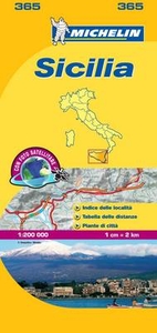
Sicily Michelin Local 365
intervals of 10’. The index of place names is next to the map; map legend includes English.
This page now acts as a permanent archive for this product. Add more information using the comments box below to ensure it can still be found by future generations.
Use our search facility to see if it is available from an alternative contributor.
- Availability: Out Of Stock
- Supplier: Stanfords
- SKU: 9782067126749
Product Description
About this series: Indexed 1:200, 000 scale regional maps of Italy with street plans of main cities. Topography is indicated by bold relief shading with spot heights & colouring for forested areas. Detailed road information, characteristic of Michelin’s maps,
Includes:: toll & free sections of motorways, road widths, difficult or dangerous roads, restrictions & seasonal closures, steep gradients, level crossings & fords, etc. Railway lines are shown with stations & car ferry routes indicate maximum tonnage. Also included is a distance/driving time table for quick & easy reference. Tourist information
Includes:: selected campsites, places of interest, scenic routes & viewpoints, sport & leisure facilities, etc. The maps have a grid showing latitude & longitude at intervals of 10’. The index of place names is next to the map; map legend
Includes:: English.
Reviews/Comments
Add New
Intelligent Comparison
Price History
Vouchers
Do you know a voucher code for this product or supplier? Add it to Insights for others to use.


 United Kingdom
 France
 Germany
 Netherlands
 Sweden
 USA
USA
 Italy
Italy
 Spain
Spain


 Denmark