
 United Kingdom
 France
 Germany
 Netherlands
 Sweden
 USA
USA
 Italy
Italy
 Spain
Spain
More From Contributor


Sicily Reise Know-How
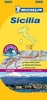
Sicily at 1:200, 000 on an indexed, waterproof and tear-resistant road map with topographic and tourist information, published by Reise Know-How as part of their highly acclaimed World Mapping Project. The map is double-sided to provide the best balance between a good scale and a convenient size sheet. The map divides the island east/west with a good overlap between the sides. Aeolian (Lipari) Islands, plus Pantelleria, Lampedusa and other small islands south of Sicily are included as insets.Topography is indicated by altitude colouring with spot heights and names of mountain ranges. Road information includes selected local tracks, indicates driving distances on main roads, and highlights scenic routes. Railways and ferry connections are also shown.The overprint also highlights local
national parks, holiday camps, campsites and mountain refuges, viewpoints, churches and castles, beaches, golf courses, etc. The map has a 10-km UTM grid, plus latitude and longitude grid at 10’ intervals. Map legend includes English.
national parks, holiday camps, campsites and mountain refuges, viewpoints, churches and castles, beaches, golf courses, etc. The map has a 10-km UTM grid, plus latitude and longitude grid at 10’ intervals. Map legend includes English.
Product Description
Reviews/Comments
Add New
Vouchers
No voucher codes found.
Do you know a voucher code for this product or supplier? Add it to Insights for others to use.
Do you know a voucher code for this product or supplier? Add it to Insights for others to use.
 Denmark