
 United Kingdom
 France
 Germany
 Netherlands
 Sweden
 USA
USA
 Italy
Italy
 Spain
Spain
More From Contributor


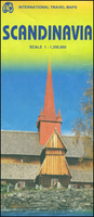
Scandinavia
Double-sided road map of Scandinavia with the Northern half at 1:1, 500, 000 and the South at 1:800, 000 from AA, with cartography by Freytag & Berndt, providing enlargements of road access to Helsinki, Oslo, Copenhagen, Stockholm and Goteborg. On one side is Finland and most or Sweden and Norway up to Oslo, with the Faroe Islands shown as an inset at 1:800, 000. The reverse provides a good repeat that sees Oslo again and shows the southern part of the peninsula, Denmark and the German coast line, extending southward down to Hamburg and eastward up to Szczecin in Poland. National boundaries and international border crossings are prominently highlighted. Lines of longitude and latitude are marked at 1
Product Description
Reviews/Comments
Add New
Intelligent Comparison
Archived Product
Scandinavia Stanfords
£19.95
Archived Product
Scandinavia Stanfords
£14.39
Archived Product
Scandinavia Stanfords
£16.99
Archived Product
Scandinavia Stanfords
£17.99
Archived Product
Scandinavia Stanfords
£5.49
Archived Product
Scandinavia Stanfords
£21.99
Archived Product
Scandinavia 1846 Stanfords
£140.00
Archived Product
Scandinavia ITMB Stanfords
£9.99
Vouchers
No voucher codes found.
Do you know a voucher code for this product or supplier? Add it to Insights for others to use.
Do you know a voucher code for this product or supplier? Add it to Insights for others to use.
 Denmark