
 United Kingdom
 France
 Germany
 Netherlands
 Sweden
 USA
USA
 Italy
Italy
 Spain
Spain
More From Contributor

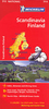
Scandinavia
Scandinavia on a double-sided indexed road map of at 1:800, 000 from the AA, with additional large panels providing city centre street plans of Copenhagen, Oslo, Stockholm, Gothenburg and Helsinki. Towns worth visiting and other interesting locations are prominently highlighted. Coverage includes the whole of Denmark, Norway and Sweden, plus most of Finland with just the westernmost part of southern Finland not included.Road network is shown on a clear base which has subtle relief shading to show the topography and colouring for national parks and other protected areas. The map emphasises motorways, shown with junction numbers and services, and other principal routes, but also clearly shows local roads. Driving distances are marked on main routes. Railway lines are included and
ferry connections are marked. Picturesque towns and villages are prominently highlighted, and symbols indicate other places of interest. The map has no geographical coordinates.Five large panels provide street plans of Copenhagen, Oslo, Stockholm, Gothenburg and Helsinki, highlighting various sights and, where appropriate, showing metro connections.
ferry connections are marked. Picturesque towns and villages are prominently highlighted, and symbols indicate other places of interest. The map has no geographical coordinates.Five large panels provide street plans of Copenhagen, Oslo, Stockholm, Gothenburg and Helsinki, highlighting various sights and, where appropriate, showing metro connections.
Product Description
Reviews/Comments
Add New
Vouchers
No voucher codes found.
Do you know a voucher code for this product or supplier? Add it to Insights for others to use.
Do you know a voucher code for this product or supplier? Add it to Insights for others to use.
 Denmark