
 United Kingdom
 France
 Germany
 Netherlands
 Sweden
 USA
USA
 Italy
Italy
 Spain
Spain
More From Contributor


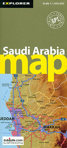
Saudi Arabia
General map of the country with physical relief represented by altitude tinting and spot heights. Swamp, sand and coral areas are distinguished, and seasonal rivers are marked. The map is double-sided, dividing the country into north and south sections with a generous overlap of coverage. Intermediate driving distances are shown on main roads. Some tracks, railways and oil and gas pipelines are shown, and symbols denote such features as historic sites, airports, ports, places of interest, oil fields and terminals and border crossing points. Internal regions and their respective centres of administration are shown. A table lists populations of major town and cities and an inset map shows the streets and notable locations of central Riyadh.The map is indexed.Latitude and longitude
lines are drawn at 1
lines are drawn at 1
Product Description
Reviews/Comments
Add New
Intelligent Comparison
Archived Product
Saudi Arabia Stanfords
£9.99
Archived Product

Saudi Arabia F&B Stanfords
£10.99
Archived Product

Flag Of Saudi Arabia Stanfords
£8.99
Archived Product

Saudi Arabia Gizi Map Stanfords
£9.99
Archived Product
Saudi Arabia Wall Map Stanfords
£13.50
Archived Product
Saudi Arabia: North 24 Stanfords
£14.95
Vouchers
No voucher codes found.
Do you know a voucher code for this product or supplier? Add it to Insights for others to use.
Do you know a voucher code for this product or supplier? Add it to Insights for others to use.
 Denmark