
 United Kingdom
 France
 Germany
 Netherlands
 Sweden
 USA
USA
 Italy
Italy
 Spain
Spain
More From Contributor


Saudi Arabia F&B
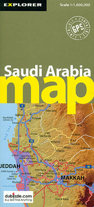
The Arabian Peninsula with Saudi Arabia, Yemen, Oman, United Arab Emirates, Qatar, Bahrain and Kuwait at 1:2, 000, 000 on a large, double-sided, indexed map which also covers most of Iraq and Jordan, plus southern Iran.The map divides the peninsula north/south with a generous overlap between the two sides. Relief shading with spot heights and graphics sandy or rocky deserts, salt flats and lakes, seasonal streams, etc. indicates the topography. Plenty of names of geographical features are provided and the map also shows locations of oil fields.Road network includes desert tracks and gives intermediate driving distances on main and most secondary routes. Railway lines are included and local airports are marked. A range of symbols highlights various places of interest. All place
names are shown in Latin alphabet only. The map has latitude and longitude lines at intervals of 1°. Multilingual map legend includes English. The index is in a separate booklet attached to the cover.
names are shown in Latin alphabet only. The map has latitude and longitude lines at intervals of 1°. Multilingual map legend includes English. The index is in a separate booklet attached to the cover.

Product Description
Reviews/Comments
Add New
Intelligent Comparison
Archived Product
Saudi Arabia Stanfords
£9.95
Archived Product
Saudi Arabia Stanfords
£9.99
Archived Product

Saudi Arabia & Kuwait ITMB Stanfords
£9.99
Archived Product

Saudi Arabia Gizi Map Stanfords
£9.99
Archived Product
Saudi Arabia Wall Map Stanfords
£13.50
Vouchers
No voucher codes found.
Do you know a voucher code for this product or supplier? Add it to Insights for others to use.
Do you know a voucher code for this product or supplier? Add it to Insights for others to use.
 Denmark