More From Contributor
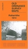
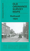
£2.95
Rotherhithe in 1914 in a fascinating series of reproductions of old Ordnance Survey plans in the Alan Godfrey Editions, ideal for anyone interested in the history of their neighbourhood or family. Selected towns in Great Britain & Ireland are covered by maps showing the extent of urban development in the last decades of the 19th & early 20th century. In this title: three versions of this map have been published to show how the area developed across the years. The maps each cover the same area, stretching from Lower Road & Thames Tunnel eastward to Alpha Road, from Rotherhithe Road & the Thames southward to Greenland Dock. The maps cover most of Rotherhithe with its docks, & also the western part of the Isle of Dogs, & a small bit of Wapping. Features include Shadwell Old Basin, West Ferry Road, Union Docks, Limehouse Basin, the western parts of West India Dock & South Dock; Surrey Commercial Docks including Lavender Pond, Stave Dock, Albion Dock, Canada Dock, Quebec Pond, Russia Dock, Lady Dock, Norway Dock, Greenland Dock; also Surrey Basin, Surrey Canal, Sulphur Works, St Olave's Union Infirmary, tramways, Barnard's Wharf, Durand's Wharf & many other wharves; part of Southwark Park. Churches include St Mary's Rotherhithe, All Saints, St Luke's Alpha Road. Streets include West Ferry Road, Commercial Dock Road, Adam Street, Albion Street, part of Wapping High Street. The maps also include extracts from contemporary directories; the 1868 map has street directory for Millwall & Rotherhithe Street. About the Alan Godfrey Editions of the 25 ...
Archived Product
£3.50
Rotherhithe in 1914 in a fascinating series of reproductions of old Ordnance Survey plans in the Alan Godfrey Editions, ideal for anyone interested in the history of their neighbourhood or family. Three versions of this map have been published, stretching from Lower Road & Thames Tunnel eastward to Alpha Road, & from Rotherhithe Road & the Thames southward to Greenland Dock. The maps cover most of Rotherhithe with its docks, & also the western part of the Isle of Dogs & a small bit of Wapping. Features include Shadwell Old Basin, West Ferry Road, Union Docks, Limehouse Basin, the western parts of West India Dock & South Dock; Surrey Commercial Docks including Lavender Pond, Stave Dock, Albion Dock, Canada Dock, Quebec Pond, Russia Dock, Lady Dock, Norway Dock, Greenland Dock; also Surrey Basin, Surrey Canal, Sulphur Works, St Olave`s Union Infirmary, tramways, Barnard`s Wharf, Durand`s Wharf & many other wharves; part of Southwark Park. Churches include St Mary`s Rotherhithe, All Saints, St Luke`s Alpha Road. Streets include West Ferry Road, Commercial Dock Road, Adam Street, Albion Street, part of Wapping High Street. The maps also include extracts from contemporary directories. About the Alan Godfrey Editions of the 25” OS Series: Selected towns in Great Britain & Ireland are covered by maps showing the extent of urban development in the last decades of the 19th & early 20th century. The plans have been taken from the Ordnance Survey mapping & reprinted at about 15 inches to one mile (1:4, 340). On the reverse most maps have historical notes & many also include extracts from contemporary directories. Most maps cover about one mile (1.6kms) north/south, one & a half miles (2.4kms) across; adjoining sheets can be combined to provide wider coverage.FOR MORE INFORMATION & A COMPLETE LIST OF ALL AVAILABLE TITLES PLEASE CLICK ON THE SERIES LINK. ...
Archived Product
£14.99
` Intricate & crisp, witty & solemn: a book with special & dangerous properties, ` Hilary Mantel ` Baroque, Byzantine & beautiful
-
...
Archived Product
£8.99
`A book with special & dangerous properties` Hilary Mantel, bestselling author of Wolf Hall` Enthralling` M.R. Carey, bestselling author of The Girl With All the Gifts ` An imaginative tour de force` The Times 1558: Twelve children, gifted far beyond their years, are banished by their Tudor queen to the town of Rotherweird. Some say they are the golden generation; some say the devil`s spawn. But everyone knows they are something to be revered
- & feared. Four & a half centuries on, cast adrift from the rest of England by Elizabeth I & still bound by its ancient laws, Rotherweird`s independence is subject to one disturbing condition: nobody, but nobody, studies the town or its history. Then an Outsider arrives, a man of unparallelled wealth & power, enough to buy the whole of Rotherweird
- deeply buried secrets & all... Welcome to Rotherweird. `A remarkable achievement` Sunday Independent ` Compelling` Guardian

...
Archived Product
£3.50
Rothesay in 1896 in a fascinating series of reproductions of old Ordnance Survey plans in the Alan Godfrey Editions, ideal for anyone interested in the history of their neighbourhood or family. The map covers Rothesay, on the Island of Bute, extending from Mackinlay Street southward to St Mary`s church. Features include Castle, Inner & Outer Harbours, saw mills, Ballochgay, tramway, Esplanade, Foley House, Barony Road area, Craigborach Wood, etc. Extracts from a trade directory are on the reverse. About the Alan Godfrey Editions of the 25” OS Series: Selected towns in Great Britain & Ireland are covered by maps showing the extent of urban development in the last decades of the 19th & early 20th century. The plans have been taken from the Ordnance Survey mapping & reprinted at about 15 inches to one mile (1:4, 340). On the reverse most maps have historical notes & many also include extracts from contemporary directories. Most maps cover about one mile (1.6kms) north/south, one & a half miles (2.4kms) across; adjoining sheets can be combined to provide wider coverage.FOR MORE INFORMATION & A COMPLETE LIST OF ALL AVAILABLE TITLES PLEASE CLICK ON THE SERIES LINK. ...
Archived Product
£3.50
Rothwell in 1924 in a fascinating series of reproductions of old Ordnance Survey plans in the Alan Godfrey Editions, ideal for anyone interested in the history of their neighbourhood or family. The map gives good coverage of Rothwell, extending eastward to Woodfield Farm, & Glen Hill Farm. Features include the town centre, Holy Trinity church, Market Hill area, Ball`s Prize Plough Works, Jesus Hospital Almshouses, Manor House, Ironstone Quarry with mineral tramways, etc. On the reverse is an 1898 directory of Rothwell. About the Alan Godfrey Editions of the 25” OS Series: Selected towns in Great Britain & Ireland are covered by maps showing the extent of urban development in the last decades of the 19th & early 20th century. The plans have been taken from the Ordnance Survey mapping & reprinted at about 15 inches to one mile (1:4, 340). On the reverse most maps have historical notes & many also include extracts from contemporary directories. Most maps cover about one mile (1.6kms) north/south, one & a half miles (2.4kms) across; adjoining sheets can be combined to provide wider coverage.FOR MORE INFORMATION & A COMPLETE LIST OF ALL AVAILABLE TITLES PLEASE CLICK ON THE SERIES LINK. ...
Archived Product
£17.99
” From Stephane Reynaud, the bestselling French author of Ripailles, comes this book about roasts. Pot-roasted or oven-roasted, Rotis turns up the heat on cooking a butcher shop window`s worth of meat. There`s a roast for every day
- Monday`s beef, Tuesday`s veal, Wednesday`s poultry, Thursday`s pork, Friday`s
- you guessed it
- fish, Saturday`s lamb & Sunday, well, that`s leftover night. Stephane also

Includes::
a clever & diverse selection of vegetable dishes
- perfect accompaniments to the main event.”


...
Archived Product
£12.99
Rotkreuz, map No. 235, in the standard topographic survey of Switzerland at 1:50, 000 from Swisstopo, i.e. without the special overprint highlighting walking trails, local bus stops, etc, presented in Swisstopo’s hiking editions of the 50K survey. Coverage

Includes::
Lucerne with the northern part of Lake Lucerne, Zug with its lake, & the peak of Rigi. Highly regarded for their superb use of graphic relief & hill shading, the maps give an almost 3-D picture of Switzerland`s mountainous terrain. Contours are at 20m intervals. All the maps have a 1-km grid with the Swiss national coordinates. This standard version of the 50K survey covers the whole country on 78 small format sheets, with special larger format maps published for several popular tourist destinations. Small format sheets cover an area of 35 x 24 km (21 x 15 miles approx) & have map legend in the language of the area covered by the map. The special larger sheets cover 50 x 35 km (31 x 22 miles approx) & have no map legend, but a separate leaflet can be provided instead.PLEASE NOTE: the hiking editions of the 1:50, 000 Swisstopo survey are listed on our website in a separate series.

...
Archived Product
£18.99
Rotkreutz area, map No. 235T, at 1:50, 000 in a special hiking edition of the country’s topographic survey, published by Swisstopo in cooperation with the Swiss Hiking Federation. Coverage

Includes::
Lucerne with the northern part of Lake Lucerne, Zug with its lake, & the peak of Rigi. Cartography, identical to the standard version of the survey, is highly regarded for its superb use of graphic relief & hill shading to provide an almost 3-D picture of Switzerland`s mountainous terrain. Contours are at 20m intervals. An overprint highlights routes maintained by the SHF, distinguishing between hiking routes, mountain routes requiring proper footwear, & alpine routes where equipment is needed. Paths which are part of the national or regional network of long-distance hiking routes are specially marked & in the more recent editions are annotated with their official numbers. The maps show mountain huts, refuges & in remote areas also inns, plus roads with bus service & the positions of bus stops. All the maps have a 1-km grid of the Swiss national coordinates. For a list of all the titles in this series, please click on the series link.

...
Archived Product
£6.99
Rotorua region in a series of maps covering various districts of New Zeal&, with each title combining a detailed road map with street plans of local towns, all with road & street indexes. The maps are published in two formats: handy Pocket Maps or Pathfinders with, as the publishers put it “ Larger print so you don’t squint”. The road maps, typically around 1:175, 000
- 1:275, 000, show local roads & 4WD tracks. Main sightseeing routes across the country, such as the Pacific Road Highway or Thermal Explorer Highway, are identified by small icons. Railways, local airports & where appropriate, ferry routes are shown. The maps also include selected local hiking tracks. A range of symbols highlight various places of interest & sport or recreational facilities. Topography is indicated by names of mountain ranges & selected peaks. Colouring shows forested areas, with national parks & reserves highlighted. The maps have no geographical coordinates but each one has an index listing names of local roads. Each title also

Includes::
numerous street plans of the main centres of population in the area covered by the road map. The plans are usually at 1:25, 000 to 1:35, 000, & for larger towns an enlargement of the town centre is also provided. The plans shows one way streets, public buildings & various facilities, including sport & recreational centres &, almost invariably, public toilets. Each plan has a separate street index.* In this title:* road map at 1:275, 000 covering the region around Lake Rotorua & extending along the coast to Tauranga & Opotiki. An enlargement at 1:125, 000 shows the immediate environs of the lake. Onn the reverse are indexed street plans of Rotorua itself, with an enlargement for the central area, plus Coastlands, Egdecumbe, Kawerau, Mamaku, Matata, Murupara, Ohope
- Ohope Beach, Opotiki, Taneatua, Te Teko, Waiotahi Beach, & Whakatane.


...
Archived Product

Rothwell 1924

Rothwell in 1924 in a fascinating series of reproductions of old Ordnance Survey plans in the Alan Godfrey Editions, ideal for anyone interested in the history of their neighbourhood or family. Selected towns in Great Britain and Ireland are covered by maps showing the extent of urban development in the last decades of the 19th and early 20th century.In this title: the map gives good coverage of Rothwell, extending eastward to Woodfield Farm, and Glen Hill Farm. Features include the town centre, Holy Trinity church, Market Hill area, Ball's Prize Plough Works, Jesus Hospital Almshouses, Manor House, Ironstone Quarry with mineral tramways, etc. On the reverse is an 1898 directory of Rothwell. About the Alan Godfrey Editions of the 25
RIP - This product is no longer available on our network. It was last seen on 25.09.2019

This page now acts as a permanent archive for this product. Add more information using the comments box below to ensure it can still be found by future generations.

Use our search facility to see if it is available from an alternative contributor.
  • External links may include paid for promotion
  • Availability: Out Of Stock
  • Supplier: Stanfords
  • SKU: 9786000007652
Availability: In Stock
£2.95

Product Description

Rothwell in 1924 in a fascinating series of reproductions of old Ordnance Survey plans in the Alan Godfrey Editions, ideal for anyone interested in the history of their neighbourhood or family. Selected towns in Great Britain & Ireland are covered by maps showing the extent of urban development in the last decades of the 19th & early 20th century. In this title: the map gives good coverage of Rothwell, extending eastward to Woodfield Farm, & Glen Hill Farm. Features include the town centre, Holy Trinity church, Market Hill area, Ball's Prize Plough Works, Jesus Hospital Almshouses, Manor House, Ironstone Quarry with mineral tramways, etc. On the reverse is an 1898 directory of Rothwell. About the Alan Godfrey Editions of the 25

Reviews/Comments

Add New

Price History

Vouchers

No voucher codes found.
Do you know a voucher code for this product or supplier? Add it to Insights for others to use.

Facebook

Jargon Buster

mineral - A naturally occurring solid chemical substance.
History - Anything that happens in the past. An acedemic subject.
Ideal - Something that satisfies a perfect criteria.
Family - A group of people that live together made up from parents and children.

Supplier Information

Stanfords
Stanfords was established in 1853 and opened their iconic Covent Garden flagship store in 1901. They have become the top retailer of maps, travel books and accessories in the UK and arguably offer the largest selection of maps and travel books worldwide. Famous names such as Captain Robert Falcon Scott, Ranulph Fiennes and Michael Palin have purchased from Stanfords. They now have a shop in Bristol and both stores together with other venues operate a calendar of events including talks, book signings and exhibitions. As a specialist map retailer, the map selection is comprehensive and includes road maps, street maps and walking maps from worldwide destinations, as well as a selection of world atlases and wall maps. Books include travel guides and travel literature. Stanfords also stock globes, from miniatures made of blue marble to magnificent floor-standing globes. The website features a selection of interesting articles on travel topics.
Page Updated: 2023-11-12 20:15:36

Community Generated Product Tags

Oh No! The productWIKI community hasn't generated any tags for this product yet!
Menu