
 United Kingdom
 France
 Germany
 Netherlands
 Sweden
 USA
USA
 Italy
Italy
 Spain
Spain
More From Contributor


Motherwell 1896
Motherwell in 1896 in a fascinating series of reproductions of old Ordnance Survey plans in the Alan Godfrey Editions, ideal for anyone interested in the history of their neighbourhood or family. Two versions have been published for this area. The maps cover central Motherwell around the station and the Town Hall. Coverage extends westward to Logans Plantation, with Hamilton Bridge towards the south-western corner. Features include station and railway junctions, mineral lines, Park Street, Brandon Street, Merry Street, Clyde Street, Muir Street, Watsonville, County Hospital for Infectious Diseases, Burgh Hospital, New Camp, Parkhead Colliery Pit 7, Camp Colliery Pit 2, Motherwell Colliery Pits 2 & 4, North Motherwell Colliery Pit 1, etc. The 1910 map has the tramway depot.
Extracts from a contemporary directory list private residents and a selection of trades are on the reverse of the 1896 map, and a selection from a trade directory on the 1910 map.About the Alan Godfrey Editions of the 25” OS Series:Selected towns in Great Britain and Ireland are covered by maps showing the extent of urban development in the last decades of the 19th and early 20th century. The plans have been taken from the Ordnance Survey mapping and reprinted at about 15 inches to one mile (1:4, 340). On the reverse most maps have historical notes and many also include extracts from contemporary directories. Most maps cover about one mile (1.6kms) north/south, one and a half miles (2.4kms) across; adjoining sheets can be combined to provide wider coverage.FOR MORE INFORMATION AND A
COMPLETE LIST OF ALL AVAILABLE TITLES PLEASE CLICK ON THE SERIES LINK.

Product Description
Reviews/Comments
Add New
Intelligent Comparison
Archived Product
Motherwell 1910 Stanfords
£3.50
Archived Product

Motherwell East 1897 Stanfords
£3.50
Archived Product
Motherwell Stanfords
£2.50
Archived Product

Motherwell North 1939 Stanfords
£3.50
Archived Product
Rothwell 1924 Stanfords
£2.95
Archived Product
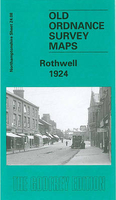
Rothwell 1924 Stanfords
£3.50
Vouchers
No voucher codes found.
Do you know a voucher code for this product or supplier? Add it to Insights for others to use.
Do you know a voucher code for this product or supplier? Add it to Insights for others to use.
 Denmark