More From Contributor

£4.95
Rajasthan in a series of state maps of India from Eicher Goodearth reflecting a change in locally produced maps to a more modern style of cartography. Each map is double-sided &

Includes::
an index of localities, street plans of main cities, a distance table & a route planner map of the whole of India. Each title comes with a small booklet with brief descriptions of main places of interest & colour photos. The maps show road & rail networks, indicating intermediate distances on many local roads. Towns & villages of particular tourist interest are highlighted & symbols mark national parks & wildlife sanctuaries, temples, etc. The base map shows rivers, lakes & local waterways system & has spot heights for peaks, but the range of elevation colouring is too finely graded to provide any useful information. No geographical coordinates are marked. The maps show the names & boundaries of local districts, indicating state capitals & district or tehsil administrative headquarters. Outside the state boundaries the colour range of the print is reduced, so only main roads are clearly visible. Please note: the various series of state maps of India often show different small villages, supplementing each other to provide a more detailed picture of each state. In this title: street plans of Bangalore & Mysore, plus a plan of the Vijayanagar temple complex in Hampi.

...
Archived Product
£4.50
Rajasthan in a series of waterproof & tear-resistant maps from Bharat Graphics, showing local districts in different colours & indicating both administrative headquarters of each district & of its subdivisions, the tehsils (or tahsils, tahasils, talukas, taluks, taluqs). Roads are classified as national or state highways & other roads, some with driving distances. Railway lines are also marked & some titles have symbols indicating places of interest or rest houses. Maps of states in mountainous areas show names of main valleys, on other titles there is no topographic information. The maps have no geographical coordinates. Some titles include insets with enlargements of popular areas or street plans, & distance tables. All the maps are indexed & have a small booklet providing a basic guide to the state district by district. The maps are printed on a waterproof & tear-resistant paper. Please note: the various series of state maps of India often show different small villages, supplementing each other to provide a more detail picture of each state. ...
Archived Product
£30.00
Rajasthan is a favourite destination of many visitors to India. Mostly infertile, the region is marked by its inhabitants whose courage & chivalry is written down in countless legends. The past almost appears to be present & is mirrored by the regions pompous palaces & formidable forts. This proud folk dress in colourful clothing that breathes life into the most monotonous desert landscape. The Thar Desert, the Aravalli mountains, the 1200 m high Mount Abu & the famous Jain temples all count as highlights of India's largest state. The overpowering character of the photographs in this book let you discover the mystical world of Rajasthan & its people. ...
Archived Product
£4.99
Rajasthan on a laminated, tear-resistant Insight Flexi Map, with a road map of the state, street plans of central Jaipur, Udaipur & Jodhpur, all indexed & highlighting main sights, plus extensive tourist information. On one side is a road map of Rajasthan at 1:1, 900, 000. Coverage

Includes::
Delhi & Agra & extends south to Ahmadabad & Bhopal. Topography is shown by relief shading & colouring with names of various mountain ranges & spot heights. Protected areas & wildlife sanctuaries are marked. The map presents the region

...
Archived Product
£14.99
Rajasthan in the Handbooks series from Footprint; comprehensive & leading guides designed & written for independent travellers who enjoy exploring off the beaten track. Footprint guides have an established reputation, built up since 1921, for catering for more adventurous & individual travellers. An unrestrictive editorial style also gives authors the freedom to capture & explore local cultures, sights & areas that are often not covered in other guides. Widely recognised for their reliability & independent writing style, Footprint guides all have the same layout. Introductory sections introduce the reader to the destination, with chapters on planning on your trip & essentials, including practical information & guidance on subjects such as when & where to go, itineraries, sport & activities, arts, getting there & around, eating & drinks, sleeping & a dedicated section on the anticipated carbon footprint involved in travelling to the destination. Each guide is organised geographically by region or country, with individual sections having a particular focus on an extensive range of sights & places of interest. Further, there are also details of accommodation, nightlife, restaurants & any notable local activities. Information boxes throughout the text give readers an insight into local customs, stories & sights of particular interest.A ...
Archived Product
£4.99
Rajasthan in the Pocket Guide series from Berlitz; a collection of handy, pocket-sized guides dedicated to an extensive range of cities, regions & countries worldwide. Written in narrative form, individual guides explore the history, main sights & attractions, food & drink, accommodation & local culture of the destination in detail. Each Berlitz pocket guide has a similar format, with colour-coded sections helping readers locate information quickly in addition to distinctive chapters exploring the city or region. An introduction outlines the destination for visitors & a section dedicated to 'A Brief History' actually explores the area in relative depth. A where to go chapter is organized by region & city & is written in prose form with references to individual sites highlighted in bold for clarity. There are also further suggestions on where & when to eat. Recommendations for leisure activities in the region, including sport, nightlife & shopping, are also provided & tailored accordingly for each destination. Handy travel tips are listed alphabetically in a dedicated section, providing practical guidance & helping visitors make the most of their stay. The main hotels, particularly for cities, are also listed in an accommodation section, offering a brief overview with approximate price bandings & relevant contact details. ...
Archived Product
£4.95
A page for each of the 30 districts of Rajasthan with railways, highways, main roads & other important routes marked. Symbols are used to show the locations of religious sites, forts, wildlife sanctuaries & other places of tourist interest. Street maps are included for ten major cities & there is also a short introduction to each district. ...
Archived Product
£8.99
Rajasthan offers huge variety to travellers, from impressive palaces & temples to glimpsing tigers in the misty hills. Footprint Focus provides invaluable information on transport, accommodation, eating & entertainment to ensure that your trip

Includes::
the best of this magnificent destination. Essentials section with useful advice on getting to & around Rajasthan. Comprehensive, up-to-date listings of where to eat, sleep & play.

Includes::
information on tour operators & activities, from the navigating the craziness of Delhi to the absorbing the calm of sacred temples. Detailed maps for Rajasthan & its key destinations. Slim enough to fit in your pocket. With detailed information on all the main sights, plus many lesser-known attractions, Footprint Focus Rajasthan, Delhi & Agra provides concise coverage of one of India's most traditional regions. Footprint Focus Rajasthan, Delhi & Agra has been extracted from Footprint's India Handbook.


...
Archived Product
£12.79
Rajasthan, Delhi & Agra in the Countries & Regions series from Lonely Planet, market-leading comprehensive guides aimed at independent travellers & serving a large range of international destinations. Frank & informal in style, the guides explore an extensive range of sights, activities, accommodation, restaurants & nightlife & are designed for practical use while travelling on the road. Written & researched by a team of experts, each book is independent in its recommendations & suggestions, often offering individual takes on individual destinations. Widely recognised for their reliability, each Lonely Planet country & region guide has the same layout. Introductory sections profile the destination with individual chapters on particular highlights, getting started, (including when to go) itineraries, history, culture, arts, food & drink & the environment. Each guide is organised geographically by region, with individual sections detailing an extensive range of sights, places of interest, attractions, restaurants, nightlife, accommodation & any local activities. The guides have detailed explanations of historical context where relevant. There is also practical guidance on ...
Archived Product
£12.99
Rajasthan offers huge variety to travellers, from impressive palaces & temples to glimpsing tigers in the misty hills. Footprint Focus provides invaluable information on transport, accommodation, eating & entertainment to ensure that your trip

Includes::
the best of this magnificent destination. Essentials section with useful advice on getting to & around Rajasthan. Comprehensive, up-to-date listings of where to eat, sleep & play.

Includes::
information on tour operators & activities, from the navigating the craziness of Delhi to the absorbing the calm of sacred temples. Detailed maps for Rajasthan & its key destinations. Slim enough to fit in your pocket. With detailed information on all the main sights, plus many lesser-known attractions, Footprint Focus Rajasthan, Delhi & Agra provides concise coverage of one of India`s most traditional regions. Footprint Focus Rajasthan, Delhi & Agra has been extracted from Footprint`s India Handbook.


...
Archived Product

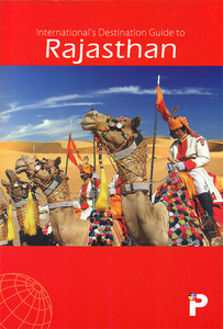
Rajasthan Map-Guide

Indian state of Rajasthan on road map from the Delhi-based International Publications, showing many small towns and villages, with a 48-page booklet describing the state and its sights. Additional features include street plans of Jaipur, Udaipur, Ajmer, Bikaner, Jaisalmer, Jodhpur, Kota and Mount Abu, all annotated with facilities and sights; a physical map of the state; a distance chart; plus a facts & figures table. The booklet includes notes on arts and crafts, national parks and sanctuaries, etc.Unless indicated to the contrary in the individual description, maps in this series present the state with its constituent districts in different colours and also show the division of districts into talukas. Town symbols indicate both district and taluka headquarters. Road network
includes many local roads, some with driving distances, although sometimes locations are marked without road access to them shown on the map. Railway lines are included and local airports are marked. Symbols indicate various locations of interest, including historical sites, wildlife sanctuaries, beaches, etc.In many titles additional panels around the main map and/or in the accompanying booklet provide more information: enlargements with more detailed presentation of the road network, street plans of main cities, etc. The booklets, which also include a general introduction to the state and district-by-district descriptions, are published on high quality paper and are illustrated with numerous colour photos.To see the list of titles in this series please click on the series link.
RIP - This product is no longer available on our network. It was last seen on 25.09.2019

This page now acts as a permanent archive for this product. Add more information using the comments box below to ensure it can still be found by future generations.

Use our search facility to see if it is available from an alternative contributor.
  • Availability: Out Of Stock
  • Supplier: Stanfords
  • SKU: 9788187765059
Availability: In Stock
£7.50

Product Description

Indian state of Rajasthan on road map from the Delhi-based International Publications, showing many small towns & villages, with a 48-page booklet describing the state & its sights. Additional features include street plans of Jaipur, Udaipur, Ajmer, Bikaner, Jaisalmer, Jodhpur, Kota & Mount Abu, all annotated with facilities & sights; a physical map of the state; a distance chart; plus a facts & figures table. The booklet

Includes::
notes on arts & crafts, national parks & sanctuaries, etc. Unless indicated to the contrary in the individual description, maps in this series present the state with its constituent districts in different colours & also show the division of districts into talukas. Town symbols indicate both district & taluka headquarters. Road network

Includes::
many local roads, some with driving distances, although sometimes locations are marked without road access to them shown on the map. Railway lines are included & local airports are marked. Symbols indicate various locations of interest, including historical sites, wildlife sanctuaries, beaches, etc. In many titles additional panels around the main map and/or in the accompanying booklet provide more information: enlargements with more detailed presentation of the road network, street plans of main cities, etc. The booklets, which also include a general introduction to the state & district-by-district descriptions, are published on high quality paper & are illustrated with numerous colour photos. To see the list of titles in this series please click on the series link.

Reviews/Comments

Add New

Price History

Vouchers

No voucher codes found.
Do you know a voucher code for this product or supplier? Add it to Insights for others to use.

Facebook

Jargon Buster

Paper - A thin sheet mainly used for writing. Available in a variety of colours. Made mainly from wood pulp.
Physical - Used to describe strength or visual properties of an item
Colour - The categorised spectrum of light visable to humans
Quality - An object that has quality is superior in function and finish than a less quality object.
Network - A link and communication between things. Often computers or people.
Small - something that takes up less space than normal.
Road - a manmade lane or a path that is used to speed up travel.
Individual - A single separate item or person.

Supplier Information

Stanfords
Stanfords was established in 1853 and opened their iconic Covent Garden flagship store in 1901. They have become the top retailer of maps, travel books and accessories in the UK and arguably offer the largest selection of maps and travel books worldwide. Famous names such as Captain Robert Falcon Scott, Ranulph Fiennes and Michael Palin have purchased from Stanfords. They now have a shop in Bristol and both stores together with other venues operate a calendar of events including talks, book signings and exhibitions. As a specialist map retailer, the map selection is comprehensive and includes road maps, street maps and walking maps from worldwide destinations, as well as a selection of world atlases and wall maps. Books include travel guides and travel literature. Stanfords also stock globes, from miniatures made of blue marble to magnificent floor-standing globes. The website features a selection of interesting articles on travel topics.
Page Updated: 2023-11-12 20:15:36

Community Generated Product Tags

Oh No! The productWIKI community hasn't generated any tags for this product yet!
Menu