More From Contributor

£11.50
Maps in this series feature extensive overprint highlighting local & long-distance footpaths & cycle routes, including King Ludwig Way or different variants of the Way of St James, indicating their waymarking. Symbols highlight different types of accommodation (campsites, youth hostels, refuges, etc), sport & recreational facilities, various places of interest, etc. The maps have a 1-km UTM grid. Map legend & all the text are in German only. To see other titles in this series please click on the series link. ...
Archived Product
£6.95
Map No. 124, Karlstejnsko
- Krivoklatsko, in a series of GPS compatible topographic maps of the Czech Republic at 1:75.000 from
...
Archived Product
£6.25
Karnataka in a series of locally produced administrative maps of Indian states, each with a booklet providing a guide to the area. The maps show the division of each state into districts & have more small towns & villages than on more general maps of India available from other publishers. Presentation is now considerably enhanced with the districts shown in different colours. The maps indicate each district ...
Archived Product
£4.95
Karnataka in a series of state maps of India from Eicher Goodearth reflecting a change in locally produced maps to a more modern style of cartography. Each map is double-sided &

Includes::
an index of localities, street plans of main cities, a distance table & a route planner map of the whole of India. Each title comes with a small booklet with brief descriptions of main places of interest & colour photos. The maps show road & rail networks, indicating intermediate distances on many local roads. Towns & villages of particular tourist interest are highlighted & symbols mark national parks & wildlife sanctuaries, temples, etc. The base map shows rivers, lakes & local waterways system & has spot heights for peaks, but the range of elevation colouring is too finely graded to provide any useful information. No geographical coordinates are marked. The maps show the names & boundaries of local districts, indicating state capitals & district or tehsil administrative headquarters. Outside the state boundaries the colour range of the print is reduced, so only main roads are clearly visible. Please note: the various series of state maps of India often show different small villages, supplementing each other to provide a more detailed picture of each state.IN THIS TITLE: street plans of central Bangalore & Mysore plus a plan of the Vijayangar site in Hampi.

...
Archived Product
£4.50
Karnataka in a series of waterproof & tear-resistant maps from Bharat Graphics, showing local districts in different colours & indicating both administrative headquarters of each district & of its subdivisions, the tehsils (or tahsils, tahasils, talukas, taluks, taluqs). Roads are classified as national or state highways & other roads, some with driving distances. Railway lines are also marked & some titles have symbols indicating places of interest or rest houses. Maps of states in mountainous areas show names of main valleys, on other titles there is no topographic information. The maps have no geographical coordinates. Some titles include insets with enlargements of popular areas or street plans, & distance tables. All the maps are indexed & have a small booklet providing a basic guide to the state district by district. The maps are printed on a waterproof & tear-resistant paper. Please note: the various series of state maps of India often show different small villages, supplementing each other to provide a more detail picture of each state. ...
Archived Product
£9.50
A journey into the heart of this vast region suits the explorer; those souls tired of the humdrum of city routine; &, those who want to discover random yet fascinating things in way out places, taking detours en route. If you are a traveller rather than a tourist, a participant rather than a spectator, you will get the most out of this guide. Yet the area is so large & diverse that it undoubtedly holds something for everyone. With highlights, interesting facts, tips & tons of contacts, written in an easy-to-read style, this is a must-read. Steve Moseley & Brent Naude live deep in the Karoo where they have spent the past eight years writing & photographing the region. They have developed a great love & respect for its natural & historical heritage, its people & culture, all of which has nurtured in them country values & a simpler way of life. Their work has appeared in national & international magazines & newspapers. Years of travel & research throughout this region have formed the basis of this book. ...
Archived Product
£9.99
Greek islands of Karpathos & Kasos on a light, waterproof & tear-resistant, contoured & GPS compatible map at 1:60, 000 from Terrain Editions. The reverse side

Includes::
descriptions of six specially selected hiking trails on Karpathos. Contour interval is 100m. All place names are shown in both Greek & Latin alphabet. Map legend & all the text include English. Maps of the Greek islands from Terrain Editions have topography well presented by contours at 20m intervals (unless indicated differently in the map`s individual description), enhanced by spot heights, subtle relief shading & additional altitude colouring. Road network is very clearly graded according to width & the type of surface, distinguishing between good & rough dirt roads. Distances are marked on most small local roads, as well as locations of petrol stations and/or tyre repair workshops; scenic routes are highlighted. Each map also shows which ports are served by ferry services. Hiking paths are graded as main or narrow trails. National parks & other protected areas are marked & a wide range of symbols indicate various places of interest & recreational facilities, with main sights clearly highlighted. Most titles distinguish between sandy & pebble beaches; some also indicate beaches with natural shade and/or the type of sea bed. The maps have a UTM grid, plus latitude & longitude margin ticks. The reverse side of each title is covered by general information about the isl&, illustrated with colour photos. Many titles also include brief descriptions of recommended hiking trails and/or a street plan of the island’s main town, with colouring clearly showing various tourist facilities. To see the other titles in this series please click on the series link.

...
Archived Product
£5.99
The Dodecanese island of Karpathos at 1:43, 000 on a light, waterproof & tear-resistant, contoured & GPS compatible map from Anavasi with recommendations for 18 hiking trails, The map is double-sided, dividing Karpathos north/south with an overlap between the sides, & shows on an inset the nearby island of Saria. All place names are in both Greek & Latin alphabets. Topography is shown by contours at 20m intervals, enhanced by relief shading & altitude colouring. Road network indicates dirt roads in poor condition & shows locations of petrol stations & driving distances on main roads. The map distinguishes between cart tracks & well defined, narrow or faint footpaths. 17 hiking trails are highlighted on Karpathos, plus a route on Saria, & are cross-referenced to a list giving their distances. Symbols highlight various places of interest & facilities, including beaches, caves, archaeological remains, etc. The map has a 1km UTM grid plus latitude & longitude crosshairs at 1’. Map legend & all the text include English. To see which other islands are covered by maps from Anavasi, please click on the series link. ...
Archived Product
£10.99
Road map of Karpathos, including the nearby islands of Kasos & Saria, with relief shading indicating the terrain. The map shows various types of vegetation on the island & highlights beaches & main places of interest. A street plan of the town of Karpathos shows hotels, restaurants & bars, shops, etc. On the reverse, there is a panorama map of the islands & the rest of the Aegean. ...
Archived Product
£9.95
Karpathos & Kasos at 1:60, 000 on a contoured, GPS compatible hiking map published by Terrain Cartography group together with Skai Maps, & printed on light, waterproof & tear-resistant Polyart plastic paper, with extensive tourist information. Topography is very well presented by contours, enhanced by spot heights, subtle relief shading & additional altitude colouring. Contour interval, unless indicated below to the contrary, is 20m. National parks & other protected areas are marked. All place names are shown in both Greek & Latin alphabet. The maps have a UTM grid, plus latitude & longitude margin ticks. Hiking trails are graded between main routes & narrow trails. A wide range of symbols indicate various places of interest & recreational facilities, with main sights clearly highlighted. Most titles distinguish between sandy & pebble beaches; some also indicate beaches with natural shade and/or the type of sea bed. Road network is very clearly graded according to width & the type of surface, distinguishing between good & rough dirt roads. Distances are marked on most small local roads, as well as locations of petrol stations and/or tyre repair workshops. Scenic routes are highlighted. Each map also shows which ports are served by ferry services. Many titles include a street plan of the island ...
Archived Product

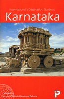
Karnataka Map-Guide

Indian state of Karnataka on road map from the Delhi-based International Publications, showing many small towns and villages, with a 46-page booklet describing the state and its sights. Additional features include street plan of Bengaluru (Bangalore) annotated with facilities and sights; a physical map of the state; a distance chart; plus a facts & figures table. The booklet includes notes on arts and crafts, national parks and sanctuaries, etc.Unless indicated to the contrary in the individual description, maps in this series present the state with its constituent districts in different colours and also show the division of districts into talukas. Town symbols indicate both district and taluka headquarters. Road network includes many local roads, some with driving distances,
although sometimes locations are marked without road access to them shown on the map. Railway lines are included and local airports are marked. Symbols indicate various locations of interest, including historical sites, wildlife sanctuaries, beaches, etc.In many titles additional panels around the main map and/or in the accompanying booklet provide more information: enlargements with more detailed presentation of the road network, street plans of main cities, etc. The booklets, which also include a general introduction to the state and district-by-district descriptions, are published on high quality paper and are illustrated with numerous colour photos.To see the list of titles in this series please click on the series link.
RIP - This product is no longer available on our network. It was last seen on 25.09.2019

This page now acts as a permanent archive for this product. Add more information using the comments box below to ensure it can still be found by future generations.

Use our search facility to see if it is available from an alternative contributor.
  • Availability: Out Of Stock
  • Supplier: Stanfords
  • SKU: 9788187765165
Availability: In Stock
£7.50

Product Description

Indian state of Karnataka on road map from the Delhi-based International Publications, showing many small towns & villages, with a 46-page booklet describing the state & its sights. Additional features include street plan of Bengaluru (Bangalore) annotated with facilities & sights; a physical map of the state; a distance chart; plus a facts & figures table. The booklet

Includes::
notes on arts & crafts, national parks & sanctuaries, etc. Unless indicated to the contrary in the individual description, maps in this series present the state with its constituent districts in different colours & also show the division of districts into talukas. Town symbols indicate both district & taluka headquarters. Road network

Includes::
many local roads, some with driving distances, although sometimes locations are marked without road access to them shown on the map. Railway lines are included & local airports are marked. Symbols indicate various locations of interest, including historical sites, wildlife sanctuaries, beaches, etc. In many titles additional panels around the main map and/or in the accompanying booklet provide more information: enlargements with more detailed presentation of the road network, street plans of main cities, etc. The booklets, which also include a general introduction to the state & district-by-district descriptions, are published on high quality paper & are illustrated with numerous colour photos. To see the list of titles in this series please click on the series link.

Reviews/Comments

Add New

Intelligent Comparison

Oooops!
We couldn't find anything!
Perhaps this product's unique.... Or perhaps we are still looking for comparisons!
Click to bump this page and we'll hurry up.

Price History

Vouchers

No voucher codes found.
Do you know a voucher code for this product or supplier? Add it to Insights for others to use.

Facebook

Jargon Buster

Paper - A thin sheet mainly used for writing. Available in a variety of colours. Made mainly from wood pulp.
Physical - Used to describe strength or visual properties of an item
Colour - The categorised spectrum of light visable to humans
Quality - An object that has quality is superior in function and finish than a less quality object.
Network - A link and communication between things. Often computers or people.
Small - something that takes up less space than normal.
Road - a manmade lane or a path that is used to speed up travel.
Individual - A single separate item or person.

Supplier Information

Stanfords
Stanfords was established in 1853 and opened their iconic Covent Garden flagship store in 1901. They have become the top retailer of maps, travel books and accessories in the UK and arguably offer the largest selection of maps and travel books worldwide. Famous names such as Captain Robert Falcon Scott, Ranulph Fiennes and Michael Palin have purchased from Stanfords. They now have a shop in Bristol and both stores together with other venues operate a calendar of events including talks, book signings and exhibitions. As a specialist map retailer, the map selection is comprehensive and includes road maps, street maps and walking maps from worldwide destinations, as well as a selection of world atlases and wall maps. Books include travel guides and travel literature. Stanfords also stock globes, from miniatures made of blue marble to magnificent floor-standing globes. The website features a selection of interesting articles on travel topics.
Page Updated: 2023-11-12 20:15:36

Community Generated Product Tags

Oh No! The productWIKI community hasn't generated any tags for this product yet!
Menu