
 United Kingdom
 France
 Germany
 Netherlands
 Sweden
 USA
USA
 Italy
Italy
 Spain
Spain
More From Contributor


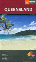
Queensland Wine Map
Wine Map of Queensland at 1:2, 500, 000 from Hema, combining a road map of the state with an overprint highlighting its wine growing regions, plus on the reverse side detailed enlargements and tables for individual wineries, etc.The map covers the whole state, showing its road and rail networks, including unsealed local roads and tracks. Roadside rest areas (with or without camping facilities) and locations of fuel supplies are marked. Driving distances are shown on most routes. Various places of interest are marked, with a special overprint highlighting wine growing regions and wineries, and colouring indicating grape varieties grown there. The map is indexed and has latitude and longitude lines at intervals of 2
Product Description
Reviews/Comments
Add New
Intelligent Comparison
Archived Product
Queensland Hema Stanfords
£11.99
Archived Product

Queensland Hema Handy Map Stanfords
£9.99
Archived Product
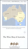
Australia Wine Map Stanfords
£10.99
Archived Product

Greenland Wall Map Stanfords
£44.99
Vouchers
No voucher codes found.
Do you know a voucher code for this product or supplier? Add it to Insights for others to use.
Do you know a voucher code for this product or supplier? Add it to Insights for others to use.
 Denmark