
 United Kingdom
 France
 Germany
 Netherlands
 Sweden
 USA
USA
 Italy
Italy
 Spain
Spain
More From Contributor


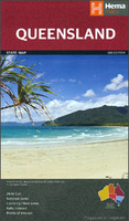
Queensland Hema
Queensland at 1:2, 500, 000 in a series of road maps from Hema covering Australia’s states. On the reverse four map panels provide more detailed coverage, plus a table of facilities in the national parks and a list of contact details for visitor information centres.On one side is an indexed road map of the whole state, accompanied by an index and a distance table. Road network from main highways, shown with their names in addition to numbers, to minor roads and 4WD tracks indicates unsealed routes and rough tracks. Driving distances are marked on main and many smaller local roads. Railway lines and local airports or airstrips are included. Symbols highlight roadside rest areas, 24h fuels supplies, as well as campsites and caravan parks, places of interest, visitor information
centres, etc. Colouring indicates national parks and other protected areas including marine parks, Aboriginal lands and restricted entry zones. Topography is shown by relief shading with plenty of names of mountain ranges, etc, and in the Great Barrier Reef World Heritage Area numerous reefs are named. The map has a latitude/longitude grid at intervals of 2º.On the reverse four panels provide additional more detailed mapping of Queensland’s most visited areas: a street plan of central Brisbane (the CBD) with lists of places of interest and selected accommodation; a Brisbane Throughroads map covering the city’s suburbs; a road map of south-east Queensland from the NSW border across the Gold Coast resorts and Brisbane to Trewantin and inland to Toowoomba; plus a map of Tropical
North Queensland centred on Cairns and including the Great Barrier Reef Coast Marine Park.To the other titles in this series please click on the series link.

Product Description
Reviews/Comments
Add New
Vouchers
No voucher codes found.
Do you know a voucher code for this product or supplier? Add it to Insights for others to use.
Do you know a voucher code for this product or supplier? Add it to Insights for others to use.
 Denmark