More From Contributor

£11.99
South Devon & Dartmoor Walks is the Jarrold Pathfinder guide to exploring the best walking possibilities in south-west Engl&. The guide covers a range of routes including walks in Broadhembury, the Yealm Estuary, Brixham & Churston Point, Rippon Tor & Buckfastleigh Moor. The walks are colour-coded by difficulty, ranging from short, easy strolls to more challenging rambles over more rugged terrain, often including climbs. Ordnance Survey mapping accompanies each walk, giving walkers detailed guidance on completing the route in conjunction with comprehensive route descriptions. Each of the walks begins with information on starting points, total distance, approximate times, parking advice, refreshments & the relevant Ordnance Survey Landranger & Explorer maps. Individual route descriptions have reference points that are included on each map extract, helping walkers plan their route accordingly. An overview of the walks covered in the guide gives further information on grid reference & general comments on the specific walk. A ...
Archived Product
£6.39
A detailed topographic map from the Ordnance Survey Explorer series, covering Brixham to Newton Ferrers (showing the district of South Hams, & parts of the Dartmoor National Park & South West Coast Path) Edition B3; Publication date August 2010 About this series: These highly detailed maps show all the administrative boundaries, settlements as small as isolated farms, the road network down to unfenced roads & country tracks, & field boundaries (hedges & drystone walls) which make navigation across the countryside much easier. Steep gradients on roads are indicated. Various landmarks, e.g. powerlines, archaeological sites, windmills, churches & lighthouses are shown & additional graphics indicate natural terrain features such as cliffs, scree, mud & vegetation variations. The contour interval is 5 metres in the lower parts of the country & 10 metres in the uplands, & spot heights are marked. Each map covers an area of 30 x 20km (i.e. approx. 19 x 12 miles), with some double-sided maps covering more, as indicated in the individual descriptions. The maps are fully GPS compatible, with the National Grid shown at 1km intervals & latitude & longitude indicated by margin ticks at 1'. The Explorer series has replaced the earlier, green-cover Pathfinder maps. The Explorer series is now complete & covers all of Engl&, Wales & Scotl&. Some sheets for popular areas like the National Parks are still branded as Outdoor Leisure (OL) maps, but are now included in this series as the cartography is the same as that in the Explorer Maps. The Explorer maps offer a substantial improvement on the Pathfinder series, with greater use of colour, larger area per map, & stronger emphasis on information for ramblers & tourists. This series is ideal for walking & other outdoor pursuits & each map shows a large amount of information for ramblers & tourists. Public rights of way are shown (except in Scotland), together with other routes with public access: National Trails & Recreational Paths, permitted paths & bridleways, & selected cycle routes. Open access land created under the Countryside & Rights of Way Act 2000 is marked. Tourist information

Includes::
caravan & camp sites, Park & Ride locations, recreation/leisure/sport centres, museums, historic buildings, English Heritage & National Trust sites, rural pubs, etc. The map legend is in English only, except for the tourist information content which is also in French & German.

...
Archived Product
£14.99
The coast of South Devon on a detailed topographic & GPS compatible map OL20, waterproof version, from the Ordnance Survey’s 1:25, 000 Explorer series. The map extends westwards beyond Newton Ferrers to Plymouth, eastwards beyond Brixham to Torquay, & inland to include part of the Dartmoor National Park. Coverage

Includes::
Paignton, Totness, Dartmouth, Salcombe, Ivybridge, sections of the South West Coast Path National trail, The Two Moors Way, the Erme-Plym Trail, etc.MOBILE DOWNLOADS: this title & all the other OS Explorer maps include a code for downloading after purchase the digital version onto your smartphone or tablet for viewing on the OS smartphone app.OS EXPLORER SERIES: to see the list of all the titles in the OS Explorer series, both paper & waterproof versions, please click on the series link. The Explorer series, Ordnance Survey’s most detailed maps recommended for anyone enjoying outdoor activities, provides topographic coverage of Great Britain at 1:25, 000 on GPS compatible maps with hiking trails, cycling routes & extensive tourist information. Each printed map is available either on paper or as a waterproof & tear-resistant OS Active Map, as indicated in its title. Britain’s National Parks & other areas of particular tourist interest are presented on often double-sided OL (Outdoor Leisure) maps, whilst most standard format Explorers cover an area of 30 x 20km (approx. 19 x 12 miles). All three versions (paper, waterproof & digital) are the same & provide plenty of recreational & tourist information, indicating the traditional public right of way paths (except in Scotland where different laws apply), including bridleways & byways. National Trails & other long-distance paths are marked, as well as permissive footpaths or bridleways & on-road or traffic-free cycle routes with, where appropriate, their National/ Regional Cycle Network numbers. Boundaries of access land are clearly marked. A wide range of symbols provides additional tourist information, highlighting camping & caravanning sites, information offices & visitors’ centres, parking & picnicking places, country pubs, sport & recreational facilities including cycle hire locations & mountain biking trails, historic buildings & museums, etc. Exceptionally clear presentation of the landscape is provided by contours at 5m or in the uplands at 10m intervals, with additional spot heights plus colouring and/or graphics for different types of woodlands, orchards, heath, marshl&, scree or boulders, & other topographic features. For GPS users the maps have British National Grid lines at 1km intervals, with latitude & longitude given by margin ticks at 1`. Clearly laid out map legend

Includes::
French & German translations for the tourist information symbols.


...
Archived Product
£8.99
The coast of South Devon on a detailed topographic & GPS compatible map OL20, paper version, from the Ordnance Survey’s 1:25, 000 Explorer series. The map extends westwards beyond Newton Ferrers to Plymouth, eastwards beyond Brixham to Torquay, & inland to include part of the Dartmoor National Park. Coverage

Includes::
Paignton, Totness, Dartmouth, Salcombe, Ivybridge, sections of the South West Coast Path National trail, The Two Moors Way, the Erme-Plym Trail, etc.MOBILE DOWNLOADS: this title & all the other OS Explorer maps include a code for downloading after purchase the digital version onto your smartphone or tablet for viewing on the OS smartphone app.OS EXPLORER SERIES: to see the list of all the titles in the OS Explorer series, both paper & waterproof versions, please click on the series link. The Explorer series, Ordnance Survey’s most detailed maps recommended for anyone enjoying outdoor activities, provides topographic coverage of Great Britain at 1:25, 000 on GPS compatible maps with hiking trails, cycling routes & extensive tourist information. Each printed map is available either on paper or as a waterproof & tear-resistant OS Active Map, as indicated in its title. Britain’s National Parks & other areas of particular tourist interest are presented on often double-sided OL (Outdoor Leisure) maps, whilst most standard format Explorers cover an area of 30 x 20km (approx. 19 x 12 miles). All three versions (paper, waterproof & digital) are the same & provide plenty of recreational & tourist information, indicating the traditional public right of way paths (except in Scotland where different laws apply), including bridleways & byways. National Trails & other long-distance paths are marked, as well as permissive footpaths or bridleways & on-road or traffic-free cycle routes with, where appropriate, their National/ Regional Cycle Network numbers. Boundaries of access land are clearly marked. A wide range of symbols provides additional tourist information, highlighting camping & caravanning sites, information offices & visitors’ centres, parking & picnicking places, country pubs, sport & recreational facilities including cycle hire locations & mountain biking trails, historic buildings & museums, etc. Exceptionally clear presentation of the landscape is provided by contours at 5m or in the uplands at 10m intervals, with additional spot heights plus colouring and/or graphics for different types of woodlands, orchards, heath, marshl&, scree or boulders, & other topographic features. For GPS users the maps have British National Grid lines at 1km intervals, with latitude & longitude given by margin ticks at 1`. Clearly laid out map legend

Includes::
French & German translations for the tourist information symbols.


...
Archived Product
£6.99
South Devon in the Short Walks guide series, produced in association with Ordnance Survey & published by Crimson; comprising a range of walking guides to popular British destinations. Each title

Includes::
20 varied walks that are suitable for walkers of all ages & abilities & is accompanied by detailed Explorer 1:25, 000 Ordnance Survey mapping with colour-coded marked routes. The guides are structured in three main sections with different levels of difficulty- short & easy walks, those of modest length that may include uphill walking & more challenging routes that may be longer & over more rugged terrain- covering a total of 20 walks. Each walk has a mini summary & an information box with details of starting points, distance, approximate time, parking & any individual route features. There is also information on refreshments, local transport & public toilets en route. Appendices provide further useful information on walking safety, GPS, the Countryside Code, local organisations & Ordnance Survey maps.

...
Archived Product
£9.99
Discover the hidden secrets of this varied & beautiful region, from the ` English Riviera`, where palm-trees abound & the sandy beaches of Torquay & Paignton attract numerous summer visitors, to the wild landscape of Dartmoor, England`s highest landmass south of the Pennines. ...
Archived Product
£2.99
The southern half of Devon at 1:100, 000 on a handy size, 50x 35cm, double-sided contoured map from Croydecycle, printed on waterproof & tear-resistant synthetic paper & showing National Cycle routes & numerous local facilities, including campsites, pubs, etc. Coverage extends southwards from Exeter & Okehampton. Contours are at 30m intervals, with colouring for woodlands (indicating those with public access), sandy or pebble beaches, plus moors & common or other access l&. Interesting landscape features are highlighted with grading. Road network indicates A & B road numbers & has gradient markings. On roads which are part of the National Cycle Network route numbers are marked. Symbols indicate numerous facilities: campsites & caravan sites, pubs & cafes, car parks & picnic sites, local shops, cycle hire, tourist information, etc. National Grid coordinates are marked in the margins. Small panels provide street plans of central Exeter, Torquay, Dartmouth, Brixham, Salcombe, Kingsbridge, Totnes, Tavistock & Plymouth. Also provided is a small overview map of the National Cycle Routes in the region. To see other titles in this series please click on the series link. ...
Archived Product
£34.95
South Devon Postcode Sector Map at 1:150, 000, encapsulated version, in a series of postcode sector maps showing the first part of the postcode & the first number of the second part, the Inward Code. Coverage extends north to Bridgewater, south to Salcombe, east to Dorchester & west to Tavistock. Map Marketing’s series of postcode sector maps covers Great Britain & Northern Ireland on 36 titles, each available only as a flat map, either on paper or encapsulated for greater durability. Presentation

Includes::
postcode changes in the most recent Royal Mail Postcode updates. The series covers Great Britain at 1:150, 000 (1” to 2.4 miles), with Northern Ireland shown at 1:210, 000 & London at two scales: 1:60, 000 for the area within the M25 & in more detail at 1:15, 000 for central London. Postcode area, district & sector boundaries & numbers/letters are shown in red, with County & Unitary Authority boundaries in green. The map base shows motorways, primary, ‘A’ & down to unclassified roads, with conurbation shapes & city plan insets showing street level detail for major cities. To see the list of all the titles in this series please click on the series link.LAMINATED & ENCAPSULATED WALL MAPS:- LAMINATED wall maps have a thin layer of plastic usually applied to the printed side only. They can be written on with suitable marker pens without any damage to the map but, unless laminated on both sides, they are not damp-proof.- ENCAPSULATED wall maps are sealed between two sheets of plastic. They are more rigid & heavier than laminated maps of the same size. They are damp-proof & do not crinkle in humid conditions. Encapsulation gives the map a shiny surface, similar to being displayed behind glass.- PLEASE NOTE: many publishers & retailers often use these two terms interchangeably. Our map titles & descriptions follow the definitions provided above.

...
Archived Product
£24.95
South Devon Postcode Sector Map at 1:150, 000, paper version, in a series of postcode sector maps showing the first part of the postcode & the first number of the second part, the Inward Code. Coverage extends north to Bridgewater, south to Salcombe, east to Dorchester & west to Tavistock. Map Marketing’s series of postcode sector maps covers Great Britain & Northern Ireland on 36 titles, each available only as a flat map, either on paper or encapsulated for greater durability. Presentation

Includes::
postcode changes in the most recent Royal Mail Postcode updates. The series covers Great Britain at 1:150, 000 (1” to 2.4 miles), with Northern Ireland shown at 1:210, 000 & London at two scales: 1:60, 000 for the area within the M25 & in more detail at 1:15, 000 for central London. Postcode area, district & sector boundaries & numbers/letters are shown in red, with County & Unitary Authority boundaries in green. The map base shows motorways, primary, ‘A’ & down to unclassified roads, with conurbation shapes & city plan insets showing street level detail for major cities. To see the list of all the titles in this series please click on the series link.

...
Archived Product
£11.19
Laminated waterproof edition of a detailed topographic map from the Ordnance Survey Explorer series, covering Brixham to Newton Ferrers (showing the district of South Hams, & parts of the Dartmoor National Park & South West Coast Path) Edition B3; publication date August 2010 About this series: These highly detailed maps show all the administrative boundaries, settlements as small as isolated farms, the road network down to unfenced roads & country tracks, & field boundaries (hedges & drystone walls) which make navigation across the countryside much easier. Steep gradients on roads are indicated. Various landmarks, e.g. powerlines, archaeological sites, windmills, churches & lighthouses are shown & additional graphics indicate natural terrain features such as cliffs, scree, mud & vegetation variations. The contour interval is 5 metres in the lower parts of the country & 10 metres in the uplands, & spot heights are marked. Each map covers an area of 30 x 20km (i.e. approx. 19 x 12 miles), with some double-sided maps covering more, as indicated in the individual descriptions. The maps are fully GPS compatible, with the National Grid shown at 1km intervals & latitude & longitude indicated by margin ticks at 1'. The Explorer series has replaced the earlier, green-cover Pathfinder maps. The Explorer series is now complete & covers all of Engl&, Wales & Scotl&. Some sheets for popular areas like the National Parks are still branded as Outdoor Leisure (OL) maps, but are now included in this series as the cartography is the same as that in the Explorer Maps. The Explorer maps offer a substantial improvement on the Pathfinder series, with greater use of colour, larger area per map, & stronger emphasis on information for ramblers & tourists. This series is ideal for walking & other outdoor pursuits & each map shows a large amount of information for ramblers & tourists. Public rights of way are shown (except in Scotland), together with other routes with public access: National Trails & Recreational Paths, permitted paths & bridleways, & selected cycle routes. Open access land created under the Countryside & Rights of Way Act 2000 is marked. Tourist information

Includes::
caravan & camp sites, Park & Ride locations, recreation/leisure/sport centres, museums, historic buildings, English Heritage & National Trust sites, rural pubs, etc. The map legend is in English only, except for the tourist information content which is also in French & German.

...
Archived Product

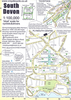
South Devon - Short Walks

South Devon is famed above all for its magnificent rugged coast, stretching from Plymouth in the west to Seaton in the east, a coastline of imposing sandstone cliffs broken into by long winding estuaries and traversed throughout by the South West Path. Punctuating this coast are a series of popular seaside resorts, both large and small, historic ports and picturesque fishing villages. The many delightful and historic old towns include Totnes and Dartmoor and, above all, the cathedral city of Exeter. And do not forget that the local delicacies of cider, pasties and cream teas add to the overall enjoyment of a walk in South Devon.
RIP - This product is no longer available on our network. It was last seen on 25.09.2019

This page now acts as a permanent archive for this product. Add more information using the comments box below to ensure it can still be found by future generations.

Use our search facility to see if it is available from an alternative contributor.
  • Availability: Out Of Stock
  • Supplier: Stanfords
  • SKU: 9780319090923
Availability: In Stock
£7.99

Product Description

South Devon is famed above all for its magnificent rugged coast, stretching from Plymouth in the west to Seaton in the east, a coastline of imposing sandstone cliffs broken into by long winding estuaries & traversed throughout by the South West Path. Punctuating this coast are a series of popular seaside resorts, both large & small, historic ports & picturesque fishing villages. The many delightful & historic old towns include Totnes & Dartmoor &, above all, the cathedral city of Exeter. & do not forget that the local delicacies of cider, pasties & cream teas add to the overall enjoyment of a walk in South Devon.

Reviews/Comments

Add New

Intelligent Comparison

Oooops!
We couldn't find anything!
Perhaps this product's unique.... Or perhaps we are still looking for comparisons!
Click to bump this page and we'll hurry up.

Price History

Vouchers

No voucher codes found.
Do you know a voucher code for this product or supplier? Add it to Insights for others to use.

Facebook

Jargon Buster

Plymouth - A city on the coast of Devon
Large - something that takes up more space than normal.
Small - something that takes up less space than normal.
Popular - Something that is admired and liked by many people.
Cider - An unfermented alcoholic drink made typically from apples.
Cream - A warmer tone of white, also a thick white/yellow food liquid used in cooking.

Supplier Information

Stanfords
Stanfords was established in 1853 and opened their iconic Covent Garden flagship store in 1901. They have become the top retailer of maps, travel books and accessories in the UK and arguably offer the largest selection of maps and travel books worldwide. Famous names such as Captain Robert Falcon Scott, Ranulph Fiennes and Michael Palin have purchased from Stanfords. They now have a shop in Bristol and both stores together with other venues operate a calendar of events including talks, book signings and exhibitions. As a specialist map retailer, the map selection is comprehensive and includes road maps, street maps and walking maps from worldwide destinations, as well as a selection of world atlases and wall maps. Books include travel guides and travel literature. Stanfords also stock globes, from miniatures made of blue marble to magnificent floor-standing globes. The website features a selection of interesting articles on travel topics.
Page Updated: 2023-11-12 20:15:36

Community Generated Product Tags

Oh No! The productWIKI community hasn't generated any tags for this product yet!
Menu