
 United Kingdom
 France
 Germany
 Netherlands
 Sweden
 USA
USA
 Italy
Italy
 Spain
Spain
More From Contributor
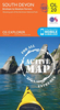
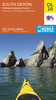


South Devon Cycle Map
The southern half of Devon at 1:100, 000 on a handy size, 50x35cm, double-sided contoured map from Croydecycle, printed on waterproof and tear-resistant synthetic paper and showing National Cycle routes and numerous local facilities, including campsites, pubs, etc. Coverage extends southwards from Exeter and Okehampton. Contours are at 30m intervals, with colouring for woodlands (indicating those with public access), sandy or pebble beaches, plus moors and common or other access land. Interesting landscape features are highlighted with grading. Road network indicates A and B road numbers and has gradient markings. On roads which are part of the National Cycle Network route numbers are marked. Symbols indicate numerous facilities: campsites and caravan sites, pubs and cafes, car
parks and picnic sites, local shops, cycle hire, tourist information, etc. National Grid coordinates are marked in the margins. Small panels provide street plans of central Exeter, Torquay, Dartmouth, Brixham, Salcombe, Kingsbridge, Totnes, Tavistock and Plymouth. Also provided is a small overview map of the National Cycle Routes in the region.To see other titles in this series please click on the series link.
parks and picnic sites, local shops, cycle hire, tourist information, etc. National Grid coordinates are marked in the margins. Small panels provide street plans of central Exeter, Torquay, Dartmouth, Brixham, Salcombe, Kingsbridge, Totnes, Tavistock and Plymouth. Also provided is a small overview map of the National Cycle Routes in the region.To see other titles in this series please click on the series link.

Product Description
Reviews/Comments
Add New
Intelligent Comparison
Archived Product

North Devon Cycle Map Stanfords
£2.99
Archived Product
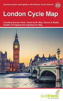
London Cycle Map Stanfords
£5.99
Vouchers
No voucher codes found.
Do you know a voucher code for this product or supplier? Add it to Insights for others to use.
Do you know a voucher code for this product or supplier? Add it to Insights for others to use.
 Denmark