
 United Kingdom
 France
 Germany
 Netherlands
 Sweden
 USA
USA
 Italy
Italy
 Spain
Spain
More From Contributor


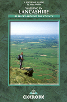
Lancashire Walking
Walking in Lancashire is Mary Welsh’s Cicerone guide to the extensive walking opportunities available in the north-west of England. The guide covers Lancashire’ great variety of landscape, from low-lying areas around Cockerham, Lytham, Martin Mere and Croston to the heights of Boulsworth Hill, Ward’s Stone, Fair Snape Fell and Pendle Hill, exploring the county’s rivers, woodlands, moors and coastline. Selected walks also take in places of historic interest, such as The Pepperpot in Silverdale and Whalley Abbey. The guide is organized into sections describing a total of 40 walks varying from 5 to 12 miles in length. Each route begins with a general outline of the walks as well as practical information on distance, time, the kind of terrain and the relevant map. Detailed
route descriptions are accompanied by Ordnance Survey extracts mapping the route ahead as well as colour photographs illustrating some of the highlights of the county.
route descriptions are accompanied by Ordnance Survey extracts mapping the route ahead as well as colour photographs illustrating some of the highlights of the county.

Product Description
Reviews/Comments
Add New
Vouchers
No voucher codes found.
Do you know a voucher code for this product or supplier? Add it to Insights for others to use.
Do you know a voucher code for this product or supplier? Add it to Insights for others to use.
 Denmark