
 United Kingdom
 France
 Germany
 Netherlands
 Sweden
 USA
USA
 Italy
Italy
 Spain
Spain
More From Contributor


Cairngorms Walking
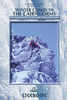
Walking in the Cairngorms is experienced walker Ronald Turnbull’s Cicerone guide exploring the Munro summits of the Cairngorm region and also the smaller hills outside the main range. The guide covers the main Cairngorm range between Speyside and Deeside, as well as Lochnagar and offers the best of the area’s rocky scrambles and the classic through-routes as well as easier, sandy trails along the banks of the rivers Spey, Nethy and Dee. There are also routes to the region’s 23 Munro summits.The guide is structured in 7 main sections - Aviemore and the Spey, Glen More, Badenoch, Glenlivet and Tomintoul, Donside, Deeside Braemar and Balmoral and Lochnagar - encompoassing a total of 102 walks. There are also ‘Summit Summaries’ for the main ranges - Cairn Gorm, Shelter
Stone, Braeriach, Cairn Toul and Lochnagar. There are also suggestions for longer routes such as the Cairngorms 4000s and the Lairig Ghru. Individual walks have a general overview of the route and an information box providing details of starting and finishing points, total distance, approximate times, maximum altitude and terrain. A detailed introduction gives practical guidance on walking conditions, when to go, safety in the mountains and recommended maps. Detailed route descriptions are accompanied by Ordnance Survey extract mapping the route in addition to colour photographs illustrating some of the highlights of the region.
Stone, Braeriach, Cairn Toul and Lochnagar. There are also suggestions for longer routes such as the Cairngorms 4000s and the Lairig Ghru. Individual walks have a general overview of the route and an information box providing details of starting and finishing points, total distance, approximate times, maximum altitude and terrain. A detailed introduction gives practical guidance on walking conditions, when to go, safety in the mountains and recommended maps. Detailed route descriptions are accompanied by Ordnance Survey extract mapping the route in addition to colour photographs illustrating some of the highlights of the region.

Product Description
Reviews/Comments
Add New
Vouchers
No voucher codes found.
Do you know a voucher code for this product or supplier? Add it to Insights for others to use.
Do you know a voucher code for this product or supplier? Add it to Insights for others to use.
 Denmark