More From Contributor

£10.99
Philippines at 1:900, 000 on a double-sided, indexed map from Freytag & Berndt with ferry connections for island hopping & icons prominently highlighting numerous places of interest, locations with tourist accommodation including campsites, etc. The map divides the country north/south, with Batan & Babuyan Islands north of Luzon shown as an inset at the same scale as the main map, & the Sulu Archipelago in the far south presented at 1:1, 500, 000. Topography is indicated by relief shading with spot heights & names of mountain ranges, peaks, etc. Throughout the whole country numerous smaller islands are named. The map shows the network of road & rail connections on the islands, as well as ferry connections & local airports. Also marked are internal administrative boundaries with names of the provinces. Icons indicate various places of interest including national parks & other protected areas, UNESCO World Heritage sites & other historical sites, temples, etc. The map is indexed & has latitude & longitude lines at intervals of 1°. Map legend

Includes::
English.

...
Archived Product
£16.99
Philippines Insight Guide is dedicated to exploring the destination in detail with a selection of glossy illustrations. Extensive introductory sections explore the region’s history & culture & there are also short articles written by locals about distinctive local issues, whilst selective photo-features illustrate the variety of the place. The ‘ Places’ section is grouped geographically & provides details of the area including places to visit, suggestions for tours & other activities. Each section has its own listings of the best restaurants, bars & cafes. Essential practical information is provided in the Travel Tips chapter on accommodation, shopping & local activities. A useful location finder & travel tip index with relevant page numbers are given on the inside covers. Overview street plans are also provided for the main cities in the region or country. ...
Archived Product
£16.99
Insight Guides: all you need to inspire every step of your journey. An in-depth book, now with free app & e Book. From deciding when to go, to choosing what to see when you arrive, this is all you need to plan your trip & experience the best of the Philippines, with in-depth insider information on must-see, top attractions like Boracay, & hidden cultural gems like Corregidor Isl&.· Insight Guides the Philippines is ideal for travellers seeking immersive cultural experiences, from exploring the Volcanoes, to discovering Palawan· In-depth on history & culture: enjoy special features on the Batanes & Mount Apo all written by local experts·

Includes::
innovative, unique extras to keep you up-to-date when you`re on the move
- this guide comes with a free e Book, & an app that highlights top attractions & regional information & is regularly updated with new hotel, bar, restaurant, shop & local event listings· Invaluable maps, travel tips & practical information ensure effortless planning, & encourage venturing off the beaten track· Inspirational colour photography throughout
- Insight Guides is a pioneer of full-colour guide books· Inventive design makes for an engaging, easy reading experience


...
Archived Product
£9.99
Philippines at 1: 1, 100, 000 from ITMB on a double-sided, indexed road map including street plans of central Davao city & Cebu city & Manila city centre. Road networks include motorways, secondary & minor roads & tracks, with intermediate distances in kilometres. Symbols clearly indicate international & domestic airports, railways & ferry routes. Topography is represented by altitude colouring & spot heights; graphics indicate rivers, lakes, coral reefs etc. Symbols mark locations of various places of interest including museums, churches, caves, national parks, beaches, dive sites, ports, etc. International, regional & provincial boundaries are clearly marked. The map is indexed & annotated with historical & tourist information of places of interest, illustrated with colour pictures &

Includes::
a small inset showing major national air routes. It

Includes::
street plans of central Davao city & Cebu city & Manila city centre at Approx. 1:12, 000. Latitude & longitude lines are drawn at intervals of 2°.


...
Archived Product
£8.95
Philippines on a map at 1:1, 950, 000 from Odyssey Guides presenting the country on one side with descriptions of its natural sites & recreational possibilities & on the reverse with historical & cultural information. On one side is a map with colouring & shading to indicate the topography. The map shows the network of main roads, principal ferry connections & domestic airports. Local administrative boundaries are shown with names of the provinces but fewer smaller towns & villages are marked than on other general road maps of the country. National parks & popular diving sites are highlighted & 26 locations are cross-referenced to descriptions and/or photos which surround the map. Descriptions are also provided several other locations. On the reverse the same map is printed without the colouring, showing fewer locations & just main roads & airports. The surrounding panels & photos, where appropriate cross-referenced to the map, provide information on the country’s history, culture, etc. Also provided is a time-line listing main historical events from the pre-Magellan times to the present day. ...
Archived Product
£7.99
Each of the maps in the Periplus Wall Maps series is available in a user-friendly format. Each map is folded neatly into a heavy-duty cardstock protective pocket/folder & features comprehensive coverage of tourist facilities & public amenities, an easy-to-use legend for quick reference, plus a fully digital map base which allows them to be frequently updated. This 1st edition Philippines Wall Map is scaled to 1:1, 750, 000 & opens to 19 3/4 x 33 3/4 inches. ...
Archived Product
£9.99
The new Philip`s 101 Objects To Spot In The Night Sky is a fun & practical guide to identifying & observing 101 of the most fascinating & exciting sights in the northern-hemisphere sky for young newcomers to astronomy, explaining what can be seen using the naked eye, binoculars or a telescope. In this book, author Robin Scagell shows the novice astronomer where to look in the sky to see a particular object, or group of objects or sights, which may be a planet, its rings or satellites, a series of lunar craters, a constellation, asteroids, meteors, a nebula, galaxy or star cluster, for example. He explains what you can expect to see with just the naked eye & describes the object in detail, giving observing tips for better viewing. A concise `fact file` is provided for major objects, & readers can award themselves `points` for their skill in finding the object in the first instance, with higher scores given for spotting some of its more elusive or hard-to-see features. Philip`s 101 Objects To Spot In The Night Sky is illustrated in full colour throughout, with Approx. 300 high-quality photographs, diagrams & star maps. ...
Archived Product
£6.99
”IF YOU BUY JUST ONE GUIDE... YOU WON`T DO BETTER THAN THIS” BBC Sky at Night Magazine * 12 month-by-month Night Sky Maps for year-round stargazing * Monthly Calendar of moon phases & special events in 2019 * Planet Watch: the best viewing days for planets in 2019 * Dark Sky Map of the UK
- find the darkest skies * Optical Equipment Guide
- Which Telescope? * The major astronomical events of 2019* Month-by-month top 20 Sky Sights 2019 Plus: * Expert advice on what to see each month from Heather Couper & Nigel Henbest, Philip`s internationally renowned authors. * The Solar System 2019 explains the movement of the planets, with particular attention paid to their positions in 2019. Solar & lunar eclipses, meteor showers & comets are also described. * Expert Robin Scagell`s Equipment Review looks at the pros & cons of Stargazing with reflector or refractor telescopes. * & all superbly illustrated with photographs taken by the best amateur photographers illustrating the night skies. Book Description Philip`s Month-by-Month Stargazing 2019 is the guide for Stargazers in Britain & Irel&. The new 2019 edition has been completely revised to make it even more essential for exploring the night skies. Essential reading for astronomers at all levels
- & the perfect gift for every stargazer. About the Authors Philip`s Stargazing Month by Month 2019 is written by two of the UK`s best-known & respected astronomers. Professor Heather Couper CBE, FRAS, is an internationally acclaimed astronomer, writer & presenter/producer of TV & radio programmes. Professor Nigel Henbest researched in radio astronomy at Cambridge University, with the Astronomer Royal, & has been a Consultant to both New Scientist magazine & the Royal Greenwich Observatory.


...
Archived Product
£16.99
A new edition of the exciting Philip`s Astronomy Starter Pack, suitable for use in the Northern Hemisphere, containing three essential items to introduce the beginner to the fascinating hobby of astronomy: a `glow-in-the-dark` planisphere, an 80-page paperback book about the stars & planets, & a colourful wall poster of the Solar System. Philip`s Glow-in-the-Dark Planisphere: This planisphere has been specially made so that, after being held under a bright light, the stars & the names & shapes of the constellations will glow in the dark for a period. It is both a fun & practical starfinder for identifying the stars & constellations visible on any night of the year from the UK, Northern Europe, Northern USA & Canada (51.5 degrees North); the star map is drawn by the well-known celestial cartographer Wil Tirion. A sheet explaining how to use the planisphere is included in the pack. Philip`s Exploring Stars & Planets: A colourful & entertaining introduction to the exciting world of astronomy, this 80-page paperback is illustrated with more than 200 colour photographs, artworks & maps, as the author Ian Ridpath describes the latest developments in the fast-moving fields of space exploration & astronomy. Concise chapters introduce the Sun, the Earth & all the other planets in our Solar System. Then, moving further into space, the author examines the stars & galaxies, & explores the origin of the Universe. Philip`s Solar System Poster: A large attractive folded wall chart (580 x 870mm) illustrating the planets & other bodies in the Solar System, with informative text & tables by Ian Ridpath. ...
Archived Product
£17.99
* Three in One Essential Starter Kit for new Stargazers* Book, Planisphere & Wall Chart* The ideal gift for beginners in astronomy
-
...
Archived Product

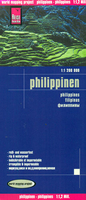
Philippines Reise Know-How

The Philippines at 1:1, 200, 000 on an indexed, waterproof and tear-resistant road map with topographic and tourist information. The map, published by Reise Know-How as part of their highly acclaimed World Mapping Project, is double-sided to provide the best balance between a good scale and a convenient size sheet. Islands north of Luzon and at the south-western corner of the country around the Tawi-Tawi Island are shown on insets.Topography is presented by altitude colouring and spot heights; coral reefs surrounding the islands are also included. Internal administrative boundaries are shown with names of the provinces. Road network includes selected unsurfaced local roads and seasonal tracks, and indicates driving distances on main and secondary roads. Railways lines are included,
local airfields are marked, and the map also shows ferry routes between the islands. Symbols highlight various places of interest, including national parks and wildlife reserves, beaches, surfing and diving sites, etc. The map has a latitude and longitude grid at intervals of 1º, plus an extensive index of localities with a separate list of national parks and reserves. Map legend includes English.
RIP - This product is no longer available on our network. It was last seen on 25.09.2019

This page now acts as a permanent archive for this product. Add more information using the comments box below to ensure it can still be found by future generations.

Use our search facility to see if it is available from an alternative contributor.
  • External links may include paid for promotion
  • Availability: Out Of Stock
  • Supplier: Stanfords
  • SKU: 9783831773428
Availability: In Stock
£11.50

Product Description

The Philippines at 1:1, 200, 000 on an indexed, waterproof & tear-resistant road map with topographic & tourist information. The map, published by Reise Know-How as part of their highly acclaimed World Mapping Project, is double-sided to provide the best balance between a good scale & a convenient size sheet. Islands north of Luzon & at the south-western corner of the country around the Tawi-Tawi Island are shown on insets. Topography is presented by altitude colouring & spot heights; coral reefs surrounding the islands are also included. Internal administrative boundaries are shown with names of the provinces. Road network

Includes::
selected unsurfaced local roads & seasonal tracks, & indicates driving distances on main & secondary roads. Railways lines are included, local airfields are marked, & the map also shows ferry routes between the islands. Symbols highlight various places of interest, including national parks & wildlife reserves, beaches, surfing & diving sites, etc. The map has a latitude & longitude grid at intervals of 1º, plus an extensive index of localities with a separate list of national parks & reserves. Map legend

Includes::
English.

Reviews/Comments

Add New

Intelligent Comparison

Oooops!
We couldn't find anything!
Perhaps this product's unique.... Or perhaps we are still looking for comparisons!
Click to bump this page and we'll hurry up.

Price History

Vouchers

No voucher codes found.
Do you know a voucher code for this product or supplier? Add it to Insights for others to use.

Facebook

Jargon Buster

Waterproof - Resistant to water, usualy specified by depth in metres
Railways - A set of tracks that have been laid for the purpose of trains to travel up and down them
World - A physical grouping, commonly used to describe earth and everything associated with ti
Size - is the measurement of how big an object is in space.
Network - A link and communication between things. Often computers or people.
Road - a manmade lane or a path that is used to speed up travel.
Resistant - Something that can repel against something.
Altitude - Something that can be quite high in relation to sea or ground level.
Balance - Something that is evenly weighted to keep something upright.
Convenient - Something that suits and fits well to other activities.

Supplier Information

Stanfords
Stanfords was established in 1853 and opened their iconic Covent Garden flagship store in 1901. They have become the top retailer of maps, travel books and accessories in the UK and arguably offer the largest selection of maps and travel books worldwide. Famous names such as Captain Robert Falcon Scott, Ranulph Fiennes and Michael Palin have purchased from Stanfords. They now have a shop in Bristol and both stores together with other venues operate a calendar of events including talks, book signings and exhibitions. As a specialist map retailer, the map selection is comprehensive and includes road maps, street maps and walking maps from worldwide destinations, as well as a selection of world atlases and wall maps. Books include travel guides and travel literature. Stanfords also stock globes, from miniatures made of blue marble to magnificent floor-standing globes. The website features a selection of interesting articles on travel topics.
Page Updated: 2023-11-12 20:15:36

Community Generated Product Tags

Oh No! The productWIKI community hasn't generated any tags for this product yet!
Menu